Filtered by:
- Category
- List
- Grid
A subscription to the Price Guide is required to view results for auctions ten days or older. Click here for more information
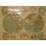

Maps: Three rolled maps including "Bacons Excelsior, Map of the World in Hemispheres," "The Educational Company Smaller School Map of Ireland;" & ...
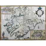
John Speed - Map of Munster"The Province of Munster," c. 1616, 39cms x 52cms. (1)
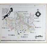
The Down SurveyCo. Tipperary: Petty (Sir Wm.) The Barony of Clanwilliam in Tipperary County, facsimile of the original, approx. 46cms x 67cms (18"...
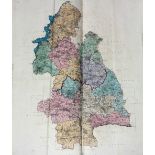
Rare Original Hand-Coloured CopyCo. Tipperary: "Ordnance Survey of the North Riding of the County of Tipperary," lg. atlas folio Dublin 1843. Firs...
Prendergast (John P.) The Cromwellian Settlement of Ireland, 8vo L. 1865. First Edn., fold. cold.
Prendergast (John P.) The Cromwellian Settlement of Ireland, 8vo L. 1865. First Edn., fold. cold. maps, cloth & approx. 23 others, all Irish inter...
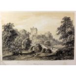
After John Brennan, Cork, c. 1835"Blarney Castle, County Cork," large sepia print, approx. 27cms x 37cms (10 1/2" x 14 1/2") in gilt frame. (1)
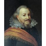
Follower of Jan Anthonisz van Ravesteyn (1572 - 1657) "Portrait of Jan de Middelste (1561 - 1623),
Follower of Jan Anthonisz van Ravesteyn (1572 - 1657)"Portrait of Jan de Middelste (1561 - 1623), Count of Nassau-Siegen wearing armour and an ora...