Filtered by:
- Category
- List
- Grid
A subscription to the Price Guide is required to view results for auctions ten days or older. Click here for more information
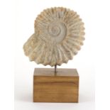

Jurassic period ammonite, Atlas Mts Morocco, raised on a polished oak block base, overall 31.5cm
Jurassic period ammonite, Atlas Mts Morocco, raised on a polished oak block base, overall 31.5cm high :For Further Condition Reports Please Visit ...
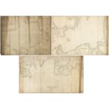
Three 19th century Nautical Charts comprising The North Sea drawn by J S Hobbs published by Charles Wilson Late J W Norie and Wilson 1860, Baltic ...
Three 19th century Nautical Charts comprising a Chart of the Coast of England and Scotland from
Three 19th century Nautical Charts comprising a Chart of the Coast of England and Scotland from Flamborough Head to Cape Wrath including The Orkne...
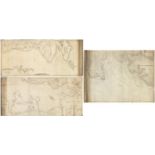
Three 19th century Nautical Charts comprising Kattegat compiled from recent Danish surveys published
Three 19th century Nautical Charts comprising Kattegat compiled from recent Danish surveys published by James Imray & Son 1863, Kattegat compiled ...
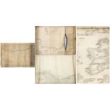
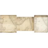
Four 19th century Nautical Charts including Western Coast of Island included between Lough Foyle and
Four 19th century Nautical Charts including Western Coast of Island included between Lough Foyle and Waterford published by James Imray & Son 1889...
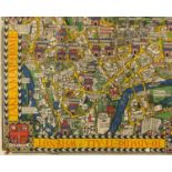
The Wonderground map of London Town, drawn by Macdonald Gill, printed and published by The Westminster Press, London 1924, 93.5cm x 75cm :For Furt...
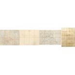
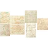
Four 19th century railwayana interest linen backed maps comprising Lancashire and Yorkshire Railway Middleton Branch plan and section 1853, Lancas...
Four 19th century linen backed maps, The Tourists Route Map of England and Wales published at the
Four 19th century linen backed maps, The Tourists Route Map of England and Wales published at the office of the Bazaar Exchange and Mart The Stran...
Six 19th century and later linen backed maps including W & A K Johnstons map of the railway systems of England and Wales showing canals, Imperial ...
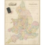
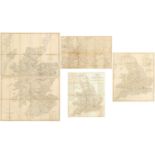
19th century hand coloured, linen backed map of England and Wales in four parts, with leather
19th century hand coloured, linen backed map of England and Wales in four parts, with leather case, published by Edward Stanford, drawn by R Creig...