Refine your search
Filtered by:
- Category
- List
- Grid
A subscription to the Price Guide is required to view results for auctions ten days or older. Click here for more information

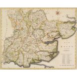
Milner (Thomas). A Descriptive Atlas of Astronomy, and of Physical and Political Geography, 1850
Milner (Thomas). A Descriptive Atlas of Astronomy, and of Physical and Political Geography ... The Maps of Physical and Political Geography, const...
Africa. A good mixed collection of approximately 110 maps, 17th - 19th century, engraved and lithographic maps of South Africa, Egypt and North Af...
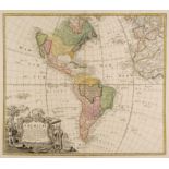
Americas. Homann (Johann Baptist, heirs of), Americae Mappa Generalis..., 1746, engraved map with contemporary outline colouring, large uncoloured...
Asia. Munster (Sebastian), Asia wie es Jetziger Zeit nach den Furnemesten Herrschafften Abgetheilet und Beschriben ist, S. Petri, Basel, circa 158...
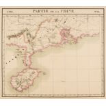
Asia. Vandermaelen (Phillipe Marie Guillaume), Seven maps of Asia (nos. 98, Partie de la Chine, 106, Partie de la Cochinchine, 97, Tonquin, 99, Pa...
Azores & Atlantic Islands. Ogilby (John), Insulae..., Hispanis Islas de Cabo Verde, circa 1670
Azores & Atlantic Islands. Ogilby (John), Insulae Promontorii Viridis Hispanis Islas de Cabo Verde, Belgis De Soute Eylanden, circa 1670, hand col...
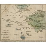
Barbauld (Anna Laetitia). A New Map of the Land of Matrimony drawn from the latest surveys, J. Johnson, 22nd August 1772, hand-coloured engraved m...
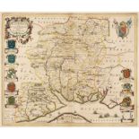
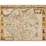
Blaeu (Johannes). Hantonia sive Southantonensis comitatus vulgo Hant-shire, Amsterdam, circa 1648, engraved map with contemporary hand-colouring, ...
British Islands. Lea (Philip), A Map of the Isle of Wight Portsea Halinge, also the Islands of Jarsey & Garnsey which are part of Hampshire, Georg...
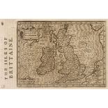
British Isles. Mercator (Gerard), Anglia Scotia et Hibernia, Thomas Cotes, [1637], uncoloured engraved map, 180 x 135 mm, English text on verso, b...
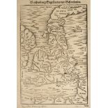
British Isles. Munster (Sebastian), Beschreibung Engellandts und Schottlandts, 1578 [or later], uncoloured woodcut maps of Britain and part of Ire...
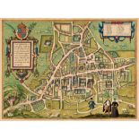
Cambridge. Braun (Georg & Hogenberg, Franz), Cantebrigia opulentissimi Anglie Regni urbs celeberrimi nominsis ab Academie conditore Cantabro cogno...
Chatelain (Henry Abraham). A collection of sixteen maps, circa 1720, 16 uncoloured engraved maps including Carte du Plan du Venise, l'Etat de sa N...
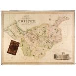
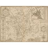
Cheshire. Swire (W. & Hutchings W. F.), A Map of the County Palatine of Chester divided into Hundreds & Parishes from an accurate Survey made in t...
Conder (Thomas). The Journey of Life, or An Accurate Map of the Roads, Counties, Towns &c. in the Ways of Happiness & Misery, J. Buckland & W. Otr...
Dawson (Lt. Robert K.). A collection of 40 town and county maps, circa 1832, engraved maps with contemporary outline colouring, old folds, occasio...
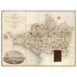
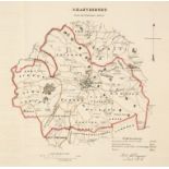
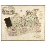
Dorset. Greenwood (C. & J.), Map of the County of Dorset from an actual survey..., Greenwood, Pringle & Co., 1826, large scale engraved map with b...
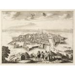
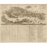
Elblag. Van der Aa (Pieter), Elbing, Ville de la Prusse Royale, circa 1726, uncoloured engraved aerial prospect of the fortified city, ribbon cart...
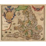
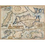
England & Wales. Ortelius (Abraham), Angliae Regni Florentissimi nova Descriptio auctore Humfredo Lhuyd Denbygiense, circa 1595, hand-coloured eng...
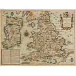
England, Ireland & Wales. Speed (John), The Invasions of England and Ireland with al their Civill Wars since the Conquest, Thomas Bassett & Richar...
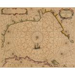
English Channel. Jacobsz (Jacob, pseud. Lootsman), De Cust van Normandie en Picardie..., Amsterdam, circa 1644, engraved sea chart with early hand...
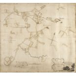
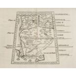
Estate plan. Singer (Joseph, Land Surveyor), A Plan of an Estate lying in the Parish of Frome Selwood and County of Somerset belonging to Mrs S. H...
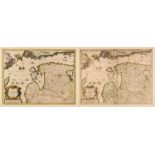
Europe. A collection of approximately 175 maps of European countries, regions, and city plans, 17th - 19th century, engraved and lithographic maps...
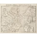
Europe. Munster (Sebastian), Europa Prima Nova Tabula, Basel, circa 1550, uncoloured woodblock map of Europe orientated to the south with a large ...
Fullarton (Archibald). A collection of 31 county maps, Glasgow, circa 1844, thirty-one hand-coloured engraved maps, each approximately 260 x 200 m...
Gillet (R., publisher). Allegorical Map of the Tract of Youth to the Land of Knowledge, 1st Feby. 1796, uncoloured engraved map, old folds, slight...
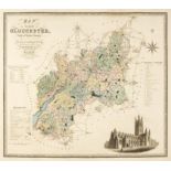
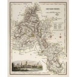
Greenwood (Charles & John). A collection of nine county maps comprising: Map of the County of Gloucester, Map of the County Palatine of Lancashire...
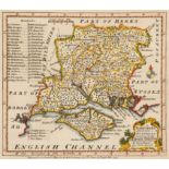
Hampshire. A collection of approximately 105 maps, 17th - 19th century, engraved and lithographic maps of Hampshire and the Isle of Wight, includi...
Holy Land. Speed (John), Canaan. Begun by Mr John More continued and finished by John Speede, 1651, Thomas Bassett & Richard Chiswell, [1676], han...
India & Pakistan. Fries (Laurent), Tabula IX Asiae [title on verso], circa 1535, uncoloured woodcut map on a trapezoidal projection, slight toning...
Isle of Wight. A collection of approximately 110 maps, 17th - 19th century, engraved and lithographic maps of the Island, including maps of 'Briti...
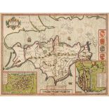
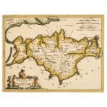
Isle of Wight. Speed (John), Wight Island, Roger Rea, circa 1665, hand-coloured engraved map, inset town plans of Newport and Southampton, central...
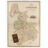
Lancashire. Hennet (G.), A Map of the County Palatine of Lancaster Divided into Hundreds and Parishes from an accurate survey made in the years 18...
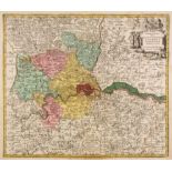
London. Lotter (Tobias Conrad), Delineatio ac Sinitima Regio Magnae, Brittaniae, Metropoleos Londini ad novissimam Norman repraesentata et exusa.....
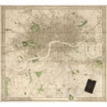
London. Stanford (Edward, publisher), Stanford's Map of Modern London and the Suburbs, May 9th, 1870, large engraved map with contemporary outline...
Maps. A collection of 30 British county, regional and country maps and charts, 17th - 19th century
Maps. A collection of 30 British county, regional and country maps, town plans and charts, 17th - 19th century, including Speed (John). The Kingdo...
Maps. A mixed collection of 110 British county and regional maps, mostly 19th century, engraved and lithographic maps, including examples by Arche...
Maps. A mixed collection of approximately 130 regional and county maps, 18th & 19th century, engraved county, country and regional maps, including...
Morden (Robert). A collection of 18 maps, [1695 or later], engraved maps, 6 with outline colouring, one duplicate (Worcestershire), various condit...
Nottinghamshire. Overton (H.), A New Map of Nottingham-Shire with the Post and Cross Roads and other remarks according to ye latest and best obser...
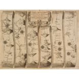
Ogilby (John). A collection of 6 maps, The Road from Tinmouth in Northumberld to the City of Carlisle in Cumberld, The Continuation of the Road fr...
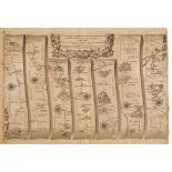
Ogilby (John). A collection of 7 maps, The Continuation of the Road from London to Aberistwith, The Roads from Kendal in Westmerld to Cockermouth,...
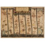
Ogilby (John). A collection of five road maps, The Continuation of the Road from London to Lands-End Commencing at Crookhorn com Somerset & extend...
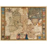
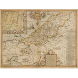
* Oxfordshire. Speed (John), Oxfordshire described with ye Citie and the Armes of the Colledges of ye famous University, Roger Rea, circa 1662, ha...
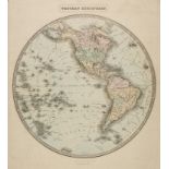
Philip (George & Son, publishers). Eastern Hemisphere, Western Hemisphere, Southern hemisphere [and] Northern Hemisphere, Liverpool, 1851 - 53, to...
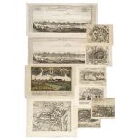
Poland. A collection of sixteen city plans, mostly 17th & 18th century, engraved city plans including Bodenehr (Gabriel). Dantzig Die Haiptstatt i...
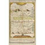
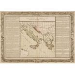
* Poland. Chodzko (Leonard & Dufour Auguste Henri). Seven maps showing the progressive dismemberment of Poland, 1832, seven (complete) double-page...
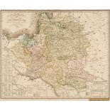
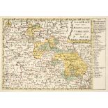
Poland. Cluver (P.), Veteris et Novae Regni Poloniae Magniq Ducatus Lithuaniae cum suis Palatinatibus ac Confiniis Descriptio, circa 1711, hand-co...
Poland. Speed (John), A Newe Mape of Poland done into English..., George Humble, 1627, hand-coloured engraved 'carte-a-figure map, six oval topogr...
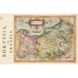
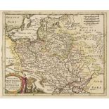
Prussia. A collection of 13 small-scale maps, mostly 17th & 18th century, including Mercator (Gerard). Prussia, [1635], engraved map with contempo...
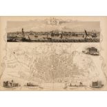
Rapkin (J.). Liverpool, Birmingham & Manchester and its Environs, John Tallis & Co., circa 1851, together three uncoloured engraved city plans, ea...
Silesia. A collection of eight maps, 16th - 18th century, including Jonge (N.). Landkort over det Hertugdom Schlesien..., Copenhagen, circa 1759, ...
Speed (John). A collection of seven county maps, 1611 - 76, comprising Worcestershire described, Thomas Bassett & Richard Chiswell, [1676], uncolo...
Surrey. Greenwood (C. & J.), Map of the County of Surrey from an actual Survey, made in the years 1822 and 1823..., George Pringle Jnr. 1823, larg...
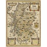
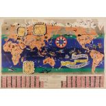
Taylor (Alfred E.). Eight Esso pictorial maps - Scotland, Ireland, Wales, British Islands, Plan of the North, West Country, Eastern Counties and t...
* The Baltics. Jansson (Jan). Nova Totius Livoniae accurata Descriptio, 1636 or later, engraved map with contemporary outline colouring, large dec...
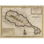
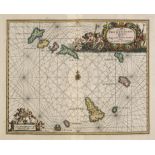
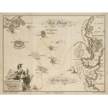
West Indies. Moll (Herman), The Island of St Christophers alias St Kitts, 1729, hand-coloured engraved map, left-hand vertical margin extended, to...
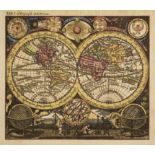
World. Huebner (Jacob), Planisphaerium Terrestrecum..., Vienna, circa 1750, hand-coloured engraved world map on a hemispheral projection, insular ...
World. Jannot (J. B.), Le Tour du Monde en 120 Images Grand Concours du Chocolat Menier, Paris, [1956], colour lithographic map, three inset maps ...
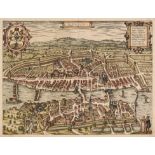
Zurich. Braun (Georg & Hogenberg Franz), Zuryck. Tigurum, sive Turegum Caesari, ut Plerique Existimant, Tigurinus Pagus, vulgo Zurych, Urbs in Hel...