Refine your search
Sale Section
- Antiquarian (94)
- Army Lists and Military Books from the Library of Bob Wyatt (64)
- Art and Architecture (52)
- Autographs (30)
- British Royalty and World Leaders (36)
- British Topography (13)
- Decorative and Topographical Prints (50)
- English Caricatures and Printed Satires (12)
- General Literature (11)
- General Stock (55)
- Historical Documents and Ephemera (63)
- Maps (134)
- Music Magazines (6)
- Natural History (30)
- Railways and Transport (16)
- The David Wilson Library of Natural History (Part 1) (51)
- The Leon Paul Library of Fencing (42)
- Travel & Exploration (45)
- Vinyl Records (Blues, Jazz, R&B, Rock, Classical) (40)
Estimate
Category
- Books & Periodicals (517)
- Maps (133)
- Prints (84)
- Musical Instruments & Memorabilia (46)
- Arms, Armour & Militaria (29)
- Watercolours (10)
- Taxidermy & Natural History (6)
- Bank notes (5)
- Classic Cars, Motorcycles & Automobilia (5)
- Models, Toys, Dolls & Games (5)
- Oil, Acrylic paintings & Mixed Media (5)
- Stamps (5)
- Photographs (4)
- Jewellery (3)
- Ceramics (2)
- Clocks (2)
- Coins (2)
- Collectables (2)
- Furniture (2)
- Scientific Instruments (2)
- Sporting Memorabilia & Equipment (2)
- Drawings & Pastels (1)
- Kitchenalia (1)
- Textiles (1)
- Wines & Spirits (1)
- List
- Grid
A subscription to the Price Guide is required to view results for auctions ten days or older. Click here for more information
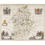

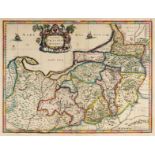
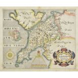
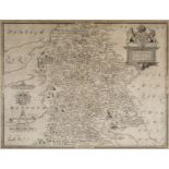
Midland counties. Blaeu (Johannes), Staffordiensis comitatus vulgo Stafford Shire, circa 1660
Midland counties. Blaeu (Johannes), Staffordiensis comitatus vulgo Stafford Shire, Amsterdam, circa 1660, hand coloured engraved map, decorative a...
* Monmouthshire. Blaeu (Johannes), Monumethensis comitatus vernacule Monmouth Shire, Amsterdam, circa 1645, engraved map with bright contemporary ...
Monmouthshire. Speed (John), The Countye of Monmouth wih the sittuation of the Shire-towne described, John Sudbury & George Huimble, [circa 1627],...
Montgomeryshire. Speed (John), Montgomery Shire, Thomas Bassett & Richard Chiswell, 1676, hand coloured engraved map, inset town plan of Montgomer...
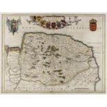
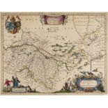
Norfolk. Blaeu (Johannes), Nortfolcia, Norfolk, Amsterdam, circa 1648, engraved map with contemporary outline colouring, 385 x 500 mm, French text...
* Northamptonshire & Surrounding Counties. Saxton (Christopher), Northamton, Bedfordiae..., 1579
* Northamptonshire & Surrounding Counties. Saxton (Christopher), Northamton, Bedfordiae, Cantabrigiae, Huntingdoniae et Rutlandiae, Comitatuum Vic...
* Northamptonshire. Smith (William), Northamptoniae Comitatus Descriptio....., J.Overton [1675 or later], engraved map with contemporary outline c...
Northumberland. Jansson (Jan), Comitatus Northumbria vernacule Northumberland, circa 1648, engraved map with contemporary outline colouring, decor...
* Northumberland. Speed (John), Northumberland, 1st edition, John Sudbury & George Humble, circa 1611, hand coloured engraved map, inset town plan...
* Nottinghamshire. Speed (John), The Countie of Nottingham described, the Shire Townes situation and the Earls there of observed, John Sudbury & G...
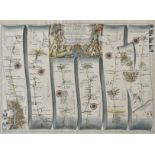
Ogilby (John). The Road from London to Aberistwith on the Sea Coast com. Cardigan Wherein are Included the Roads to Oxford and Worcester..., [1675...
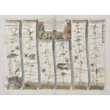
* Ogilby (John). The Road from London to Flamborough Head, com Ebor..., circa 1698, hand coloured engraved strip road map, slight overall toning, ...
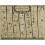
Ogilby (John). The Road from London to Holy-head co. Anglesey, [1675 or later], hand coloured engraved strip road map, the cartouche showing a sur...
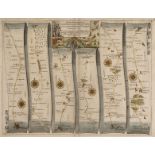
Ogilby (John). The Road from Oxford to Bristol [and] The Road from Oxford to Coventry continued to Darby 1675 or later, two hand coloured strip ro...
Ogilby (John). The Road from the City of Salisbury Com Wilts. to Campden com Gloc, circa 1698
Ogilby (John). The Road from the City of Salisbury Com Wilts. to Campden com Gloc. circa 1698 [and] The Continuation of ye Road from London to Abe...
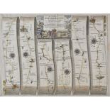
Ogilby (John). The Roads from York to Whitby and Scarborough in Yorkshi...., [and] The Road from York to West-Chester, circa 1680, two hand colour...
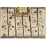
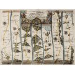
Ogilby (John). The Road from Bristoll to Worcester, The Continuation of the Road from London to Holyhead..., Plate 2 Commencing at Towcester in co...
* Oxfordshire. Plot (Robert), The Map of Oxfordshire, circa 1677, hand coloured engraved map, decorative cartouche, mileage scale, table of explan...
* Oxfordshire. Speed (John), Oxfordshire described with ye Citie and the Armes of the Colledges of ye famous University, John Sudbury & George Hum...
Paris. Jaillot (Bernard Jean Hyacinthe), Plan de la Ville, Cité, Université et Faubourgs de Paris avec ses Environs..., Paris, 1715 or later, hand...
* Playing card maps. Morden (Robert), Somerset & Durham, circa 1676 (or later), two engraved playing card maps, each with contemporary outline col...
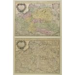
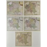
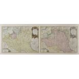
* Poland. A collection of four Polish town plans, 16th -18th century, engraved town plans, including Lissa (Leszno) by Christoph Riegel, Elbing (E...
Poland. Blaeu (Johannes), Ducatus Breslanus sive Wratislaviensis, Amsterdam, circa 1663, engraved map with contemporary hand colouring, large deco...
Poland. Bowles (John), Poland Subdivided according to the extent of its Severall Palatinates, 1744
Poland. Bowles (John), Poland Subdivided according to the extent of its Severall Palatinates, circa 1744, engraved map with contemporary outline c...
* Poland. De L'Isle (Guillaume), Estats de la Courone de Pologne..., Amsterdam, J. Covens & C. Mortier, 475 x 610 mm circa 1740, engraved map with...
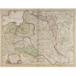
Poland. De L'Isle (Guillaume), La Pologne Dressée sur ce qu'en ont donné Starovolsk, Beauplan, Hartnoch et autres Auteur..., Ph. Buache, Paris, 17...
* Poland. De Vaugondy (Robert), Le Royaume de Pologne, Paris, 1767, engraved map with contemporary outline colouring, uncoloured strapwork cartouc...
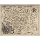
Poland. Homann (J. B. heirs of), Principatus Silesiae Munsterbergensis exactissima Tabula Geographica exhibens...,1736, hand coloured engraved map...
* Poland. Homann (Johann Baptist, heirs of), Carte du Diocese de Breslav ..., 1751, engraved map with contemporary outline colouring, large uncolo...
* Poland. Homann (Johann Baptist, heirs of), Mappa Geographica Regni Poloniae..., 1773, engraved map with contemporary hand colouring, additional ...
Poland. Hondius (J.), Nova Poloniae delineatio, Amsterdam, circa 1630, hand coloured engraved carte-a figures map with six costumed figures to ver...
* Poland. Janson (Jan), Elbing , Amsterdam, circa 1657, engraved town plan with contemporary hand colouring, panoramic view supported by the coat ...
* Poland. Jansson (Jan), Silesia Inferior..., Amsterdam, circa 1647, engraved map after J. Scultetus, contemporary hand colouring, 420 x 510 mm, w...
* Poland. Janvier (Jean), Les Royaumes de Pologne et de Prusse avec le Duche de Curlande Divises en Provinces et Palatinats..., 1st state, Paris, ...
* Poland. Meletius (Josephus, publisher), Polonia et Hungaria nuova tavola, Venice, circa 1562
* Poland. Meletius (Josephus, publisher), Polonia et Hungaria nuova tavola, Venice, circa 1562, engraved map with contemporary outline colouring, ...
* Poland. Ortelius (Abraham). Silesiae Typus descriptus et editus a Martino Heilwig..., circa 1580
* Poland/Silesia. Ortelius Abraham), Silesiae Typus Descriptus et editus Martino Heilwig Neissense, et Nobili viro Nicolao Rhedinger dedicatus Ann...
Poland. Van den Keere (Pieter), Silesiae Ducatus Nova De-scriptio, Amsterdam, 1621, uncoloured engraved map, inset town plan of Breslau , some cre...
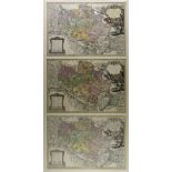
* Poland/Silesia . Homann (Johann Baptist), Principatus Silesiae Oelsnensis in suos Districtus Oels Bernstadt et Trebnitz..., 1739, three identica...
* Poland/Silesia. Mercator (Gerard), Polonia et Silesia, [1585 - 1630], engraved map with contemporary hand colouring, 345 x 455 mm, with another ...
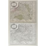
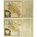
Prussia. Gussefeld (F. L. & Homman J. B. , heirs of), ...., Ober-Saescsischen..., Nuremberg, 1783
Prussia. Gussefeld (F. L. & Homman J. B. , heirs of), Der Südliche Theil des Ober-Saescsischen Kreises die Chur-und Fürstl Sächsische..., Nurember...
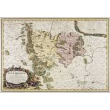
Prussia. Henneberger (Caspar), Prussiae das ist des L andes zu Preussen, Welches das herrlichste Theil ist Sarmatiae Europeae..., Konigsberg, Lore...
Prussia. Jansson (Jan & Schenk P. & Valk G.), Prussia accurata Descripta..., Amsterdam circa 1700
Prussia . Jansson (Jan & Schenk P. & Valk G.), Prussia accurata Descripta a Gasparo Henneberg Erlichensi, Amsterdam circa 1700, engraved map with ...
* Prussia. Ortelius (Abraham), Prussiae Vera Descriptio per Gaspar Henneberg. Erlichens, 1595
* Prussia. Ortelius (Abraham), Prussiae Vera Descriptio per Gaspar Henneberg. Erlichens, [1595 or later], engraved map with contemporary hand colo...
* Prussia. Sotzmann (Daniel Friedrich), General Karte von den Konig. Preussischen Staaten nach den neuesten und zuverlassigsten Hulfmitteln auf da...
Prussia. Visscher (Nicolas), Magnae Prussiae Ducatus Tabula..., Amsterdam, circa 1620, engraved map with contemporary outline colouring, large dec...
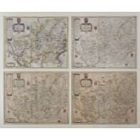
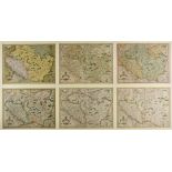
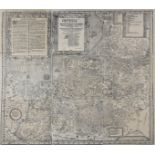
Regional maps of England and Wales. A collection of six maps, 17th - 19th century, hand coloured engraved maps, including examples by Cassini, Phi...
River Dnieper. Blaeu (J.), Tractus Borysthenis vulgo Dniepr et Niept dicti a Civitate Czyrkassii as ostia Ilmien lacum per quem in Pontum Euxinium...

River Dnieper. Blaeu (Willem Janszoon), Campus Inter Bohum Borystenem, Amsterdam, circa 1645, hand coloured engraved map on two conjoined sheets, ...
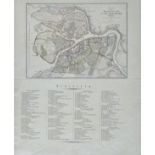
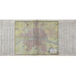
Russia. Weimar Geographisches Institut (publisher), Plan der Residenzstadt St Petersburg, 1834, engraved city plan with contemporary outline colou...
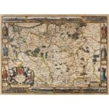
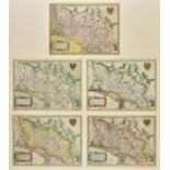
Saxton (Christopher & Hole W.). A collection of twelve county maps, 1610 - 1637, hand coloured engraved maps, two laid on later paper, four framed...
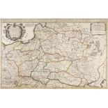
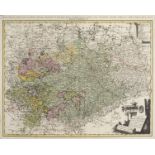
Shropshire. A collection of twenty-two county maps, 17th - 19th century, engraved county maps, with examples by Cary, Van den Keere, Pigot, Ramble...
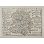
Shropshire. A mixed collection of sixty maps, mostly 18th & 19th century, engraved and lithographic county maps, road maps, hunting maps and town ...
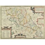
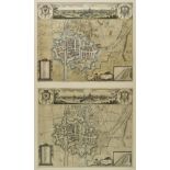
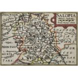
Shropshire. Saxton (Christopher & Lea Philip), Shropshire accuratly drawen and sett forth, 1693
Shropshire. Saxton (Christopher & Lea Philip), Shropshire accuratly drawen and sett forth by C. S. Corrected with some additions..., circa 1693, h...
Shropshire. Saxton (Christopher & Web William), Salopiae Comitatus, Summa cum Fide cum et Diligentia Descriptionem haec Tibi Tabula Refert Ao. Dm....
Shropshire. Speed (John), Shropshyre described, The Sittuation of Shrowesbury Shewed with the Armes of thos Earles and other memorable things obse...
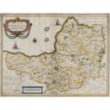
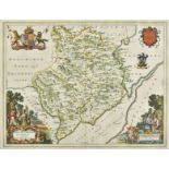
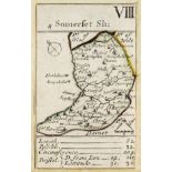
Somerset. Jansson (Jan), Comitatus Somerettensis Somerset-Shire, circa 1638, engraved map with contemporary hand colouring, ornate strapwork carto...
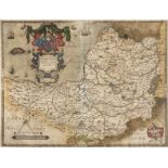
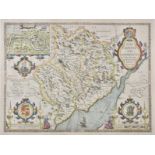
* Somerset. Saxton (Christopher), Somersetensem Comitat (agri fertiltate celebrem) hec ob oculos ponit Tabula. Anno 1575. et D. Elizabethe Regine ...
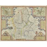
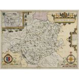
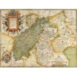
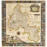
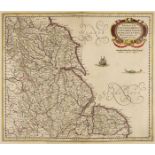
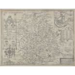
* Staffordshire. Speed (John), Stafford Countie and Towne with the ancient Citie Lichfeild described, Thomas Bassett & Richard Chiswell, [1676], h...
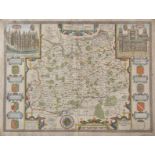
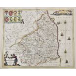
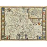
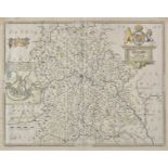
Surrey. Speed (John), Surrey Described and Divided into Hundreds, Thomas Bassett & Richard Chiswell, [1676], hand coloured engraved map, inset vie...
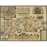
Sussex. Norden (John & Speed John), Sussex described and divided into rapes with the situation of Chichester the cheife citie thereof and the arme...