Refine your search
Sale Section
Remove filter- Antiquarian Books (56)
- Art & Architecture (23)
- Autograph Letters (37)
- Bibliotheca Cloughiana (25)
- Books from a Shropshire Private Library (25)
- Books from the Estate of John Lawson (24)
- British Topography (23)
- Decorative Prints & Original Art (38)
- General Literature (19)
- General Stock (86)
- Geology (9)
- Historical Documents & Ephemera (30)
- Maps (90)
- Natural History (11)
- Periodicals (3)
- Travel & Exploration (16)
- Winston Spencer Churchill (10)
Estimate
Category
- Books & Periodicals (331)
- Maps (113)
- Prints (37)
- Arms, Armour & Militaria (9)
- Collectables (8)
- Watercolours (7)
- Photographs (4)
- Sporting Memorabilia & Equipment (3)
- Stamps (3)
- Bank notes (2)
- Coins (2)
- Classic Cars, Motorcycles & Automobilia (1)
- Drawings & Pastels (1)
- Oil, Acrylic paintings & Mixed Media (1)
- Russian Works of Art (1)
- Taxidermy & Natural History (1)
- Textiles (1)
Filtered by:
- Sale Section
- List
- Grid
A subscription to the Price Guide is required to view results for auctions ten days or older. Click here for more information
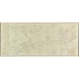

* Atlantic Ocean. Blunt (E. & G. W.), North Atlantic from 65o to 37o North, New York, 1867, large uncoloured engraved chart on two conjoined sheet...
* Balkans. Homann (Johann Baptist), Danubii Fluminis..., pars Media [and] Danubii Fluminis..., pars Infima , circa 1720, together two engraved map...
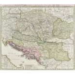
Balkans. Homann (Johann Baptist, heirs of), Regnum Bosniae, una cum Finitimis Croatiae, Dalmatiae, Slavoniae, Hung. et Serviae Partibus ... / Regn...
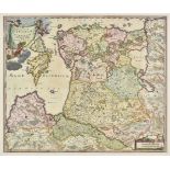
* Baltic Coast, Homann (Johann Baptist), Ducatuum Livoniae et Curlandiae cum Vicinis Insulis..., Nuremberg, circa 1720, engraved map with contempo...
Belgrade. Seutter (George Matthaus ), Belgradum sive Alba Graeca ..., Augsburg, circa 1760, engraved map with contemporary hand colouring with an ...
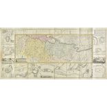
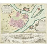
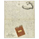
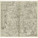
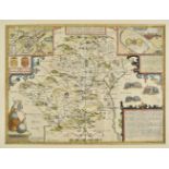
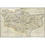
Berkshire. A Topographical Survey of the County of Berks ... by John Rocque, 1st edition, 1761
Berkshire. A Topographical Survey of the County of Berks, in Eighteen Sheets, in which is expressed, His Majesty's Royal Palace of Windsor, its Pa...
Birmingham. Blood (Charles Henry), This Map of Birmingham and its Environs within a circle of Ten Miles, the Town Hall being its Centre, published...
Birmingham. Sherriff (James), A Map of Upwards of 25 Miles round the Town of Birmingham. To his most sacred Majesty George the Third, King of Grea...
Birmingham. Sherriff (James), A Map of Upwards of 25 Miles round the Town of Birmingham. To his most sacred Majesty George the Third, King of Grea...
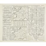
British county maps. A collection of approximately sixty-five maps, 17th - 19th century, engraved county maps, town plans and road maps, of Midlan...
British Isles. A collection of eighteen maps, mostly 18th & 19th century, eighteen engraved maps, including examples by De Vaugondy, Mollo, Drioux...
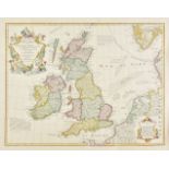
British Isles. De L'Isle (Guillaume), Les Isles Britanniques... , 1772, hand coloured engraved map, large decorative cartouche, 480 x 615 mm, toge...
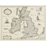
British Isles. Mariette (Pierre), Novissima Descriptio Angliae, Scotiae et Hiberniae, circa 1650
British Isles. Mariette (Pierre), Novissima Descriptio Angliae, Scotiae et Hiberniae, circa 1650, engraved map with contemporary outline colouring...
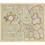
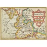
British Isles. Mercator (Gerard & Hondius Henricus ), Four regional maps, circa 1610, including Westmorlandia, Lancastria, Cestria...., circa 1613...
Camden (William). [ Britain , or a Chorographicall Description of the Most Flourishing Kingdomes, England, Scotland, and Ireland, and the Ilands A...
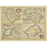
Channel Islands. A collection of seven maps, 17th - 19th century, including Mercator (Gerard). Anglesey [on sheet with] Garnesay, Wight olim Vecti...
Chatelain (Henri Abraham). A collection of twenty dynastic and heraldic charts and maps, circa 1720, twenty uncoloured engraved double page and fo...
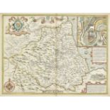
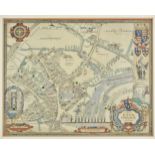
Cheshire. Speed (John), The Countye Palatine of Chester with the most ancient Citie described, published John Sudbury and George Humble, 1616, han...
China. Haffner ( Melchior ), Imperium Sinarum , Augsburg , circa 1688, uncoloured engraved map, old folds, 295 x 355 mm (Qty: 1)NOTESA scarce map ...
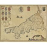
* Cornwall. Blaeu (Johannes), Cornubia sive Cornwallia, Amsterdam, circa 1650, engraved map with contemporary hand colouring, some repaired margin...
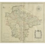
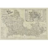
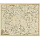
Devon. Donn (Benjamin), A Map of the County of Devon, with the City and County of Exeter, 1st. edition, 1765, printed title, key plate, twelve eng...
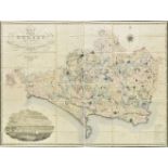
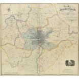
Dorset. Greenwood (C. & G.), Map of the County of Dorset, from an actual survey, made in the years 1825 & 1826..., published Sept. 11th 1826, engr...
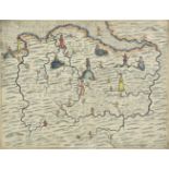
* Drayton (Michael). North Wales & Warwickshire, circa 1622, together two untitled allegorical engraved maps, one with later hand colouring, the m...
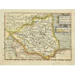
Durham. Bill (John), The Bishoprick of Durham, [1626], hand coloured engraved miniature map, slight text show-through, 95 x 125 mm, English text o...
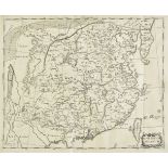
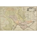
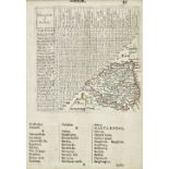
Durham. Bowen (Emanuel), An Accurate Map of the County Palatine of Durham, Divided into its Wards, [1762], engraved map with contemporary outline ...
Durham. Speed (John), The Bishoprick and Citie of Durham, published Thomas Bassett & Richard Chiswell [1676], hand coloured engraved map, inset to...
* Eastern Europe. Facius J. G. & G. S.), Carte exacte d'une Partie de L'Empire de Russie et de la Pologne meridionale renfermant l'Ukraine..., Bon...
* Embroidered map. Europe, by M.S. Smeaton, 1823, oval map of Europe and North Africa, hand-embroidered in silk threads on linen, the place names ...
England & Wales . A collection of ten maps, mostly 18th century, engraved maps, nine with hand colouring, including examples by Van der Aa, Albriz...
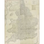
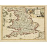
England & Wales. Cary (John), Cary's New Map of England and Wales with Part of Scotland, on which are carefully laid down all the Direct and Princ...
England & Wales. Chatelain (Henry Abraham), Nouvelle carte du Gouvernement civil D'Angleterre et de celuy de la Ville de Londres, Nouvelle carte p...
England and Wales. De Wit (Frederick), Orientalior Districtus Regni Angliae comprehendens Comitatus et Provicias Cantium, Suthsexiam , Hantonium, ...
England & Wales. Dighton (Robert, after), England and Wales, Caricatures of Ireland, Scotland &c. with other ingenious devices, circa 1810, engrav...
* England & Wales. Kitchin (Thomas), A New Map of England & Wales. Drawn from Several Surveys &c. on a New Projection, Corrected from Astronomical...
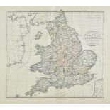
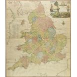
England & Wales. Lewis (Samuel), A Map of England & Wales Divided into Counties, Parliamentary Divisions and Dioceses, Shewing the Principal Roads...
England and Wales. Wyld (James), Railway Map of England, Wales and Scotland, Drawn from the Triangulation of the Ordnance Survey, the Survey of th...
* Eton. Wagstaff (H. M.), A Map of Eton College and its Environs, published The Petersfield Workshops, circa 1948, engraved map with contemporary ...
Folding maps. A mixed collection of approximately 175 maps, 18th - 20th century, folding engraved and lithographic maps of British counties, regio...
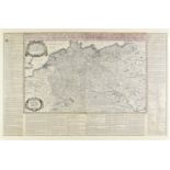
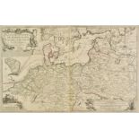
* Germany & Northern Europe. Tavernier (Melchior), Generalis exactissima et novissima Germaniae descriptio..., Paris, 1638, large hand coloured en...
Germany. Ortelius (Abraham), Germaniae Veteris Typus, 1601, hand coloured engraved map, slight spotting to margins, 370 x 470 mm, Latin text on ve...
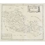
Gloucestershire. A collection of forty maps, 17th - 19th century, county maps, town plans and road maps, including examples by Bickham, Fullarton,...
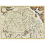
Haffner (Melchior). Die Halb Insul Indiens Disseit des Ganges..., Das Reich des Grossen Mogols, Armenia seu Turcomania Georgia Commania, Das Kónig...
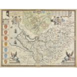
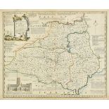
Hertfordshire. Speed (John), Hartford Shire Described, The sittuations of Hartford and the most ancient town S. Albons with such memorable actions...
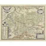
Hungary. Blaeu (Johannes), Hungaria Regnum , circa 1644, engraved map with contemporary outline colouring, some dust soiling and very light overal...
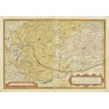
Hungary. Ortelius (Abraham), Ungariae Loca Praecipua Recens Emendata atque Edita, per Ioannem Sambucum Pannonium, Imp. Ms. Historicum. 1579, [1584...
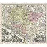
Hungary. Seutter (George Matthaus), Novissima et Accuratissima Hungariae cum Circumjacentibus Regnis et Principatibus..., Augsburg, circa 1745, en...
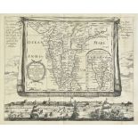
* India. Coronelli (Vincenzo Maria), Impero Del Gran Mogol , circa 1700, engraved map with contemporary outline colouring and some later enhanceme...
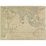
* Indian Ocean. Valentijn (Francois.), Tabula Indiae Orientalis et Regnorum Adjacentium, J van Braam et G. onder de Linden, Amsterdam, circa 1726,...
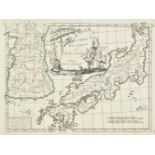
Japan. Le Rouge (George Louis), Carte du Japon et de la Corée, Paris, [1748 - 1759], engraved map with contemporary outline colouring, 215 x 285 m...
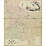
Kent. Greenwood (C.), Map of the County of Kent, from an actual survey made in the years 1819 & 1820, published G.Pringle July 19th, 1821, large e...
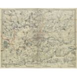
London. Froggett (John Walter), From the Ordnance Survey of the Country Thirty Miles round London, published G. F. Cruchley, with additions to 185...
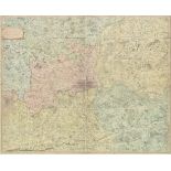
London. Faden (William), The Country Twenty-five miles round London, planned from a scale of one mile to an inch, 3rd. edition, 1815, large engrav...
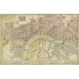
London. Roades (William), A Pocket Map of the Citties of London & Westminster and the Suburbs thereof being a New & Exact Plan with the additions ...
Maps. A mixed collection of approximately 250 British & foreign maps, mostly 19th century, engraved and lithographic foreign and British county an...
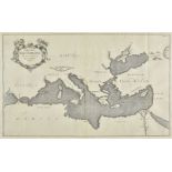
Mediterranean Sea, Kircher (Athanasius), Mappa Maris Mediterranei Fluxus Currentes et Naturam motionum explicans, circa 1680, uncoloured engraved ...
Morden (Robert). A collection of thirty-nine maps, [1695 or later], uncoloured engraved maps, some duplicates, a few maps trimmed to image, each a...
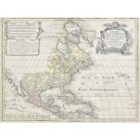
North America. Lotter (Tobias Conrad), America Septentrionalis Concinnata juxta Observationes Dun Academiae Regalis Scientiarum et nonnullorum ali...
Northern British counties. A collection of sixteen maps, 17th - 19th century, engraved county and strip road maps of Yorkshire, Westmorland and Du...
* Northern Europe. De Fer (Nicolas), Estats des Couronnes de Dannemark, Suede, et Pologne sur la Mer Baltique, Paris, 1705, map with contemporary ...
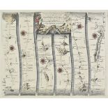
* Ogilby (John). The road from London to Barstable in Devonshire..., 1676 or later, hand coloured engraved strip road map, 365 x 455 mm, mounted, ...