Filtered by:
- Category
- List
- Grid
A subscription to the Price Guide is required to view results for auctions ten days or older. Click here for more information
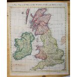

British Isles . A mixed collection of approximately 140 maps, mostly 19th century, maps of England & Wales, Scotland and Ireland, including exampl...
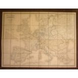
Europe. Dufour (A. H.), Carte Itineraire de L'Europe indiquant les limites actuelles des Etats..., Paris, 1843, large folding engraved map with co...
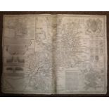
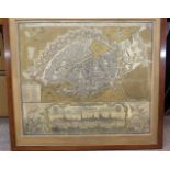
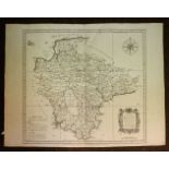
Gloucestershire. Speed (John), Glocestershire contrived into thirty thre severall hundreds & those againe into foure principall devisions. The cit...
Greece, Italy, Spain & Portugal. A mixed collection of forty-five maps, 18th & 19th century, engraved and lithographic maps, including examples by...
Hamburg. Visscher (Nicolas), Nobilissimi Albis Fluvii ostia nec non Hamburgense..., circa 1668, engraved linear map in two parts, with contemporar...
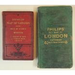
London . Reynolds (James), Reynolds' Map of London with Recent Improvements. Divided into Quarter Mile Sections for Measuring Distances, circa 188...
Maps. A mixed collection of approximately twenty maps, mostly 18th & 19th century, engraved British & foreign maps, including examples by Johnston...
![Saxton (Christopher), Twenty-five maps, [1579 but 20th century reproductions],](https://portal-images.azureedge.net/auctions-2019/srdom10135/images/e7f3297c-706c-4db9-a16b-aaa3012fb091.jpg?w=155&h=155)
Saxton (Christopher), Twenty-five maps, [1579, but 20th century reproductions], colour printed maps, each approximately 460 x 520 mm, some duplica...
Touring & Ordnance Survey. A mixed collection of approximately sixty five maps, mostly 20th century
Touring & Ordnance Survey. A mixed collection of approximately sixty five maps, mostly 20th century, O rdnance Survey, cycling and touring maps, i...
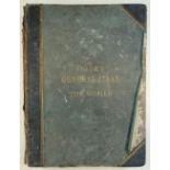
Hall (Sidney & Hughes William). Black's General Atlas, published Adam & Charles Black, 1851, printed title and index, sixty (complete as list and ...
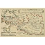
Hase (Johann Matthias). Regni Davidici et Salmonaei descriptio geographica et historica ... juncta est huic operi consideratio urbium maximarum ve...
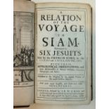
[Tachard, Guy]. A Relation of the Voyage to Siam. Performed by Six Jesuits, Sent by the French King, to the Indies and China, in the Year, 1685. W...
Murray's Handbooks. A Handbook to the English Lakes, included in the Counties of Cumberland, Westmoreland and Lancashire, 1st edition, 1889, foldi...
![Walpoole (George Augustus). The New British Traveller..., [1784],](https://portal-images.azureedge.net/auctions-2019/srdom10135/images/69f0aece-e0a3-42a4-8d1c-aaa3012fc982.jpg?w=155&h=155)
Walpoole (George Augustus). The New British Traveller or a Complete Modern Universal Display of Great-Britain and Ireland: [1784], decorative fron...