Refine your search
Filtered by:
- Category
- List
- Grid
This auctioneer has chosen to not publish their results. Please contact them directly for any enquiries.
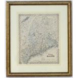

A 20thC print of J. H. Colton's map of Maine. Approx. 16" x 13" CONDITION: Please Note - we do not make reference to the condition of lots within...
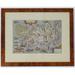
A print of Abraham Ortelius' map of Islandia - Iceland, from his atlas 'Theatrum Orbis Terrarum'.
A print of Abraham Ortelius' map of Islandia - Iceland, from his atlas 'Theatrum Orbis Terrarum'. Detailing Iceland's mountains, fjords, glaciers ...
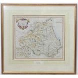
A framed map of the Bishoprick of Durham by Robert Morden, 1715. Approx. 15" x 43" CONDITION: Please Note - we do not make reference to the condi...
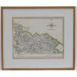
An engraved and hand coloured map of the north part of the West Riding of Yorkshire, published in New and Correct Atlas, by John Cary, 1809. Appro...
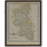
An engraved and hand coloured map of Buckinghamshire, published by John Cary, 1793. Approx. 10 1/4" x 8 1/4" CONDITION: Please Note - we do not m...
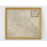
An engraved and hand coloured map of Northamptonshire, by Robert Morden, titled within a decorative cartouche, top right. Published by Abel Swale,...
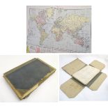
A cloth board folio containing a large quantity of 20thC coloured maps from The Daily Telegraph
A cloth board folio containing a large quantity of 20thC coloured maps from The Daily Telegraph Victory Atlas of the World series by Geographia Lt...