Filtered by:
- Category
- List
- Grid
A subscription to the Price Guide is required to view results for auctions ten days or older. Click here for more information
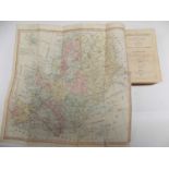

WAKEFIELD (PRISCILLA) "The Juvenile Traveller... Europe." Folding hand col map, cont sheep worn,
WAKEFIELD (PRISCILLA)"The Juvenile Traveller... Europe."Folding hand col map, cont sheep worn, 1818.
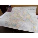
FOLDING ENGR. MAP. "Bacon's Excelsior Map of Yorkshire..." Col linen backed, approx 3 x 4 feet, c
FOLDING ENGR. MAP."Bacon's Excelsior Map of Yorkshire..."Col linen backed, approx 3 x 4 feet, c 1890's cloth covers.
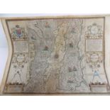
JOHN SPEED. good engraved map "The Isle of Man." hand coloured engr map 20 x 24 inches. Roger Rea,
JOHN SPEED. good engraved map "The Isle of Man." hand coloured engr map 20 x 24 inches. Roger Rea, early 1600's, printed text English reverse ......
LYSONS (D. & S.) "Magna Britannia... Cornwall." all engr plts and map complete, cont 1/2 ct, worn,
LYSONS (D. & S.) "Magna Britannia... Cornwall." all engr plts and map complete, cont 1/2 ct, worn, 1814. ...[more]
OGILBY (john). "Britannia...Principal Roads." 1939 edition, col maps comp, vg ...[more]
WRIGHT (REV. G.N.) "The Shores & Islands of the Mediterranean." Maps & 64 engr plts comp, finely
WRIGHT (REV. G.N.) "The Shores & Islands of the Mediterranean." Maps & 64 engr plts comp, finely bound Morocco gilt, aeg, 4to 1838 fine. ...[more]