Filtered by:
- Category
- List
- Grid
A subscription to the Price Guide is required to view results for auctions ten days or older. Click here for more information
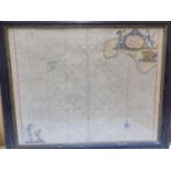

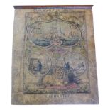
CAPT . GREENVILE COLLINS. Engraved Chart. West Cornwall and the Isles of Scilly. hand col engraving with cartouche, treasure, putti etc, 20 x 24 i...
DINES ( H.G .) "The Metalliferous Mining Region of South -West England." 2 Vols, maps comp, dj, 1969
DINES ( H.G .) "The Metalliferous Mining Region of South -West England." 2 Vols, maps comp, dj, 1969 good.
ROWE (SAMUEL) "A Peramulation of the Ancient and Royal Forest of Dartmoor." maps and plts comp, orig
ROWE (SAMUEL) "A Peramulation of the Ancient and Royal Forest of Dartmoor." maps and plts comp, orig cl gt, uncut, 1896 g.

CORNISH IRON AGE ARCHAOLOGICAL SITES Approx rolled pen and ink surveys, various sizes, name of
CORNISH IRON AGE ARCHAOLOGICAL SITES Approx rolled pen and ink surveys, various sizes, name of Col. F.C. Hirst noted on one, Portmeor, etc. one da...
ENGRAVED MAP. "A New Map of Surry ." by Robert Cary, 24 x 26 inches, f&g, 1804 good. ...[more]
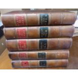
BRALEY ( E.W .) "A Topographical History of Surrey." 5 Vols, plts, maps etc. comp, cont 1/2 calf,
BRALEY ( E.W .) "A Topographical History of Surrey." 5 Vols, plts, maps etc. comp, cont 1/2 calf, 1841, some water staining.
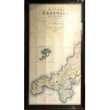
'Map of the County of Cornwall from an Actual Survey made in the years 1826 & 1827 C & J Greenwood, Most Respectfully Dedicated to the Nobility, C...
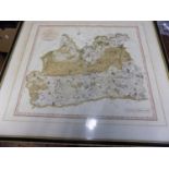
MORDEN (ROBERT). 'Surrey.' hand col engr map, 15 x 17", f & g c 1695g. ...[more]
JIGSAW MAP. 'Dissected Map of Europe.' hand col engr paper on wood ( four pieces missing) original
JIGSAW MAP. 'Dissected Map of Europe.' hand col engr paper on wood ( four pieces missing) original wooden box with paper onlay, circa 1830's publi...