Filtered by:
- Category
- List
- Grid
This auctioneer has chosen to not publish their results. Please contact them directly for any enquiries.
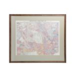

Descriptive Map of London Poverty 1889, North-Western sheet comprising part of Hampstead; Paddington (excepting north-west corner); Parts of St Ge...
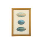
JOSEPH BONELLO (ACT.1878)
JOSEPH BONELLO (ACT.1878) Vignettes of Malta, three views of Valletta harbour Gouache Largest 6 x 11cm (3) ...[more]
Blome (Richard)
Blome (Richard) A Generall Mapp of the County of Hereford, woodcut map, from 'Britannia: or, a Geographical Description of the Kingdoms of Englan...
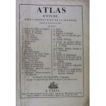
de Vaugondy (Didier Robert) & Delamarche (Charles-François) Atlas d'étude, pour l'instruction de la jeunesse: composé de trente-sept cartes, thir...
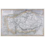
Macpherson (David) Asia Peninsularis cum insulis adjacentibus, steel engraved map, hand coloured, from ‘Atlas of ancient geography’, central ver...
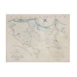
Middle East.- Moullart-Sanson (Pierre) Carte de la Geographie Sacree pour l’Ancien Testament…, copper engraved map, from Moullart’s 'Table Méthod...
Morden (Robert) Darbyshire
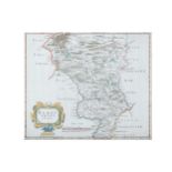
Morden (Robert) Darbyshire [Derbyshire], engraved map, contemporary handcolouring in outline, decorative title cartouche, c.358 x417mm, central v...
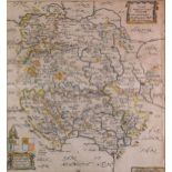
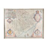
Morden (Robert) Hereford
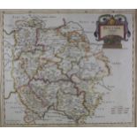
Morden (Robert) Hereford, copper engraved map, outlined in colour, decorative title cartouche, paper reinforced, occasional light foxing, 385 x 4...
Speed (John) The County of Monmouth…, wood engraved map, contemporary hand colouring, inset plan of Monmouth, decorative title cartouche, coats ...
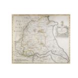
Yorkshire.- Morden (Robert)
Yorkshire.- Morden (Robert) The East Riding of Yorkshire & The North Riding..., hand-coloured engravings on laid paper, from Camden’s Britannia, ...

A mid to late 19th Century bronze depicting the philosopher Galileo (1564 - 1642) standing with one hand resting on a book on a pedestal, with boo...