Filtered by:
- Category
- List
- Grid
A subscription to the Price Guide is required to view results for auctions ten days or older. Click here for more information

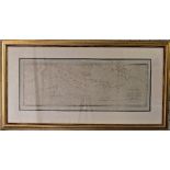
Japan: Scheuchzer (Johann Gaspar) 1702-1729, an 18thC Map of Japan: 'Ichnographica Urbis JEDO, quoe
Japan: Scheuchzer (Johann Gaspar) 1702-1729, an 18thC Map of Japan: 'Ichnographica Urbis JEDO, quoe Japonica Impery Metropolis & summi Japonum Mon...
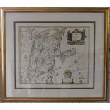
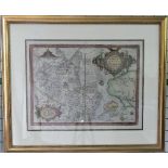
Japan: Blaeu (Johannes), Japonia Regnum, a mid 17thC engraved map of Japan with contemporary
Japan: Blaeu (Johannes), Japonia Regnum, a mid 17thC engraved map of Japan with contemporary outline colouring, image size16¼in x 22¼in (42cm x 56...
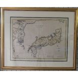
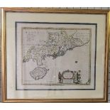
Japan: Bowen (Emanuel), A New and Accurate Map of the Empire of Japan, a mid 18thC engraved map
Japan: Bowen (Emanuel), A New and Accurate Map of the Empire of Japan, a mid 18thC engraved map of Japan with contemporary colouring, image size13...
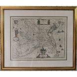
China: Blaeu (Guiljelmus & Johannes), CHINA Veteribus SINARUM REGIO nunc Incolis TAME dicta, a
China: Blaeu (Guiljelmus & Johannes), CHINA Veteribus SINARUM REGIO nunc Incolis TAME dicta, a mid 17thC engraved map of China, hand coloured, ima...
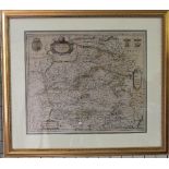
China: Blaeu (Johannes), QUANTUNG, IMPERII SINARUM PROVINCIA DUODECIMA, a mid 17thC engraved map of
China: Blaeu (Johannes), QUANTUNG, IMPERII SINARUM PROVINCIA DUODECIMA, a mid 17thC engraved map of Hong Kong, hand coloured, image size 16in x 19...
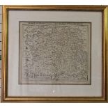
China: Blaeu (Johannes), SUCHUEN, IMPERII SINARUM PROVINCIA SEXTA, a mid 17thC engraved map of
China: Blaeu (Johannes), SUCHUEN, IMPERII SINARUM PROVINCIA SEXTA, a mid 17thC engraved map of Sechuan, hand coloured, image size 15¾in x 19¼in (4...
China: Blaeu (Johannes), NANKING, SIVE KIANGNAN IMPERII SINARUM PROVINCIA NONA, a mid 17thC engraved map of Nanking, hand coloured, image size 16i...
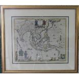
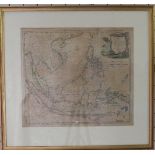
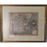
Southeast Asia: Blaeu (Guiljelmus), INDIA quae ORIENTALIS dicitur et INSULAE ADIACENTES., a mid
Southeast Asia: Blaeu (Guiljelmus), INDIA quae ORIENTALIS dicitur et INSULAE ADIACENTES., a mid 17thC engraved map of Asia, hand coloured, image s...
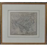
Russia and North Pacific: Ortelius (Abraham), TARTARIAE SIVE MAGNI CHAMI REGNI typus, a circa
Russia and North Pacific: Ortelius (Abraham), TARTARIAE SIVE MAGNI CHAMI REGNI typus, a circa 1573 engraved map of Russia & North Pacific, hand co...
World Map: Jansson (Joannes), Orbis Terrarum Veteribus Cogniti Typus Geographicus, a mid 17thC
World Map: Jansson (Joannes), Orbis Terrarum Veteribus Cogniti Typus Geographicus, a mid 17thC engraved map of the ancient world showing Europe, A...
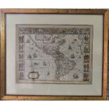
The Americas: Blaeu (Guiljelmus), AMERICAE nova Tabula. Auct: Guiljelmo Blaeuw., a mid 17thC
The Americas: Blaeu (Guiljelmus), AMERICAE nova Tabula. Auct: Guiljelmo Blaeuw., a mid 17thC engraved map of the New World (the Americas) across t...
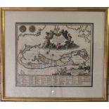
Bermuda: Montanus (Arnoldus), Mappa AESTIVARUM Insularum, Alias BARMUDAS Dictarum ad Ostia Mexi:, a
Bermuda: Montanus (Arnoldus), Mappa AESTIVARUM Insularum, Alias BARMUDAS Dictarum ad Ostia Mexi:, a late 17thC engraved map of Bermuda, hand colou...
A Chart of Captn. Carteret`s Discoveries at New Britain, with Part of Captn. Cook`s Passage Thro
A Chart of Captn. Carteret`s Discoveries at New Britain, with Part of Captn. Cook`s Passage Thro Endeavour Streights, & of Captn. Dampier`s Tract ...
Italy: Blaeu (Joh. and Cornelius), TERRITORIO PADOVANO, a mid 17thC engraved Map of Venice and
Italy: Blaeu (Joh. and Cornelius), TERRITORIO PADOVANO, a mid 17thC engraved Map of Venice and its environs, hand coloured, image size 15in x 19¾i...
Spain: After Blaeu (family), UTRUSQUE CASTILAE nova descriptio, a mid 17thC map of Castille, Spain,
Spain: After Blaeu (family), UTRUSQUE CASTILAE nova descriptio, a mid 17thC map of Castille, Spain, another map verso, hand coloured, image size 1...
France: Munster, Sebastian, Das Gantzte Frankreich/so vorzeiten Narbonensis, Lugdunensis, Belgica
France: Munster, Sebastian, Das Gantzte Frankreich/so vorzeiten Narbonensis, Lugdunensis, Belgica und Celtica ist genennt worden; a late 16thC/ear...
Wales: Mercator (Gerard), CAMBRIAE TYPUS Auctore HUMFREDO LHUYDO Denbigiense Cambobritanno, Petrus Kaerius caela, [1606 - 1633], a mid 17thC engra...
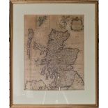
Scotland: Hole (William), Scotia Regnum, an early 17thC engraved topgraphical Map of Scotland, hand
Scotland: Hole (William), Scotia Regnum, an early 17thC engraved topgraphical Map of Scotland, hand coloured, image size 10¼in x 12¼in (26cm x 31c...
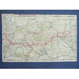
![Scotland: Gordon (Robert) SCOTIA ANTIQUA: MAP OF SCOTLAND [Amsterdam: Blaeu,] a mid 17thC](https://portal-images.azureedge.net/auctions-2020/srchil10043/images/61382a68-adc4-4cb3-b628-ac2400f67a54.jpg?w=155&h=155)
Scotland: Gordon (Robert) SCOTIA ANTIQUA: MAP OF SCOTLAND [Amsterdam: Blaeu,] a mid 17thC engraved Map of Scotland, hand coloured, image size 16½i...
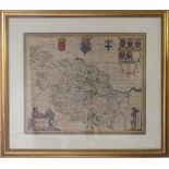
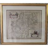
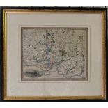
Yorkshire: Blaeu (Johannes), Ducatus Eboracensis pars Occidentalis The West Riding of Yorkshire,
Yorkshire: Blaeu (Johannes), Ducatus Eboracensis pars Occidentalis The West Riding of Yorkshire, a mid 17thC engraved map of The West Riding of Yo...
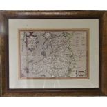
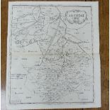
Shropshire: Morden (Robert), Shropshire by Robert Morden sold by Abel Swale Awnsham & John Churchil, a late 17thC engraved Map, hand coloured, ima...
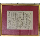
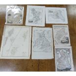
English Counties: twelve various antiquarian Maps, including a 19thC Birmingham Street Map, A New
English Counties: twelve various antiquarian Maps, including a 19thC Birmingham Street Map, A New Map of Northamptonshire from the best Authoritie...
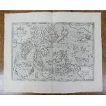
South East England: Mercator (Gerald), Warwicum, Northhamtonia, Huntingdonia, Cantabrigia, Suffolcia, Oxonium, ..., a mid 17thC engraved map of So...
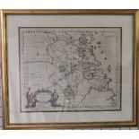
Sussex: Blaue (Johannes)/Jansson (Jan), SUTHSEXIA, Vernacule SUSSEX, a mid 17thC engraved map of
Sussex: Blaue (Johannes)/Jansson (Jan), SUTHSEXIA, Vernacule SUSSEX, a mid 17thC engraved map of Sussex and The British Sea, hand coloured, image ...
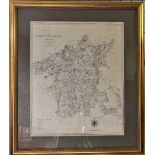
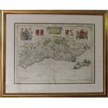
Cornwall: Morden (Robert), CORNWALL by Robert Morden, a late 17thC engraved Map, hand coloured,
Cornwall: Morden (Robert), CORNWALL by Robert Morden, a late 17thC engraved Map, hand coloured, image size 14in x 16½in (35.5cm x 42cm), paper puc...

A quantity of Map and Map Collecting reference Books, including Shirley; 'The Mapping of the World',
A quantity of Map and Map Collecting reference Books, including Shirley; 'The Mapping of the World', New Holland, 1993, Humphreys; 'Old Decorative...
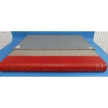
'Baleu's Atlas, England, Scotland, Wales and Ireland', published by Thames and Hudson, undated, c.
'Baleu's Atlas, England, Scotland, Wales and Ireland', published by Thames and Hudson, undated, c.1970, folio, in red half leather over grey cloth...
English Counties: Wiltshire, Somersetshire, Glocestershire, Dorsetshire, Devon and Cornwall -
English Counties: Wiltshire, Somersetshire, Glocestershire, Dorsetshire, Devon and Cornwall - fifteen various antiquarian Maps, including a 18thC ...
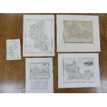
English Counties: Northamptonshire, Oxfordshire, Worcestershire, Leicestershire, Herefordshire,
English Counties: Northamptonshire, Oxfordshire, Worcestershire, Leicestershire, Herefordshire, Monmouthshire, Warwickshire, Rutlandshire and The ...
English Counties: Isle of Wight, Surrey, Berkshire, Hampshire, Herfordshire and Buckinghamshire -
English Counties: Isle of Wight, Surrey, Berkshire, Hampshire, Herfordshire and Buckinghamshire - approx. sixteen various antiquarian Maps, includ...
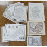
English Counties: Bedfordshire, Buckinghamshire, Lincolnshire, Huntingdonshire, Essex, Cambridgeshire, approx. thirty various antiquarian Maps, in...
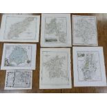
English Counties: Northumberland, Westmoreland, Yorkshire, Derbyshire, Cumberland, and Durham,
English Counties: Northumberland, Westmoreland, Yorkshire, Derbyshire, Cumberland, and Durham, together with a map of Great Britain and Ireland an...
Four maps by E Bowen, monochrome: France, Italy and 'A Map of the Extent of Alexanders Conquests' , together with another similar: Persia Sive Sha...
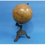
An early 20thC Globe, raised on a cast iron stand, retailed by G. Pirks and Son, 10 Old Town
An early 20thC Globe, raised on a cast iron stand, retailed by G. Pirks and Son, 10 Old Town Street and 1 East Street, Plymouth for The West of En...
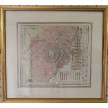
The "District Railway" Map of London, 5th edition, c1893, a large-scale, full-colour map, 42in x
The "District Railway" Map of London, 5th edition, c1893, a large-scale, full-colour map, 42in x 26in (107cm x 66cm), linen-backed and folded, sho...