
Filtered by:
- Category
- List
- Grid
A subscription to the Price Guide is required to view results for auctions ten days or older. Click here for more information


LOCAL HISTORY TOPOGRAPHY/TRAVEL - various travel pamphlet guides from the UK and Worldwide, to
LOCAL HISTORY TOPOGRAPHY/TRAVEL - various travel pamphlet guides from the UK and Worldwide, to include; Eccles Official Guide and Industrial Handb...
J. AIKIN, A DESCRIPTION OF THE COUNTRY FROM THIRTY TO FORTY MILES ROUND MANCHESTER, PRINTED FOR JOHN
J. AIKIN, A DESCRIPTION OF THE COUNTRY FROM THIRTY TO FORTY MILES ROUND MANCHESTER, PRINTED FOR JOHN STOCKDALE PICCADIILY JUNE 4 1795, various pla...
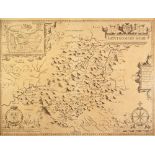
ANTIQUE MAP OF MONTGOMERYSHIRE BY JOHN SPEED, with town plan upper left, and text verso, 15" x
ANTIQUE MAP OF MONTGOMERYSHIRE BY JOHN SPEED, with town plan upper left, and text verso, 15" x 20", (38cm x 50.8cm), foxing, ...[more]
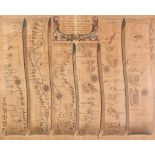
ANTIQUE HAND COLOURED ROAD MAP, 'St. DAVIDS TO HOLYWELL' BY JOHN OGILBY, 13 ½" x 17 ½" (34.3cm x
ANTIQUE HAND COLOURED ROAD MAP, 'St. DAVIDS TO HOLYWELL' BY JOHN OGILBY, 13 ½" x 17 ½" (34.3cm x 44.4cm) heavily faded
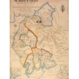
ANTIQUE HAND COLOURED MAP OF LANCASTER BY ROBERT MORDEN, 17" X 15" (43.2cm x 38.1cm) unframed but
ANTIQUE HAND COLOURED MAP OF LANCASTER BY ROBERT MORDEN, 17" X 15" (43.2cm x 38.1cm) unframed but stuck down, LATER MAP OF THE DIOCESE OF CARLISLE...
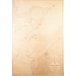
LARGE MAP OF THE MENAI STRAIT PUBLISHED AT THE ADMIRALTY, 1963 Including a vignette of 'THE SWELLIES', surveyed, 1872 39" x 26 ½" (99cm x 67.3cm) ...
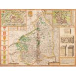
JOHN SPEED (1610) ENGRAVED AND HAND COLOURED COUNTY MAP of Northumerland Published by Sudbury and
JOHN SPEED (1610) ENGRAVED AND HAND COLOURED COUNTY MAP of Northumerland Published by Sudbury and Humble text verso 15" x 20" (38cm x 51cm) borde...
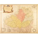
LE ROUGE 1742 A FRENCH ENGRAVED AND HAND COLOURED MAP OF MORAVIA 20" X 25 1/4" (51cm X 64cm)
LE ROUGE 1742 A FRENCH ENGRAVED AND HAND COLOURED MAP OF MORAVIA 20" X 25 1/4" (51cm X 64cm) ...[more]