Filtered by:
- Category
6 items
- List
- Grid
A subscription to the Price Guide is required to view results for auctions ten days or older. Click here for more information

Lot 442
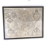
A 17th century map of the county of Monmouth, by John Speede, framed with glazed viewing panel on
442A 17th century map of the county of Monmouth, by John Speede, framed with glazed viewing panel on
A 17th century map of the county of Monmouth, by John Speede, framed with glazed viewing panel on the back, frame length 56cm
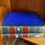
2 volumes of Picturesque Europe, including British Isles and The Continent
A group of Antique maps prints, framed (5)
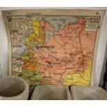
A Vintage French double-sided school map, depicting Russian and Finland
Lot 1733
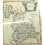
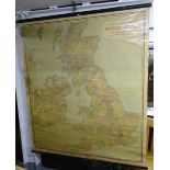
A Vintage coloured single-sided school map, New Reduced Survey of The British Isles, by John
A Vintage coloured single-sided school map, New Reduced Survey of The British Isles, by John Bartholomew F.R.G.S., 140cm x 166cm
Lot 1734
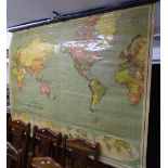
A Vintage coloured single-sided school map, Philip's School Room Map of the World, 168cm x 130cm
1734A Vintage coloured single-sided school map, Philip's School Room Map of the World, 168cm x 130cm
A Vintage coloured single-sided school map, Philip's School Room Map of the World, 168cm x 130cm