Refine your search
Filtered by:
- Category
- List
- Grid
A subscription to the Price Guide is required to view results for auctions ten days or older. Click here for more information
![[BLAEU, Joannes (1596-1673)]. Hertfordia Comitatus. Vernacule Hertfordshire. [Amsterdam: c. 1648].](https://portal-images.azureedge.net/auctions-2020/srbe10231/images/3fb6853c-8ae5-4023-bd9b-ac7e010e9348.jpg?w=155&h=155)

[BLAEU, Joannes (1596-1673)]. Hertfordia Comitatus. Vernacule Hertfordshire. [Amsterdam: c. 1648].
[BLAEU, Joannes (1596-1673)]. Hertfordia Comitatus. Vernacule Hertfordshire. [Amsterdam: c. 1648]. Hand-coloured engraved map of Hertfordshire, f...
![[BLAEU, Joannes (1596-1673)]. Surria Vernacule Surrey. [Amsterdam: c. 1662].](https://portal-images.azureedge.net/auctions-2020/srbe10231/images/ab54f02e-66e7-40a3-97de-ac7e010e9c52.jpg?w=155&h=155)
[BLAEU, Joannes (1596-1673)]. Surria Vernacule Surrey. [Amsterdam: c. 1662]. Hand-coloured engraved map of Surrey, baroque title cartouche, coats...
![[BRAUN, Georg (1541-1622) & Frans HOGENBERG (1535-90)].](https://portal-images.azureedge.net/auctions-2020/srbe10231/images/aeddec23-10f2-4aa0-af8f-ac7e010ec040.jpg?w=155&h=155)
[BRAUN, Georg (1541-1622) & Frans HOGENBERG (1535-90)]. Brightstowe, vulgo; quondam venta, floretissimum Angliae Emporium. [Amsterdam c. 1581]. E...
CASSINI, Giovanni Maria (1745-1824). L' America. Secondo. Le ultime osservazioni divisa ne' suoistati principali. Rome: 1788. Hand-coloured engra...
CRUCHLEY, George Frederick (1797-1880). Cruchley's Environs of London Extending Thirty Miles from the Metropolis. London: 1825. Large hand-colour...
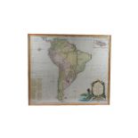
D' ANVILLE, Jean Baptisite Bourguignon (1697-1782). A Map of South America containing Tierra-Firma, Guayana, New Granada, Amazonia, Brasil, Peru,...
![[DRAYTON, Michael (1563-1631) & William HOLE (d. 1624)]. Surrey ... Sussex.](https://portal-images.azureedge.net/auctions-2020/srbe10231/images/1c725cf6-2192-4884-87f0-ac7e010f8aaf.jpg?w=155&h=155)
[DRAYTON, Michael (1563-1631) & William HOLE (d. 1624)]. Surrey ... Sussex. [London: 1612 or later]. Engraved allegorical map including London, ...
FADEN, William (1749-1836).
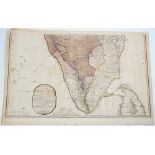
FADEN, William (1749-1836). A Map of the Peninsula of India from the 19th Degree North Latitude to Cape Comorin. London: 1792. Hand-coloured engr...
![[GOOS, Pieter (c. 1616-75)]. Pascaerte van Westindien de Vaste Kusten en de Eylanden.](https://portal-images.azureedge.net/auctions-2020/srbe10231/images/1b6961d5-f697-40d8-a4df-ac7e010fe89c.jpg?w=155&h=155)
[GOOS, Pieter (c. 1616-75)]. Pascaerte van Westindien de Vaste Kusten en de Eylanden. [Amsterdam: c. 1666]. Hand-coloured engraved sea chart, tit...
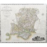
GREENWOOD & CO. (publisher). Map of the County of Southampton. From an Actual Survey made in the Years 1825 & 1826 by C. & I. Greenwood. London: ...
![“LESAGE, A.” (psued.) [i.e. Emmanuel-Augustin-Dieudonné-Joseph, comte de Las Cases (1766-1842)].](https://portal-images.azureedge.net/auctions-2020/srbe10231/images/1e170262-8d20-4c47-8775-ac7e0110b819.jpg?w=155&h=155)
“LESAGE, A.” (psued.) [i.e. Emmanuel-Augustin-Dieudonné-Joseph, comte de Las Cases (1766-1842)].
“LESAGE, A.” (psued.) [i.e. Emmanuel-Augustin-Dieudonné-Joseph, comte de Las Cases (1766-1842)]. [Twin-hemisphere Map of the World.] Venice: c. 1...
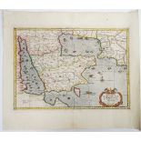
MERCATOR, Gerard (1512-94). Tab. VI. Asiae. Arabiam Felicem, Carmaniam ac Sinum Persicum comprehendens. [Utrecht: François Halma, c. 1695]. Hand-...
SAXTON, Christopher (c. 1540-c. 1610) & William HOLE (d. 1624). Oxoniensis. Comitatus vulgo Oxfordshyre qui pars olim Dobunorum. [London: c. 1607...
SEUTTER, Matthäus (1678-1757).
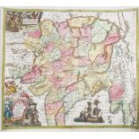
SEUTTER, Matthäus (1678-1757). Imperii magni Mogolis sive indici Padschach, juxta recentissimas navigations, accurate delineatio. Augsburg: [c. 1...
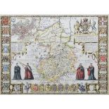
SPEED, John (1552-1629).
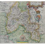
SPEED, John (1552-1629). Cambridgeshire described with the devision of the hundreds, the Townes situation, with the Armes of the Colleges of that...
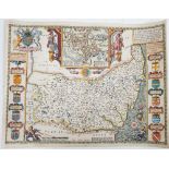
SPEED, John (1552-1629).
SPEED, John (1552-1629). Suffolke described and divided into Hundreds, The situation of the fayre towne Ipswich shewed, with the Armes of the mos...
![SPEED, John (1552-1629). Wight Island. [London:] John Sudbury and G. Humbell[sic], [1611 or later].](https://portal-images.azureedge.net/auctions-2020/srbe10231/images/fa7349a3-6e35-4eb5-9983-ac7e011206dd.jpg?w=155&h=155)
SPEED, John (1552-1629). Wight Island. [London:] John Sudbury and G. Humbell[sic], [1611 or later].
SPEED, John (1552-1629). Wight Island. [London:] John Sudbury and G. Humbell[sic], [1611 or later]. Hand-coloured engraved map of the Isle of Wig...
MARTIN, Ferdinand (1795-1866). Mémoire sur l' Etiologie du Pied-Bot ... Atlas. Paris: chez l' Auteur, 1839. Oblong 4to (223 x 308mm). 6 lithograp...