Refine your search
Filtered by:
- Category
- List
- Grid
A subscription to the Price Guide is required to view results for auctions ten days or older. Click here for more information
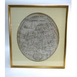

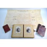
An Irish George IV silk embroidered oval map of Europe 'Wrought' by Mary Knott, Mountmelik School AD
An Irish George IV silk embroidered oval map of Europe 'Wrought' by Mary Knott, Mountmelik School AD 1822, 55 x 46 cm, later mounted, framed and g...
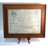
A 17th century County map engraving of Sussex, 35 x 41 cm, mounted, framed and glazed
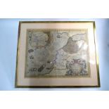
A 17th century map engraving afer Abraham Ortelius 'Fessae et Marocchi Regna Africae Celeberr' (
A 17th century map engraving afer Abraham Ortelius 'Fessae et Marocchi Regna Africae Celeberr' (Morocco), dated 1595, 39.5 x 50.5 cm, mounted, fra...
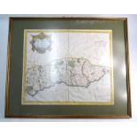
A John Speede uncoloured map engraving after Jodocus Hondius, 'Hantshire defcribed and devided',
A John Speede uncoloured map engraving after Jodocus Hondius, 'Hantshire defcribed and devided', with text on reverse, 38 x 52 cm, framed and glaz...
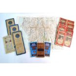
Five Ordnance Survey linen-backed folding maps, c.1904
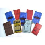
Nine various Bacons folding maps - early 20th century
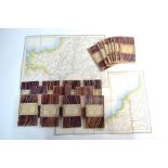
Twenty Victorian Ordnance Survey linen-backed folding 1-inch maps of England & WalesNew 1inch
Twenty Victorian Ordnance Survey linen-backed folding 1-inch maps of England & WalesNew 1inch Ordnance Survey of England and WalesSheets 285, 322,...
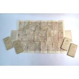
A bundle of vintage folding maps - mostly pre 1950
A Victorian linen-backed folding map of the Lydenburg Gold Fields (Transvaal), by R. Kelsey Loveday,
A Victorian linen-backed folding map of the Lydenburg Gold Fields (Transvaal), by R. Kelsey Loveday, Pretoria 1883, 100 x 106 cm, in slip-case, to...