Refine your search
Filtered by:
- Category
- List
- Grid
A subscription to the Price Guide is required to view results for auctions ten days or older. Click here for more information
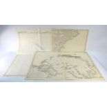

A collection of maritime charts, Northern Europe, Mediterranean, Atlantic & Polar, circa 1970s
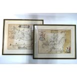
A pair of 17th century map engravings by Joan Blaeu after Timothy Pont, 'Nithia Vicecomitatus,
A pair of 17th century map engravings by Joan Blaeu after Timothy Pont, 'Nithia Vicecomitatus, The Shirifdome of Nidis-Dail' (now: Nithsdale Dumfr...
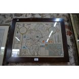
A John Speed county map engraving, Cumberland, showing Carlile (sic) and 'Many Memorable Antiquities', including The Picts Wall (Hadrian's Wall), ...
A 17th century Jan Jansson map engraving of Dombes (Burgundy region), 40 x 50 cm approx, framed and glazed Condition Report Heavy foxing ...[m...
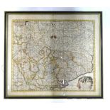
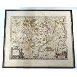
A 17th century map engraving by Frederik de Witt, 'Belgii, Hispanici Gallici' (Belgium), 47 x 55 cm,
A 17th century map engraving by Frederik de Witt, 'Belgii, Hispanici Gallici' (Belgium), 47 x 55 cm, framed and glazed