Filtered by:
- Category
- List
- Grid
A subscription to the Price Guide is required to view results for auctions ten days or older. Click here for more information
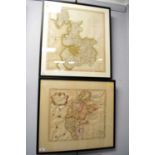

Robert Morden and three others
Robert Morden - Map of Cumberland, hand coloured engraving, 34 x 42cms; 'A new map of the County Palatinenof Lancaster', hand coloured engraving, ...
Two 18th Century style road maps
Two 18th Century style road maps, comprising; 'The Continuation of the Road from London to Berwick', 30.5 x 37cms; together with 'The Continuation...
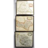
Group of four maps
A group of four maps, comprising; an Ordnance Survey map of Cumbria, 35 x 49.5cms; a map of Monmouth and surroundings, 15 x 20.5cms; After G Cole ...
Robert Morden - Group of four maps, comprising; 'The East Riding of Yorkshire' hand coloured engraving, 38 x 44cms; 'The North Riding of Yorkshire...
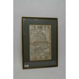
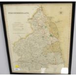
A framed map of Northumberland
Engraved map of Northumberland by Herman Moll, framed and under glass. ...[more]
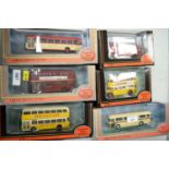
Selection of Exclusive First Edition model buses, including: Newcastle Ales; Showbus Special; United N.B.C.; O K Motorservices; and others; each b...
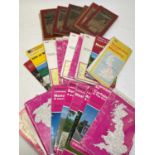
Selection of Early 20th Century and later Ordnance Survey maps, including: Map of Barnard Castle and District; Contoured Road Map of Kirkby Stephe...