Filtered by:
- Category
- List
- Grid
A subscription to the Price Guide is required to view results for auctions ten days or older. Click here for more information
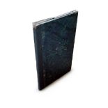

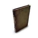
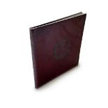
Atlas - Ansart, Felix - Cours D'histoire Et De Geographie, 16 Hand Coloured Maps, C1850 "Cours D'
Atlas - Ansart, Felix - Cours D'histoire Et De Geographie, 16 Hand Coloured Maps, C1850 "Cours D'histoire Et De Geographie…" Paris: Ch. Fouraut. 8...
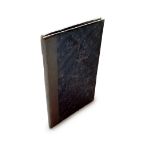
Atlas - Ansart, Felix - Cours D'histoire Et De Geographie, 16 Hand Coloured Maps, C1850 A Bound
Atlas - Ansart, Felix - Cours D'histoire Et De Geographie, 16 Hand Coloured Maps, C1850 A Bound set of Maps from "Cours D'histoire Et De Geographi...
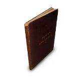
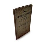
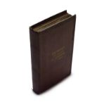
Atlas - Arnold, Thomas Kerchever - A First Classical Atlas, 14 Maps, 1849 "A First Classical Atlas…"
Atlas - Arnold, Thomas Kerchever - A First Classical Atlas, 14 Maps, 1849 "A First Classical Atlas…" London: Francis & John Rivington, 1849. 8vo (...
Atlas - Black's Modern Atlas, 27 Colour Maps, 1879, Fine Copy "Black's Modern Atlas…" Edinburgh:
Atlas - Black's Modern Atlas, 27 Colour Maps, 1879, Fine Copy "Black's Modern Atlas…" Edinburgh: Adam and Charles Black, 1879. 4to (305 x 245mm) C...
Atlas - Brion de La Tour, Louis - Atlas et tables elementaires de geographie, 20 Maps, 1774 "Atlas
Atlas - Brion de La Tour, Louis - Atlas et tables elementaires de geographie, 20 Maps, 1774 "Atlas et tables elementaires de geographie, ancienne ...
Atlas - British Isles Invasions, Large Hand Coloured Map by Tardieu, 1798 "Notice Historique des
Atlas - British Isles Invasions, Large Hand Coloured Map by Tardieu, 1798 "Notice Historique des Descentes qui ont ete faites dans les isles Brita...
Atlas - Cornell, Sarah Sophia - Cornell's Companion Atlas, 25 Maps, 1861 "Cornell's Companion Atlas to Cornell's High School Geography" New York: ...
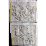
Atlas - Duruy, Victor - Atlas de Geographie Historique Universelle, 10 Maps, 1845 "Atlas de Geographie Historique Universelle" Paris: Chamerot, 18...
Atlas - Geographie Cartographique - 12 Colour Maps, 1878 "Geographie Cartographique Illustree des
Atlas - Geographie Cartographique - 12 Colour Maps, 1878 "Geographie Cartographique Illustree des Commencants" Paris: A. Pigoreau, 1878. 8vo (185 ...
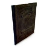
Atlas - Goldsmith, Rev. J - A Grammar of General Geography, 23 Maps & Plates, C1860 "A Grammar of
Atlas - Goldsmith, Rev. J - A Grammar of General Geography, 23 Maps & Plates, C1860 "A Grammar of General Geography…" London: Longman, Brown, Gree...
Atlas - Manuscript Atlas, 20 Hand Painted Maps, Sophie de Baure, Fine Example "Atlas Geographique
Atlas - Manuscript Atlas, 20 Hand Painted Maps, Sophie de Baure, Fine Example "Atlas Geographique Fair par Sophie de Baure" nd, C1840. Oblong 4to ...
Atlas - Mitchell, Samuel Augustus - A System of Modern Geography, 40 Hand Col Maps, 1852 "A System
Atlas - Mitchell, Samuel Augustus - A System of Modern Geography, 40 Hand Col Maps, 1852 "A System of Modern Geography, Comprising a Description o...
Atlas - Strada, Famiano, Leo Belgicus Map, Vellum Binding, Fine Copy, 1658 "Famiani Stradae Romani E
Atlas - Strada, Famiano, Leo Belgicus Map, Vellum Binding, Fine Copy, 1658 "Famiani Stradae Romani E Societate Jesu De Bello Belgico Decas Secunda...
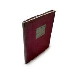
Atlas - The Student's Atlas of Physical Geography, 20 Colour Maps, 1871 "The Student's Atlas of
Atlas - The Student's Atlas of Physical Geography, 20 Colour Maps, 1871 "The Student's Atlas of Physical Geography" William Collins: London, nd 18...
Pelham, Cavendish - The World: Or, the Present State of the Universe, 50 Plates & Maps, 1819, Full
Pelham, Cavendish - The World: Or, the Present State of the Universe, 50 Plates & Maps, 1819, Full Calf "The World: Or, the Present State of the U...
Bowen, Emanuel 1733 Rare Hand Coloured Map of the USA, Canada & Atlantic "A Map Of The King of Great
Bowen, Emanuel 1733 Rare Hand Coloured Map of the USA, Canada & Atlantic "A Map Of The King of Great Britain's Dominions In Europe, Africa and Ame...
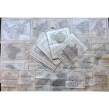
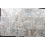
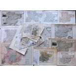
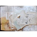
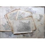
British County Maps C1830-50 Lot of 45 Maps Incl Northants, Notts, Northumberland, Westmoreland,
British County Maps C1830-50 Lot of 45 Maps Incl Northants, Notts, Northumberland, Westmoreland, Monmouth, Flint, Huntingdon, Beds, Derbys, Herefo...
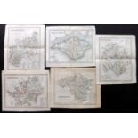
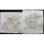
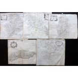
British County Maps C1840 Group of 5 Maps by Dugdale/Archer Incl Herefordshire, Hertfordshire,
British County Maps C1840 Group of 5 Maps by Dugdale/Archer Incl Herefordshire, Hertfordshire, Gloucester, Isle of Wight and Radnor. Steel Engrave...
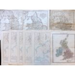
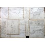
British Isles/England and Wales 1808-1892 Lot of 9 Maps Lot of 9 Maps showing the British Isles or
British Isles/England and Wales 1808-1892 Lot of 9 Maps Lot of 9 Maps showing the British Isles or England and Wales as a whole. Incl Hydrographic...
British Maps 18th-19th Century Lot of 19 Incl Yorkshire, Cheshire, Cumberland, Channel Islands,
British Maps 18th-19th Century Lot of 19 Incl Yorkshire, Cheshire, Cumberland, Channel Islands, Bedford, Huntingdon, Middlesex, Gloucestershire, P...
California C1790 Pair of Early Maps by Vaugodny from Diderot's Encyclopedia "Carte de la Californie Suivant" together with "Carte De La Californie...
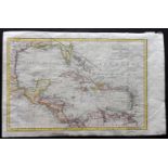
Cary, John 1801 Hand Coloured Map of the West Indies & Gulf of Mexico "The West Indies, and Gulf
Cary, John 1801 Hand Coloured Map of the West Indies & Gulf of Mexico "The West Indies, and Gulf of Mexico" Hand Coloured Copper Engraved Map Publ...
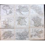
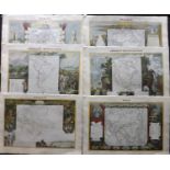
Dower, John C1836 Lot of 20 Maps Incl Austria, Turkey, South America, Spain/Portugal, Russia,
Dower, John C1836 Lot of 20 Maps Incl Austria, Turkey, South America, Spain/Portugal, Russia, Prussia, Belgium, Chile, Denmark, Egypt, Columbia, E...
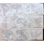
Dower, John C1850 Lot of 12 Maps from the School Atlas Incl South America, Turkey, Russia, Persia,
Dower, John C1850 Lot of 12 Maps from the School Atlas Incl South America, Turkey, Russia, Persia, Palestine, India, Greece, Italy, Africa and Sou...
Essex 18th-19th Century Lot of 25 County Maps Good Lot of 25 Copper & Steel Engraved Maps. Examples by Owen & Bowen, Pigot, Zatta, Cary, Moule, Mo...
Findlay, Alexander & Kelly, Thomas 1843 Lot of 15 Maps Incl France, Holland & Belgium, Brazil, South
Findlay, Alexander & Kelly, Thomas 1843 Lot of 15 Maps Incl France, Holland & Belgium, Brazil, South America, Egypt, England and Wales, German Sta...
Gilbert, James & Archer, J. 1845 Lot of 9 Maps Incl Belgium, Turkey, Switzerland, Germany, Prussia, Austria and Africa. Steel Engraved Maps Publi...
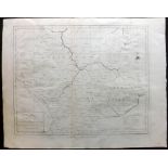
Harrison (Pub) 1789 Map of Leicester & Rutland Copper Engraved Map Published 1789, by John Harrison,
Harrison (Pub) 1789 Map of Leicester & Rutland Copper Engraved Map Published 1789, by John Harrison, London for "The History of England..." by Pau...
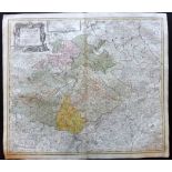
Homann, Johann Baptist C1730 Hand Coloured Map of Saxon Germany & Bohemia, Czech Republic "Circuli
Homann, Johann Baptist C1730 Hand Coloured Map of Saxon Germany & Bohemia, Czech Republic "Circuli Supe. Saxoniae Pars Meridionalis sive Ducatus" ...
Kent C1780 Pair of Hand Coloured Maps by Edward Hasted Hand Coloured Copper Engraved Maps Published 1778-99, London for "The History and Topograph...
Levasseur, Victor 1856 Set of 6 Hand Coloured Continent Maps Hand Coloured Steel Engraved Maps
Levasseur, Victor 1856 Set of 6 Hand Coloured Continent Maps Hand Coloured Steel Engraved Maps Published 1856, Paris for "Atlas National Illustre"...
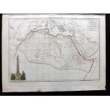
Malte-Brun, Conrad 1812 Map of Ancient Africa "Afrique Ancienne" Copper Engraved Map Published 1812,
Malte-Brun, Conrad 1812 Map of Ancient Africa "Afrique Ancienne" Copper Engraved Map Published 1812, Paris for "Atlas Complet du Précis de la Géog...
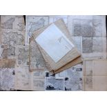
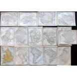
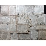
Maps 18th-19th Century. Mixed Lot of 43 Maps Lot of 43 Copper, Steel and Lithographed Maps. Incl
Maps 18th-19th Century. Mixed Lot of 43 Maps Lot of 43 Copper, Steel and Lithographed Maps. Incl Australia, New Zealand, Pacific, Turkey, Belgium,...
Morden, Robert C1700 Group of 5 County Maps Incl Sussex, Huntingdon, Notts, Northants and Monmouth. Copper Engraved Map Published 1695-1722, Londo...
Moule, Thomas C1840 Lot of 50 British County Maps Good lot of Moule Maps, full set or near full set.
Moule, Thomas C1840 Lot of 50 British County Maps Good lot of Moule Maps, full set or near full set. All different. Steel Engraved Maps Published ...
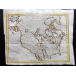
North America C1790 Hand Coloured Map by Vaugondy from Diderot's Encyclopedia "Carte des parties
North America C1790 Hand Coloured Map by Vaugondy from Diderot's Encyclopedia "Carte des parties nord et ouest de l'Amerique" Hand Coloured Copper...
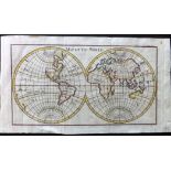
Pluche, Noel Antoine 1776 Hand Coloured Map of the World. Hemispheres "Map of the World" Copper
Pluche, Noel Antoine 1776 Hand Coloured Map of the World. Hemispheres "Map of the World" Copper Engraved Map Published 1776, London for "Spectacle...
SDUK (Pub) C1840 Lot of 12 Maps of Africa Incl West Africa, North Africa, Egypt, Algeria, Tunis,
SDUK (Pub) C1840 Lot of 12 Maps of Africa Incl West Africa, North Africa, Egypt, Algeria, Tunis, Tripoli and Libya. Steel Engraved Maps Published ...
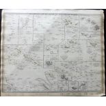
SDUK (Pub) C1840's Map of Polynesia or Islands in the Pacific Ocean Steel Engraved Map Published
SDUK (Pub) C1840's Map of Polynesia or Islands in the Pacific Ocean Steel Engraved Map Published C1840, London for "Maps by the Society for the D...
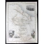
Tallis, John (Pub) 1852 Hand Coloured Map of British Guayana Steel Engraved Map Published London for
Tallis, John (Pub) 1852 Hand Coloured Map of British Guayana Steel Engraved Map Published London for "The Universal Pronouncing Dictionary" Centre...
Weekly Dispatch C1860 Lot of 60+ Maps by Edward Weller et al. Incl Prussia, Germany, Kent, Hertfordshire, Naples/Sicily, Yorkshire, West Africa, R...
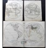
World Hemispheres C1810-50 Group of 3 Maps "Hydrographical Map of the World" 2 Joined Maps Published
World Hemispheres C1810-50 Group of 3 Maps "Hydrographical Map of the World" 2 Joined Maps Published by Orr, London, 1850. Together with Eastern a...
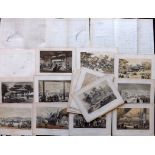
Japan 1856 Lot of 21 Lithographs + 3 Maps. Perry Expedition Lithographs Published 1856 by D. Appleton & Co., New York for "Narrative of the Expedi...