Sortieren nach:
- Kategorie
- Liste
- Galerie
Ein Abonnement der Preisliste ist notwendig um Ergebnisse, von Auktionen die vor einem längeren Zeitraum als 10 Tagen stattgefunden haben, ansehen zu können. Klicken Sie hier für mehr Informationen
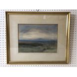

Eveleen Buckton (20th century) - 'North Wales', signed lower right, titled verso, 24 x 32 cm,
Eveleen Buckton (20th century) - 'North Wales', signed lower right, titled verso, 24 x 32 cm, mounted, framed and glazed
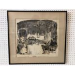
Gerald Scarfe (b.1936) - 'But Nell, the Queen is becoming suspicious!', ink and correction fluid
Gerald Scarfe (b.1936) - 'But Nell, the Queen is becoming suspicious!', ink and correction fluid on paper with characters collaged on top, signed ...
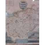
Four hand coloured maps to include: Robert Morden (c.1650-1703), 'Leicestershire' engraving on
Four hand coloured maps to include: Robert Morden (c.1650-1703), 'Leicestershire' engraving on paper, 43 x 36 cm; William Henri Toms (c.1700-c.175...
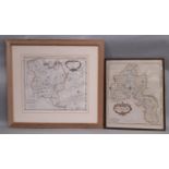
Three hand-coloured engravings of maps to include: Georg Matthäus Suetter (1678-1757) - Gallia,
Three hand-coloured engravings of maps to include: Georg Matthäus Suetter (1678-1757) - Gallia, France old map, 'Gallia Concinata Ad Magnum', 26 x...
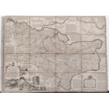
An antiquarian map of the County of Kent Divided into its Lathes, by Eman Bowen 1736 together with
An antiquarian map of the County of Kent Divided into its Lathes, by Eman Bowen 1736 together with an early 19th century map of Italy (2)
Wallis's New & Correct Map Of The Post Roads of England & Wales, published by John Wallis, London
Wallis's New & Correct Map Of The Post Roads of England & Wales, published by John Wallis, London 1790 with original case, a French postal map pub...
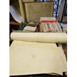
A collection of assorted maps to include various ordnance survey maps, a framed rail road and
A collection of assorted maps to include various ordnance survey maps, a framed rail road and township map of Wyoming, a late 19th century Atlas o...