Sortieren nach:
- Kategorie
- Liste
- Galerie
Ein Abonnement der Preisliste ist notwendig um Ergebnisse, von Auktionen die vor einem längeren Zeitraum als 10 Tagen stattgefunden haben, ansehen zu können. Klicken Sie hier für mehr Informationen
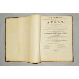

'LE SAGE'S HISTORICAL, GENEALOGICAL, CHRONOLOGICAL AND GEOGRAPHICAL ATLAS, 1st Edition, pub Gold &
'LE SAGE'S HISTORICAL, GENEALOGICAL, CHRONOLOGICAL AND GEOGRAPHICAL ATLAS, 1st Edition, pub Gold & Co, 1818 ...[more]
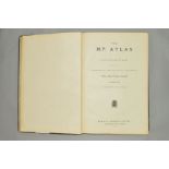
THE M.P. ATLAS, a collection of maps showing the Commercial and Political Interests of The British
THE M.P. ATLAS, a collection of maps showing the Commercial and Political Interests of The British Isles and Empire, 1st Edition, W & A.K. Johnsto...
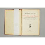
BARTHOLOMEW, J.G., 'The Royal Atlas of England and Wales', 1st Edition, pub Newnes lacks front
BARTHOLOMEW, J.G., 'The Royal Atlas of England and Wales', 1st Edition, pub Newnes lacks front endpapers, otherwise clean and complete
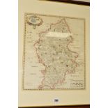
STAFFORDSHIRE, MORDEN (ROBERT), an 18th Century hand coloured engraved map of the county, framed and
STAFFORDSHIRE, MORDEN (ROBERT), an 18th Century hand coloured engraved map of the county, framed and glazed, approximately 43cm x 37cm
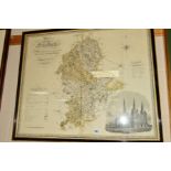
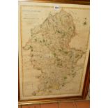
STAFFORDSHIRE, GREENWOOD (C & J), 'A Map of the County of Stafford from an Actual Survey Made in the
STAFFORDSHIRE, GREENWOOD (C & J), 'A Map of the County of Stafford from an Actual Survey Made in the years 1818 and 1819', published by Greenwood ...
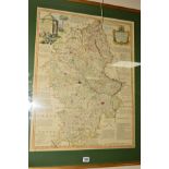
STAFFORDSHIRE, BOWEN (EMANUEL), 'An IMPROVED MAP of The COUNTY of STAFFORD Divided into its HUNDREDS, Collected from the best materials and Illust...

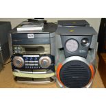
A COLLECTION OF 1940'S AND LATER AIRCRAFT RECOGNITION CARDS AND PHOTOGRAPHS, etc, with a quantity of
A COLLECTION OF 1940'S AND LATER AIRCRAFT RECOGNITION CARDS AND PHOTOGRAPHS, etc, with a quantity of WWII A.T.C. Gazette and The Aeroplane Spotter...
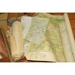
A QUANTITY OF ORDNANCE SURVEY MAPS, road and town maps and plans, Bradshaws and ABC Railway guides, bus, maps, timetables and other ephemera
STAFFORDSHIRE, YATES (W), 'The County of Stafford Reduced from the Improved Map in Six Sheets, .....
STAFFORDSHIRE, YATES (W), 'The County of Stafford Reduced from the Improved Map in Six Sheets, ..... Planned by a Scale of Two Miles to an Inch', ...