Verfeinern Sie Ihre Suche
Auktionshaus-Kategorie
Schätzpreis
Kategorie
- Books & Periodicals (160)
- Prints (56)
- Maps (29)
- Watercolours (16)
- Furniture (10)
- Arms, Armour & Militaria (7)
- Collectables (4)
- Musical Instruments & Memorabilia (4)
- Drawings & Pastels (3)
- Oil, Acrylic paintings & Mixed Media (3)
- Classic Cars, Motorcycles & Automobilia (2)
- Vintage Fashion (2)
- Jewellery (1)
- Models, Toys, Dolls & Games (1)
- Sculpture (1)
- Stamps (1)
- Liste
- Galerie
Ein Abonnement der Preisliste ist notwendig um Ergebnisse, von Auktionen die vor einem längeren Zeitraum als 10 Tagen stattgefunden haben, ansehen zu können. Klicken Sie hier für mehr Informationen

Evans (Edward). South With Scott, London: Collins, circa 1942, 27 monochrome illustrations, folding map to the rear endpapers, period inscription ...
Facsimile Atlas. Ptolemy (Claudio), Geographia Ptolemaeus Auctus Restitutus Emaculatus, cum tabulis veteribus ac nobis, West of England Press Ltd....
Loader (T. B. publisher). The Illustrated Atlas of Ancient and Modern Geography..., circa 1850
Loader (T. B. & Ashton J. publishers). The Illustrated Atlas of Ancient and Modern Geography, Science, Commerce and Statistics, circa 1850, callig...
Portugal. The History of Spain and Portugal, from B.C. 1000 to A.D. 1814, London: Baldwin and Cradock, 1833, spotted, contemporary calf gilt, red ...
![Rome. [Costumi della Corte Pontificia, Rome, 1846],](https://portal-images.azureedge.net/auctions-2023/srdom10209/images/94408559-5f9f-4cc8-92c5-afa200c972d7.jpg?w=155&h=155)
Rome. [Costumi della Corte Pontificia, Rome, 1846], appears to lack the printed title, 31 engraved plates with contemporary hand-colouring of Vati...
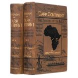
Stanley (Henry Morton). Through the Dark Continent, or the Sources of the Nile Around the Great Lakes of Equatorial Africa and Down the Livingston...
Tardieu (Ambrose). Atlas pour servir a L'Intelligence de L'Histoire Générale des Voyages de la Harpe, Paris, Étienne Ledoux, 1821, additional half...
![Wright (G.N. & Thomas Allen). China, in a Series of Views, 2 volumes (of 4), [1843]](https://portal-images.azureedge.net/auctions-2023/srdom10209/images/bb2a3628-67a4-4644-b3e9-afa200c98677.jpg?w=155&h=155)
Wright (G.N. & Thomas Allen). China, in a Series of Views, Displaying the Scenery, Architecture, and Social Habits, 2 volumes (of 4), London: Fish...
Beattie (William). The Waldenses or Protestant valleys of Piedmont, Dauphiny, and the Ban de la Roche, London: George Virtue, 1838, engraved portr...
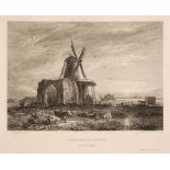
Cotman (John). A Series of Etchings Illustrative of the Architectural Antiquities of Norfolk, 1818
Cotman (John Sell). A Series of Etchings Illustrative of the Architectural Antiquities of Norfolk; with references to the authors who have describ...
Cromwell (Thomas Kitson). Excursions in the county of Norfolk, Suffolk & Essex, 6 volumes, 1818-19
Cromwell (Thomas Kitson). Excursions in the county of Norfolk, Suffolk & Essex, 6 volumes, London: Longman, Hurst, Orme & Brown, 1818-19, engraved...
Green (William). The Tourist's New Guide, containing a Description of the Lakes, 2 vols., 1819
Green (William). The Tourist's New Guide, containing a Description of the Lakes, Mountains, and Scenery, in Cumberland, Westmorland, and Lancashir...
Hoare (Sir Richard Colt). A Collection of Forty-Eight Views of Noblemen's and Gentlemen's Seats, Towns, Castles, Churches, Monasteries, and Romant...
Pevsner (Nikolaus). Buildings of England series, 50 volumes, Penguin Books, 1952-84, comprising 23 1st editions from London, 1952 to Dorset, 1972,...
Radclyffe (Charles W.) Views in Birmingham and its Vicinity, Birmingham: Knott, Hawker and Coburn, circa 1840, tinted additional lithograph title,...
Richardson (Thomas Miles). Memorials of old Newcastle upon Tyne ... comprising forty etchings from original drawings of the towers, gateways, chur...
Stark (James & J.W. Robberds, Jun.) Scenery of the Rivers of Norfolk, comprising the Yare, the Waveney, and the Bure, Norwich: printed by John Sta...
Taunt (Henry W.) A New Map of the River Thames, 3rd edition, Oxford: Henry W. Taunt, [1879], 33 double-page leaves of map sections, ecah with moun...
The Victoria History of the Counties of England. 50 volumes, mixed editions, circa 1930-74, numerous monochrome illustrations, some odd & ex-libra...
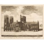
Willis (Browne). A survey of the cathedrals of York, Durham, Carlisle, Chester ... and Bristol,
Willis (Browne). A Survey of the Cathedrals of York, Durham, Carlisle, Chester, Man, Lichfield, Hereford, Worcester, Gloucester and Bristol... Lon...
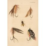
Bainbridge (George C.) The Fly Fisher's Guide, illustrated by coloured plates, representing upwards of forty of the most useful flies, accurately ...
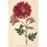
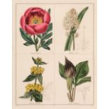
Curtis (William). The Botanical Magazine or Flower-Garden Displayed, volumes 9 & 10 (bound as one) 1795 - 96, 72 engraved plates with contemporary...
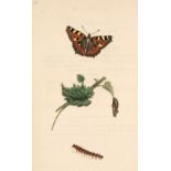
Donovan (Edward). The Natural History of British Insects:..., volume 2 only, London: printed for the author, 1793, 36 hand-coloured plates, some l...
Jones (Henry). The Wildfowl Paintings of Henry Jones, Text by Peter J.S. Olney, Foreword by Sir Peter Scott, London: Threshold/Harrap, 1987, sixty...
Maund (Benjamin). The Botanic Garden or Magazine of Hardy Flower Plants, 55 parts, numbers 133, 135 - 137, 139 - 140, 142 - 146, 148 - 156 [and] 1...
Millais (John Guille). The Mammals of Great Britain and Ireland, 3 vol., limited edition, 1904.
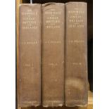
Millais (John Guille). The Mammals of Great Britain and Ireland, 3 volumes, London: Longmans, Green, and Co., 1904-06, titles in red and black, ph...
Osbaldiston (William Augustus). The Universal Sportsman: or, Nobleman, Gentleman, and Farmer’s Dictionary of Recreation and Amusement. Including a...
Anglesey. Speed (John), Anglesey Antiently called Mona, Henry Overton, circa 1710, hand-coloured engraved map, inset plan of Beaumaris, large stra...
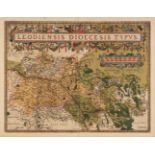
* Belgium. Ortelius (Abraham), Leodiensis Dioecesis Typus, [1595 or later], engraved map with contemporary hand colouring, elaborate strapwork car...
British Isles. A collection of approximately 40 maps, 19th century, engraved and lithographic maps of the British Isles and England & Wales, inclu...
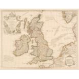
British Isles. De L'Isle (Guillaume), Les Isles Britanniques ou sont le Rme. d'Angleterre tiré de Sped celuy d'Ecosse tiré de Th. Pont &c. et celu...
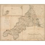
Cornwall. Rundell (William Westcott), Cornwall, W. Wood, Falmouth, circa 1850, uncoloured engraved folding map, printed in blue and laid on linen,...
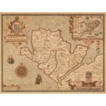
Durham. Speed (John), The Bishoprick and Citie of Durham, Henry Overton, circa 1720, engraved map with sparse early outline colouring, inset map o...
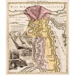
* Egypt. Homann (Johann Baptist). Aegyptus Hodierna, Nuremberg, circa 1720, engraved map with bright contemporary hand-colouring, slight staining ...
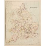
England & Wales. Barlow (William), England, 17th September 1861, highly detailed pen, ink and watercolour map of England and Wales, slight dust so...
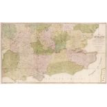
England & Wales. Phillips (M.), The Grand Southern Tour of England including the Principal part of the East, West & Inland Counties, Patronised by...
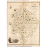
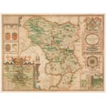
Folding Maps. Greenwood (C. & J.), Map of the County of Warwick from actual Survey, made in the years 1820 & 1821, Dedicated to the Nobility, Cler...
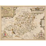
Huntingdonshire. Speed (John), Huntington Both Shire and Shire Towne with the Ancient Citie Ely Described, Thomas Bassett & Richard Chiswell [1676...
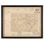
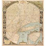
* London Railways. Betts (J. C.), Railways of London, Waterlow & Sons Limited, Dunstable & Watford, winter 1924/25 issue, colour lithographic map ...
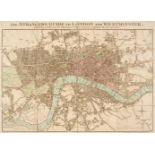
London. Mogg (Edward). The Strangers Guide to London and Westminster, Exhibiting all the various Alterations & Improvements to the Present Time, J...
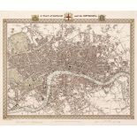
London. Walker (J & C), A Plan of London and its Environs, circa 1830, hand-coloured engraved map, originally published in 'Lewis's Topographical ...
Mackenzie (Murdoch). The South Coast of Cardigan Bay..., & The North Part of Cardigan Bay..., 1775
Mackenzie (Murdoch Snr.). The South Coast of Cardigan Bay in Wales..., & The North Part of Cardigan Bay in Wales..., 1775, two large coloured sea ...
Map Reference & Facsimile Atlases. A collection of 30 volumes, mostly 20th-century, including Shirley (Rodney W.). The Mapping of the World, Early...
Maps. A collection of approximately 200 maps, 17th - 19th century, including Speed (John). Anno Darbieshire described, Thomas Bassett & Richard Ch...
Maps. A collection of approximately 40 British & foreign maps, 18th & 19th century, engraved and lithographic maps, including examples by or after...
![Maps. Saxton (Christopher & Hole G.), Glocestriae comitatus olim sedes Dobunorum [1627]](https://portal-images.azureedge.net/auctions-2023/srdom10209/images/8c567a23-f952-4ad5-8a39-afa200c9ba46.jpg?w=155&h=155)
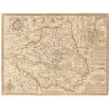
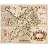
* Maps. Saxton (Christopher & Hole G.), Glocestriae comitatus olim sedes Dobunorum [1627], hand-coloured engraved map, large strapwork cartouche, ...
Maps. Smith (Charles). Smith's New Map of England and Wales and part of Scotland including the Turnpike and principal Cross Roads..., 1821, engrav...
* Montgomeryshire. Speed (John), Montgomery Shire, John Sudbury & George Humble, circa 1627, hand-coloured engraved map, inset town plan of Montgo...
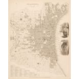
National Geographic Society (publishers). The Reaches of New York City, Baltimore, 1939, large decorative lithographic map by Albert H. Bumstead, ...
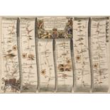
* Ogilby (John). The Road from London to Holy-head co. Anglesy..., circa 1675, hand-coloured engraved strip road map, cartouche shows surveyor wit...
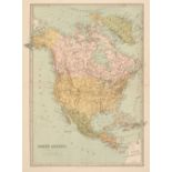
Philip (George & Son, publishers). Philip's Handy General Atlas of America, 1879, title and index, 22 (of 23, lacking the map of Kansas) double-pa...
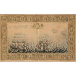
* Pine (John). Untitled engraving showing the progress of the Spanish Armada, T. & J. Bowles, 1739, a hand-coloured engraving with the central pan...
S. D. U. K. A collection of approximately 95 maps, circa 1840, engraved maps, many with contemporary outline colouring, including 18 town and city...
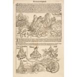
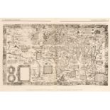
Schedel (H.). A collection of approximately 25 leaves, mostly late 15th century, woodblock leaves of text illustrated with portraits, allegorical ...
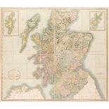
Scotland. Cary (John), A New Map of Scotland from the Latest Authorities, 1819, engraved map with contemporary wash colouring, sectionalised and l...
The Map Collector. A complete run, volumes 1 - 74, December 1977 - Spring 1996, numerous colour and black and white illustrations throughout, all ...
Title Pages. A collection of approximately 50 title pages, 17th - 19th century, letterpress titles, portrait frontispieces, decorative titles and ...
![Tombleson (William). Tombleson's Panoramic Map of the Thames and Medway, [1834]](https://portal-images.azureedge.net/auctions-2023/srdom10209/images/bd659016-820f-41c8-8866-afa200c9c1f7.jpg?w=155&h=155)
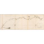
* Tombleson (William). Tombleson's Panoramic Map of the Thames and Medway, [1834], hand-coloured engraved panoramic map on two sheets conjoined, o...
* Wales. A collection of 24 maps, 17th - 20th century, engraved and lithographic county maps, town plans and regional maps, including examples by ...
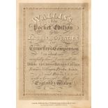
Wallis (James). Wallis's New Pocket Edition of the English Counties or Travellers Companion in which are carefully laid down all the Direct & Cros...