Sortieren nach:
- Kategorie
- Liste
- Galerie
Ein Abonnement der Preisliste ist notwendig um Ergebnisse, von Auktionen die vor einem längeren Zeitraum als 10 Tagen stattgefunden haben, ansehen zu können. Klicken Sie hier für mehr Informationen
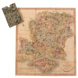

County maps etc. A collection of 19th Century maps including Cary, John. A New Map of Hampshire, 1811; A New Map of Warwickshire, 1818; A New Map ...
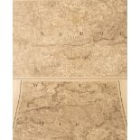
Baker (B) Ordnance Map of Hampshire, published by Col. Mudge Tower, 14th Aug 1817, folding map of 52 linen backed panels, 465cm x 91cm and the gre...
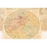
Mogg, Edward. Mogg's Twenty Four Miles Round London, 1812. Folding engraved map, linen backed, hand coloured. With another map (2)
Stewart (F A) Hunting Counties, a map of Gloucestershire by James C Walker, Places of the Meeting of the Foxhounds and five other maps
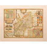
John Speed/Gloucestershire/hand coloured engraved map with text on reverse, 39cm x 52cm
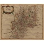
Robert Morden/Map of Gloucestershire/engraving, 36cm x 44.5cm