Filtered by:
- Category
- List
- Grid
A subscription to the Price Guide is required to view results for auctions ten days or older. Click here for more information
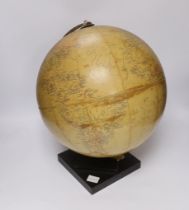

An early 20th century Philips Challenge 13 1/2 inch globe
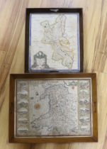
An 18th century hand coloured map of Wales, framed as a twin handled drink’s tray, together with
An 18th century hand coloured map of Wales, framed as a twin handled drink’s tray, together with another after Robert Morden, Buckinghamshire, lar...
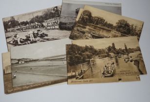
A collection of vintage topographical postcards including some local views
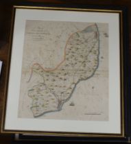
Four 18th / 19th century Map’s of the Hundreds including ‘Loningborough & Folkestone’ together
Four 18th / 19th century Map’s of the Hundreds including ‘Loningborough & Folkestone’ together with ‘The Road from London to Dover’, by John Ogilb...
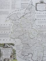
After Emanuel Bowen (1694-1767), hand coloured map of Buckinghamshire, printed for R Sayer, T Bowles
After Emanuel Bowen (1694-1767), hand coloured map of Buckinghamshire, printed for R Sayer, T Bowles and I Bowles, 1756, 72 x 56cm
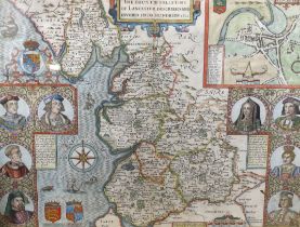
After John Speed (1552-1629), hand-coloured engraved map, ‘The Countie Palletine of Lancaster
After John Speed (1552-1629), hand-coloured engraved map, ‘The Countie Palletine of Lancaster Described and Divided into Hundreds’, 1610, text ver...