Filtered by:
- Categoria
- Elenco
- Grid
A subscription to the Price Guide is required to view results for auctions ten days or older. Click here for more information
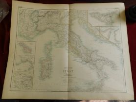

Maps of Europe - Kingdom of Italy Large detailed double page map with several insets from 'The Royal
Maps of Europe - Kingdom of Italy Large detailed double page map with several insets from 'The Royal Illustrated Atlas, of Modern Geography' publi...
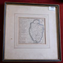
Framed Map of Norfolk Sept 20th 1741 published by Badeslade & Jones measurements 32cm x 32cm good
Framed Map of Norfolk Sept 20th 1741 published by Badeslade & Jones measurements 32cm x 32cm good condition black and white. Buyer collects
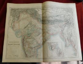
The British Possessions in the East Indies with The Dependant States and Countries Adjacent (
The British Possessions in the East Indies with The Dependant States and Countries Adjacent (compiled by J. Hugh Johnson F.R.G.S. and printed by A...
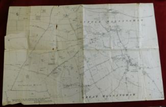
Maps (2) including a Kelly's Map of Lincolnshire and an Ordnance Map of Great & Little Massingham
Maps (2) including a Kelly's Map of Lincolnshire and an Ordnance Map of Great & Little Massingham
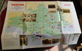
Dorset in Wartime 50th Anniv D. Day Dorset 1994 including map good condition

Stereographic risqué 1960s Postcards from Prague (2) made by Magicard Co., and produced by Jan Vit
Stereographic risqué 1960s Postcards from Prague (2) made by Magicard Co., and produced by Jan Vit in the Czech Republic, in good condition. The e...