Filtered by:
- Catégorie
4 items
- Liste
- Grille
A subscription to the Price Guide is required to view results for auctions ten days or older. Click here for more information
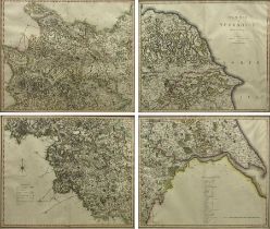

'A New Map of Yorkshire Divided into Ridings', set of four 19th century engraved maps, printed by C.S. Smith, London, second edition pub. 1808, ea...
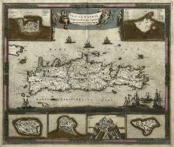
Frederik de Wit (Dutch 1629-1706): 'Insula Candia Ejusque Fortificatio' - Crete, 17th century engraved map with later hand-colour 46cm x 55cm
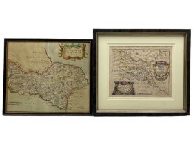
Robert Morden (British c.1650-1703): 'The North Riding of Yorkshire', 18th/19th century engraved map with later hand-colour 35cm x 41cm;Richard Bl...
Lot 4119
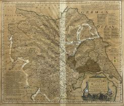
Emanuel Bowen (British 1694-1767): 'An Accurate Map of the County of York Divided into its Ridings a
Emanuel Bowen (British 1694-1767): 'An Accurate Map of the County of York Divided into its Ridings and Subdivided into Wapontakes', 18th/19th cent...