Filtered by:
- Sale Section
3 items
- Liste
- Grille
Ce commissaire-priseur a choisi de ne pas publier ses résultats. Veuillez le contacter directement pour toute demande de renseignements.
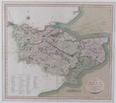

‘A New Map of Kent Divided into Lathes’ engraved by John Cary (1755-1835), dated 1806. Hand coloured. Framed/glazed. ‘A new map of Kent divided in...
Lot 211
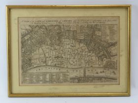
An engraved map illustrating the ruins and extent of the Great Fire of London, late 18th century.
211An engraved map illustrating the ruins and extent of the Great Fire of London, late 18th century.
An engraved map illustrating the ruins and extent of the Great Fire of London, late 18th century. Entitled ‘A Plan of the City and Liberties of Lo...
Lot 212
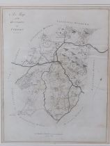
‘A Map of the Hundred of Twyford’ engraved by Bayly of London, circa 1779. From Edward Hasted’s
‘A Map of the Hundred of Twyford’ engraved by Bayly of London, circa 1779. From Edward Hasted’s History & Topographical Survey of the County of Ke...