Filtered by:
- Category
- List
- Grid
A subscription to the Price Guide is required to view results for auctions ten days or older. Click here for more information
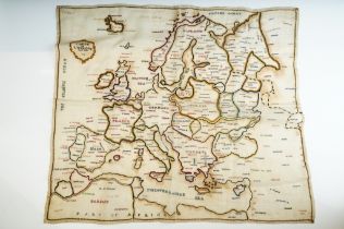

18th Century George III hand stitched sampler depicting a map of Europe including stitched place
18th Century George III hand stitched sampler depicting a map of Europe including stitched place names. Dated 1783. Measures 53 x 46cm.

L.S. Lowry (1887 - 1976), ' The Old Town Hall ', Middlesborough, limited edition print, numbered
L.S. Lowry (1887 - 1976), ' The Old Town Hall ', Middlesborough, limited edition print, numbered lower left 601/850, 41.5 x 31cm, gilt framed
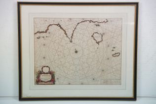
Doncker, Henrick (1626 - 1699), Morea, a coastal map of Peloponnese, numbered 14 bottom left and
Doncker, Henrick (1626 - 1699), Morea, a coastal map of Peloponnese, numbered 14 bottom left and right, plate size 40 x 52cm, margins under mount,...
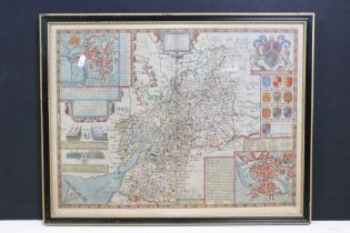
John Speede (1552 - 1629) Glocestershire ( Gloucestershire) map, hand coloured engraving, label
John Speede (1552 - 1629) Glocestershire ( Gloucestershire) map, hand coloured engraving, label verso ' This print is guaranteed to be over 120 ye...
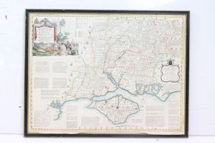
Thomas Kitchin, a new and improved map of Hampshire, published by Sayer, Fleet Street, London,
Thomas Kitchin, a new and improved map of Hampshire, published by Sayer, Fleet Street, London, page number 16 in top and bottom right margin, hole...