
Filtered by:
- Item Type
- List
- Grid
This auctioneer has chosen to not publish their results. Please contact them directly for any enquiries.
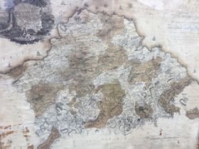

A large engraved map of Haddingtonshire, Scotland, 2in/mile, print published in Edinburgh in 1802
A large engraved map of Haddingtonshire, Scotland, 2in/mile, print published in Edinburgh in 1802 from the 1799 survey by William Forrest, with el...
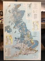
A large 1:625 000 scale quaternary map of the United Kingdom, first edition, 1977, paper laid on
A large 1:625 000 scale quaternary map of the United Kingdom, first edition, 1977, paper laid on plywood, showing areas of geological deposits. (4...
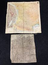
Two wartime silk double-sided maps of Germany, the French Spanish border, the German Swiss frontier,
Two wartime silk double-sided maps of Germany, the French Spanish border, the German Swiss frontier, The Pyrenees, etc. (20in x 18.25in & 28.5in x...
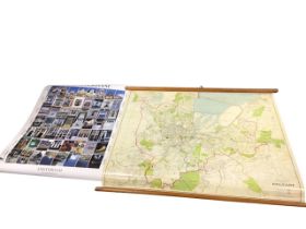
A Geographia 1960s wall chart map of Belfast on pine battens - 37in x 31in; and an Art Unlimited
A Geographia 1960s wall chart map of Belfast on pine battens - 37in x 31in; and an Art Unlimited poster printed with images of Amsterdam - 23.75in...
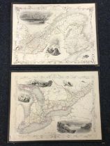
A pair of handcoloured engraved maps of West and East Canada & New Brunswick by J Rapkin for The
A pair of handcoloured engraved maps of West and East Canada & New Brunswick by J Rapkin for The Illustrated Atlas 1851, with vignettes of local s...
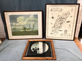
Cyril Walter Bion, colour print, Springtime in Ireland, bearing Edinburgh label verso, framed - 19.
Cyril Walter Bion, colour print, Springtime in Ireland, bearing Edinburgh label verso, framed - 19.5in x 15.5in; a printed map of Colonsay, framed...