Refine your search
Sale Section
Remove filter- Books, Maps, Postcards & Stamps (33)
Estimate
Category
Filtered by:
- Lots with images only,
- Sale Section
- List
- Grid
A subscription to the Price Guide is required to view results for auctions ten days or older. Click here for more information
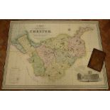

Cheshire. Swire (W. & Hutchings W.F.), A Map of the County Palatine of Chester, Divided into Hundreds and Parishes from an Accurate Survey made in...
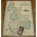
Lancashire. Hennet (George), A Map of the County Palatine of Lancaster Divided into Hundreds and
Lancashire. Hennet (George), A Map of the County Palatine of Lancaster Divided into Hundreds and Parishes from an Accurate Survey made in the Year...
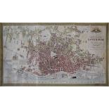
LIVERPOOL, BENNISON (JONATHAN) A Map of the Town and Port of Liverpool, large engraved map by J.
LIVERPOOL, BENNISON (JONATHAN) A Map of the Town and Port of Liverpool, large engraved map by J. Dower after Bennison, finely hand-coloured, disse...
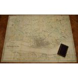
GAGE (MICHAEL ALEXANDER) Trigonometrical Plan of the Town and Port of Liverpool, including the
GAGE (MICHAEL ALEXANDER) Trigonometrical Plan of the Town and Port of Liverpool, including the Environs of Kirkdale, Everton, Low Hill, Edge Hill,...
Teesdale's Map of the County Palatine of Chester, Divided into Hundreds and Parishes, from an
Teesdale's Map of the County Palatine of Chester, Divided into Hundreds and Parishes, from an accurate survey made in the years 1828 and 1829 by W...
SPEED (JOHN) Stafford Countie and Towne with the Ancient Citie Lichfeild described, hand-coloured
SPEED (JOHN) Stafford Countie and Towne with the Ancient Citie Lichfeild described, hand-coloured double-page engraved map, inset views of Staffor...

SPEED (JOHN) Shropshiyre described The Sittuation of Shrowesbury Shewed, inset plan of Shrewsbury,
SPEED (JOHN) Shropshiyre described The Sittuation of Shrowesbury Shewed, inset plan of Shrewsbury, coats of arms, inset note on Battle of Shrewsbu...
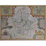
SPEED (JOHN) The West Ridinge of Yorkeshire with the most famous and fayre Citie Yorke described,
SPEED (JOHN) The West Ridinge of Yorkeshire with the most famous and fayre Citie Yorke described, hand-coloured double-page engraved map, inset vi...
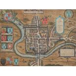
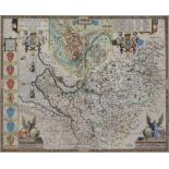
Braun (Georg) and Hogenburg (Frans), Cestria (vulgo) Chester. Anglia, a bird's eye view of Chester, engraved town plan, hand coloured, first publi...
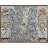
SPEED (JOHN) The Isle of Man, Exactly Described and into several Parishes divided with every Towne, Village, Baye, Creke and River therein conteyn...
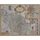
Cheshire. Speed (John), The Countye Palatine of Chester with that most ancient Citie described, sold
Cheshire. Speed (John), The Countye Palatine of Chester with that most ancient Citie described, sold John Sudbury and George Humble, [1611, or lat...

Cheshire. Bowen (Emanuel), An Accurate Map of the County Palatine of Chester, Divided into Its
Cheshire. Bowen (Emanuel), An Accurate Map of the County Palatine of Chester, Divided into Its Hundreds, c.1760s, engraved map, ornamental title a...
![CHESHIRE [BLAEU (WILLEM and JAN)] Cestria comitatus Palatinus, hand-coloured, double-page engraved](https://portal-images.azureedge.net/auctions-2015/srpet10071/images/b0adebe5-35e7-4a8d-a3be-844be05a984b.jpg?w=155&h=155)
CHESHIRE [BLAEU (WILLEM and JAN)] Cestria comitatus Palatinus, hand-coloured, double-page engraved
CHESHIRE [BLAEU (WILLEM and JAN)] Cestria comitatus Palatinus, hand-coloured, double-page engraved map, with decorative cartouches, Dutch text on ...
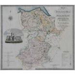
C & J Greenwood, Map of the North West Circuit of The Principality of Wales, comprising the Counties
C & J Greenwood, Map of the North West Circuit of The Principality of Wales, comprising the Counties of Anglesey, Caernarfon & Merioneth, from Act...
C & J Greenwood, Map of the North East Circuit of The Principality of Wales, comprising the Counties
C & J Greenwood, Map of the North East Circuit of The Principality of Wales, comprising the Counties of Flint, Denbigh & Montgomery, from an Actua...
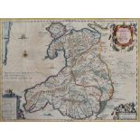
Humfredo Lhuydo, Lloyd (Humphrey), Cambriae Typus, a map of Wales, 17th century, hand coloured,
Humfredo Lhuydo, Lloyd (Humphrey), Cambriae Typus, a map of Wales, 17th century, hand coloured, engraved, plate size 34.5 x 49.5cm.; 13.75 x 19.5i...

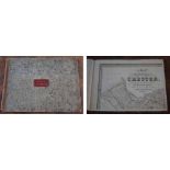
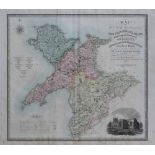
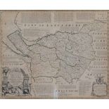
Ordnance Survey map of Cheshire running from Warrington in the North to Nantwich in the South,
Ordnance Survey map of Cheshire running from Warrington in the North to Nantwich in the South, folding into 32 sections, paper laid on linen, over...
Cheshire. Bowen (Emanuel), An Accurate Map of the County Palatine of Chester, Divided into Its
Cheshire. Bowen (Emanuel), An Accurate Map of the County Palatine of Chester, Divided into Its Hundreds, c.1760s, engraved map, ornamental title a...
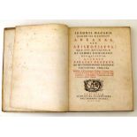
Macarius, J., Ioannis Macarii Canonici Ariensis Abraxas, 1657, printed by Platiniana Balthasar
Macarius, J., Ioannis Macarii Canonici Ariensis Abraxas, 1657, printed by Platiniana Balthasar Moretti, Anturpiae, 143 pages plus index and Ioanni...
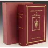
Warrilow, E.J., A Sociological History of Stoke on Trent, limited edition, 1977, red calf, illustrated, no 242 of 1000, signed author, slip-case, ...

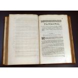
The English Hexapla in parallel columns, exhibiting the six important English translations of the
The English Hexapla in parallel columns, exhibiting the six important English translations of the New Testament scriptures, black cloth, published...
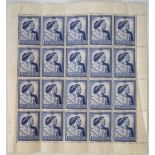
GB 1948 £1 silver wedding value in unmounted mint sheet of 20 stamps, some creasing affecting two
GB 1948 £1 silver wedding value in unmounted mint sheet of 20 stamps, some creasing affecting two stamps. ...[more]
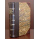
Leycester, P., Historical Antiquities in two books the first treating Great Brettain, the second
Leycester, P., Historical Antiquities in two books the first treating Great Brettain, the second concerning Cheshire, 673, front board detached, b...
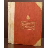
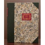
Cooke, J.H., Bibliotheca Cestriensis limited edition, cream vellum spine, marbled end papers,
Cooke, J.H., Bibliotheca Cestriensis limited edition, cream vellum spine, marbled end papers, teg., ex. Stoke on Trent library, 4to, 1 volume.
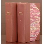
Baines, E., History, Directory, Gazetteer of County of Lancashire 1824, 2 volumes, rebound brown
Baines, E., History, Directory, Gazetteer of County of Lancashire 1824, 2 volumes, rebound brown cloth spine, marbled boards, new end papers, maps...
White's, F., History, Gazetteer and Directory of Cheshire, 1860, brown calf spine, marbled boards,
White's, F., History, Gazetteer and Directory of Cheshire, 1860, brown calf spine, marbled boards, new end papers, map missing, 1 volume.
Price's Description of Wales, 1764, rebound leather spine, marbled boards, map of North Wales,
Price's Description of Wales, 1764, rebound leather spine, marbled boards, map of North Wales, engravings, approximately 40 pages, 4to, 1 volume.
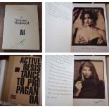
Westwood, V., Opus, Active Resistance Against Propaganda, Manifesto cover design, 2008, signed on
Westwood, V., Opus, Active Resistance Against Propaganda, Manifesto cover design, 2008, signed on the title page, number 85 of a limited edition o...
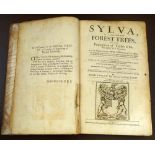
Evelyn, J. Sylva: or a Discourse of Forest Trees and the Propagation of Trees in His Majesty's
Evelyn, J. Sylva: or a Discourse of Forest Trees and the Propagation of Trees in His Majesty's Dominions, 1670, five copper engravings, binding we...

The Works of Francis Bacon, Baron of Verulam printed for W. Baynes, brown patterned calf, marbled
The Works of Francis Bacon, Baron of Verulam printed for W. Baynes, brown patterned calf, marbled fore-edges, 10 volumes.
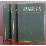
Macquoid, Edwards, The Dictionary of English Furniture from the Middle Ages to the Late Georgian
Macquoid, Edwards, The Dictionary of English Furniture from the Middle Ages to the Late Georgian period, 3 volumes, 1924 pub, Country Life, colour...
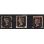
GB stamp collection including QV 1d blacks x 3, several mint 1d reds, KGV 10 \- seahorse and various
GB stamp collection including QV 1d blacks x 3, several mint 1d reds, KGV 10 \- seahorse and various issues to 1954.
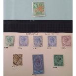
Commonwealth stamp collection of old auction lots in folders and packets with many sets and high
Commonwealth stamp collection of old auction lots in folders and packets with many sets and high values, also an album of 1949 UPU sets (64 in tot...