Filtered by:
- Category
- List
- Grid
A subscription to the Price Guide is required to view results for auctions ten days or older. Click here for more information
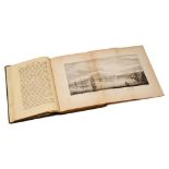

PHILIP,J. (pub.) A Panorama of Falmouth, Falmouth. nd. sm. 8vo. Folding plt & map. 2 ptls. advts. to
PHILIP,J. (pub.) A Panorama of Falmouth, Falmouth. nd. sm. 8vo. Folding plt & map. 2 ptls. advts. to rear. 1/3 cl.
BAEDEKER'S Egypt & The Sudan, Leipzig, 1929. 8th edn. revised. maps, d/w. tog.with TALBOT-BOOTH, E.
BAEDEKER'S Egypt & The Sudan, Leipzig, 1929. 8th edn. revised. maps, d/w. tog.with TALBOT-BOOTH, E.C. The British Army. Sampson Low, 2nd. ed. Plus...
Lascelles & co. Directory & Gazetteer of the County of Oxford, Birmingham, 1853. lacks map. tog.with
Lascelles & co. Directory & Gazetteer of the County of Oxford, Birmingham, 1853. lacks map. tog.with Oxford Directory 1909, Kelly, lacking upr. bd...
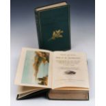
BENNET, James, Henry, Winter and Spring on the Shores of The Mediterranean. Churchill, London, 1875.
BENNET, James, Henry, Winter and Spring on the Shores of The Mediterranean. Churchill, London, 1875. 5th edn. cold. frontis, maps and illus. as li...

LIVINGSTONE, David, Missionary Travels and Researches in South Africa. Murray, 1857. 4to. folding
LIVINGSTONE, David, Missionary Travels and Researches in South Africa. Murray, 1857. 4to. folding frontis. full page plts. as listed. worn cl. bds...
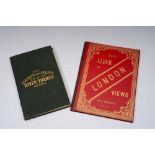
STANFORD, Edward, pub. The Oarsman's & Angler's map of The River Thames. A New Edition. Lacks tp. p.
STANFORD, Edward, pub. The Oarsman's & Angler's map of The River Thames. A New Edition. Lacks tp. p. 4-10. map of Thames on Canvas in cl. folder....
CARY, G. & J. A New and Accurate Map of the Country for Twenty-Five Miles round The University of
CARY, G. & J. A New and Accurate Map of the Country for Twenty-Five Miles round The University of Cambridge. J. Richardson, 1828. cold. map on can...
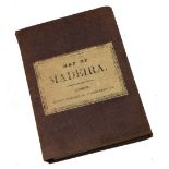
STANFORD, Edward, Map of Madeira, London, Ordnance Survey maps. Physical Map constructed by J.M.
STANFORD, Edward, Map of Madeira, London, Ordnance Survey maps. Physical Map constructed by J.M. ZIEGLER from that of Capt. Vidal.R.N. with Panora...
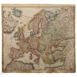
AN EARLY MAP OF EUROPE by Johann Baptiste Homann with cartouche, later coloured, 50 x 59cm