
Filtered by:
- Category
- List
- Grid
A subscription to the Price Guide is required to view results for auctions ten days or older. Click here for more information
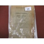

One volume ' Nur Fur Den Dienstgebrauch Stadtdurchfahrtplane, England (Ohne London) ', published
One volume ' Nur Fur Den Dienstgebrauch Stadtdurchfahrtplane, England (Ohne London) ', published Berlin 1941, small atlas of English towns, publis...
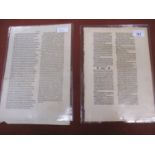
Two examples of 15th Century printing, a leaf from J. Reuchlin Vocabularius Breviloquus Johann
Two examples of 15th Century printing, a leaf from J. Reuchlin Vocabularius Breviloquus Johann Amberbach of Basle and a leaf from Silius Italicus ...

Elisabeth Lalouschek, pastel on paper, ' Darkness Turns into Light II ', 29.5ins x 44ins, gilt
Elisabeth Lalouschek, pastel on paper, ' Darkness Turns into Light II ', 29.5ins x 44ins, gilt framed
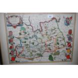
Framed antique hand coloured map of Surrey by Cary, together with a small framed antique map of
Framed antique hand coloured map of Surrey by Cary, together with a small framed antique map of England and Wales from a French atlas
Framed antique hand coloured map of Surrey, together with a framed map ' The Road from London to
Framed antique hand coloured map of Surrey, together with a framed map ' The Road from London to Hythe ' by Ogilby and another small framed map of...
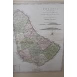
Antique hand coloured map, ' Barbadoes ', by William Mayo, engraved and improved by Thomas Jefferys,
Antique hand coloured map, ' Barbadoes ', by William Mayo, engraved and improved by Thomas Jefferys, geographer to the King, gilt framed, 24ins x ...
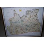
Framed antique hand coloured map of Hereford by C. Smith, 1804
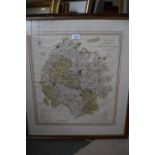
Group of five antique hand coloured maps by Blaeu of Wiltshire, East Riding, Lincolnshire, Derbyshire and Leicestershire, all unframed, each appro...
Small antique hand coloured map of Leicestershire by Moll, unframed together with a quantity of 18th
Small antique hand coloured map of Leicestershire by Moll, unframed together with a quantity of 18th and 19th Century World maps and other maps, u...
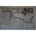
Seven small 18th Century unframed maps of North Africa and the Mediterranean, together with a
Seven small 18th Century unframed maps of North Africa and the Mediterranean, together with a quantity of other 18th and 19th Century small unfram...
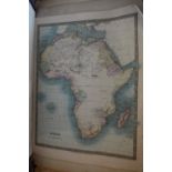
Folio containing a large quantity of 18th and 19th Century unframed maps, mainly relating to
Folio containing a large quantity of 18th and 19th Century unframed maps, mainly relating to AfricaThere are approximately 40 maps in this lot
Folio containing a large quantity of 19th and 20th Century maps, mainly relating to Europe and
Folio containing a large quantity of 19th and 20th Century maps, mainly relating to Europe and AmericaOver one hundred maps in this lot.Also some ...