Filtered by:
- Category
- List
- Grid
A subscription to the Price Guide is required to view results for auctions ten days or older. Click here for more information

Boswell, Edward. The Civil Division of the County of Dorset, first edition, half-title, folding
Boswell, Edward. The Civil Division of the County of Dorset, first edition, half-title, folding engraved map, contemporary half calf, rebacked, 8v...
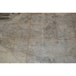
Greenwood, Charles. Map of the County of Wilts, from Actual Survey made in the Years 1819 and
Greenwood, Charles. Map of the County of Wilts, from Actual Survey made in the Years 1819 and 1820, engraved map in 48 sections, backed on linen, ...
Blaeu, Willem and Jan. Territorium Norimbergense, hand-coloured engraved map, stained in lower
Blaeu, Willem and Jan. Territorium Norimbergense, hand-coloured engraved map, stained in lower margin, 435mm x 540mm, Amsterdam, [n.d.]
Blaeu, William. Zeelandia Comitatus, engraved map, hand-coloured in outline, 500mm x 382mm, [?
Blaeu, William. Zeelandia Comitatus, engraved map, hand-coloured in outline, 500mm x 382mm, [?Amsterdam, c.1670]
Blome, Richard. A Mapp of the County of Somerset, hand-coloured engraved map from Blome's Britannia,
Blome, Richard. A Mapp of the County of Somerset, hand-coloured engraved map from Blome's Britannia, 338 x 246mm, c.1673, framed and glazed
Cary, John. New And Correct English Atlas: being a New Set of County Maps from Actual Surveys,
Cary, John. New And Correct English Atlas: being a New Set of County Maps from Actual Surveys, engraved title, 47 hand-coloured engraved maps, wit...
Cary, John. Traveller's Companion; or, A Delineation of the Turnpike Roads of England and Wales,
Cary, John. Traveller's Companion; or, A Delineation of the Turnpike Roads of England and Wales, engraved title, 43 engraved maps hand-coloured in...
Delamarche, Charles Francois. A group of 36 double-page engraved maps and charts, probably from '
Delamarche, Charles Francois. A group of 36 double-page engraved maps and charts, probably from 'Atlas de la Geographie Ancienne et Moderne', most...
Jansson, Jan. Herefordia comitatus vernacule Hereford Shire, hand-coloured engraved map, slightly
Jansson, Jan. Herefordia comitatus vernacule Hereford Shire, hand-coloured engraved map, slightly split along fold, some fading to colour and surf...
Kaer, Petrus. Palestina, hand-coloured engraved map, 95mm x 131mm, framed and glazed, [n.d.], and
Kaer, Petrus. Palestina, hand-coloured engraved map, 95mm x 131mm, framed and glazed, [n.d.], and 3 other maps (4)
Mogg, Edward. Paterson's Roads; being An Entirely Original and Accurate Description of all the
Mogg, Edward. Paterson's Roads; being An Entirely Original and Accurate Description of all the Direct and Principal Cross Roads in England and Wal...
Ogilby, John. The Continuation of the Road from London to Barwick, beginning at Tuxford and
Ogilby, John. The Continuation of the Road from London to Barwick, beginning at Tuxford and Extending to York, hand-coloured engraved map, rather ...
Ogilby, John. The Road from Exeter to Truroe... hand-coloured engraved map, 485mm x 385mm, [
Ogilby, John. The Road from Exeter to Truroe... hand-coloured engraved map, 485mm x 385mm, [London: c.1675], framed and glazed
Paris. Plan Pittoresque de la Ville de Paris, Grave sur Acier par Benard, a folding engraved map
Paris. Plan Pittoresque de la Ville de Paris, Grave sur Acier par Benard, a folding engraved map of the capital with numerous highly detailed engr...
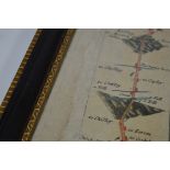
Read, Lieutenant R.P. The Island & Forts of Saint Helena... dedicated by Permission to Field
Read, Lieutenant R.P. The Island & Forts of Saint Helena... dedicated by Permission to Field Marshall His Royal Highness The Duke of Kent and Stra...
Speed, John. Rutlandshire. With Oukham and Stanford her bordering neighbour, hand-coloured engraved map, some surface soiling, 510 x 384mm, c.1676...
Taylor, Isaac. Dorset Shire, folding engraved map of 42 sections, backed onto linen, with engraved
Taylor, Isaac. Dorset Shire, folding engraved map of 42 sections, backed onto linen, with engraved views of Maiden Castle, Shirborne Castle, and L...