
Refine your search
Sale Section
Remove filter- Atlases, Maps, Prints Etc. (41)
- Ephemera, Printed Collectables & Items of Historical Interest (2)
- Miscellaneous Collections (3)
- Mixed, Including Transport Military, Theology, Antiquarian etc (2)
- Natural History, Field & Other Sports (1)
- Travel, Topography & Local Interest (17)
Estimate
Category
Remove filter- Maps (66)
Filtered by:
- Sale Section,
- Category
- List
- Grid
A subscription to the Price Guide is required to view results for auctions ten days or older. Click here for more information
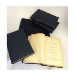

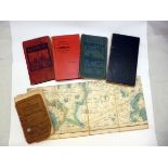
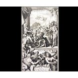
BARON JOMINI: LIFE OF NAPOLEON, trans H W Halleck, NY, D van Nostrand, 1864 4 vols, rebnd cl
BARON JOMINI: LIFE OF NAPOLEON, trans H W Halleck, NY, D van Nostrand, 1864 4 vols, rebnd cl silvered + later Atlas vol prepared by the Department...
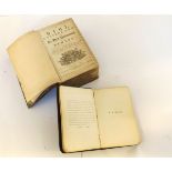
WHY CYSSEGR-LAN, SEF..., Joseph Bentham 1796, 2 engrd fdg maps, old full cf, bds detchd but present + one other similar (2)
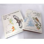
PETER LACK: THE ATLAS OF WINTERING BIRDS IN BRITAIN AND IRELAND, T & A D Poyser, 1986, orig cl, d/
PETER LACK: THE ATLAS OF WINTERING BIRDS IN BRITAIN AND IRELAND, T & A D Poyser, 1986, orig cl, d/w + DAVID WINGFIELD GIBBONS, JAMES B REID AND RO...
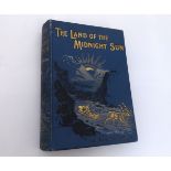
PAUL B DU CHAILLU: THE LAND OF THE MIDNIGHT SUN: SUMMER AND WINTER JOURNEYS THROUGHOUT SWEDEN NORWAY
PAUL B DU CHAILLU: THE LAND OF THE MIDNIGHT SUN: SUMMER AND WINTER JOURNEYS THROUGHOUT SWEDEN NORWAY LAPLAND AND NORTHERN FINLAND ..., 1899, new e...
![HUDSON STUCK: VOYAGES ON THE YUKON AND ITS TRIBUTARIES, [1917], 1st edn, frontis, 48 plts, 2 maps (](https://portal-images.azureedge.net/auctions-2015/srkey10082/images/559ca0e4-d4fa-4afe-cf0d-b4a9210298d6.jpg?w=155&h=155)
HUDSON STUCK: VOYAGES ON THE YUKON AND ITS TRIBUTARIES, [1917], 1st edn, frontis, 48 plts, 2 maps (
HUDSON STUCK: VOYAGES ON THE YUKON AND ITS TRIBUTARIES, [1917], 1st edn, frontis, 48 plts, 2 maps (both with some damage), orig cl, gt, ex lib + M...

W STUART TRENCH: REALITIES OF IRISH LIFE, 1868, engrd frontis, 29 engrd plts, 1 fdg map compl,
W STUART TRENCH: REALITIES OF IRISH LIFE, 1868, engrd frontis, 29 engrd plts, 1 fdg map compl, orig blind stpd cl gt
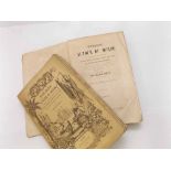
JAMES HAKEWILL: A SERIES OF VIEWS ON THE NEIGHBOURHOOD OF WINDSOR INCLUDING THE SEATS OF SEVERAL
JAMES HAKEWILL: A SERIES OF VIEWS ON THE NEIGHBOURHOOD OF WINDSOR INCLUDING THE SEATS OF SEVERAL OF THE NOBILITY AND GENTRY, L, B E Lloyd & Son, 1...
THE ABBEY CHURCH OF SAINT ALBAN, HERTFORDSHIRE, ill James Neale, L, 1877, col'd engrvd ttle pge,
THE ABBEY CHURCH OF SAINT ALBAN, HERTFORDSHIRE, ill James Neale, L, 1877, col'd engrvd ttle pge, 60 plts, + plan, complete, old qtr cf gt
PERCY R LOWE: A NATURALIST ON DESERT ISLANDS, 1911, frontis, 31 plts, 1 map, sigd and inscr by
PERCY R LOWE: A NATURALIST ON DESERT ISLANDS, 1911, frontis, 31 plts, 1 map, sigd and inscr by Lady Laura Wilton, orig cl worn
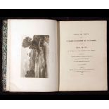
GEORGE M DOUGLAS: LANDS FORLORN A STORY OF AN EXPEDITION TO HEARNE'S COPPER MINE RIVER, NY, G P
GEORGE M DOUGLAS: LANDS FORLORN A STORY OF AN EXPEDITION TO HEARNE'S COPPER MINE RIVER, NY, G P Putnam's Sons, 1914, 1st edn, col'd frontis, 2 fdg...
WILLIAM SMITH: VOYAGES AUTOUR DU MONDE..., Paris Societe Bibliophiles circa 1841, 12 vols, added
WILLIAM SMITH: VOYAGES AUTOUR DU MONDE..., Paris Societe Bibliophiles circa 1841, 12 vols, added engrd ttl, 100 plts, 8 fdg maps, orig pict wraps ...
RICHARD LORD BRAYBROOKE: THE HISTORY OF AUDLEY END TO WHICH ARE APPENDED NOTICES OF THE TOWN AND
RICHARD LORD BRAYBROOKE: THE HISTORY OF AUDLEY END TO WHICH ARE APPENDED NOTICES OF THE TOWN AND PARISH OF SAFFRON WALDEN IN THE COUNTRY OF ESSEX,...
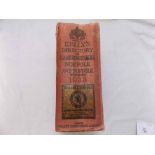
KELLY'S DIRECTORY OF THE COUNTIES OF CAMBRIDGE, NORFOLK, SUFFOLK AND ESSEX 1912, 4 fdg col'd maps
KELLY'S DIRECTORY OF THE COUNTIES OF CAMBRIDGE, NORFOLK, SUFFOLK AND ESSEX 1912, 4 fdg col'd maps compl, orig cl gt worn
KELLY'S DIRECTORY OF THE COUNTIES OF CAMBRIDGE, NORFOLK AND SUFFOLK 1922, lacks maps, orig cl
KELLY'S DIRECTORY OF THE COUNTIES OF CAMBRIDGE, NORFOLK AND SUFFOLK 1922, lacks maps, orig cl
KELLY'S DIRECTORY OF THE COUNTIES OF CAMBRIDGE, NORFOLK AND SUFFOLK 1933, 3 fdg maps, orig cl worn
KELLY'S DIRECTORY OF THE COUNTIES OF CAMBRIDGE, NORFOLK AND SUFFOLK 1933, 3 fdg maps, orig cl worn
KELLY'S DIRECTORY OF THE COUNTIES OF CAMBRIDGE, NORFOLK AND SUFFOLK 1937, 3 fdg col'd maps compl,
KELLY'S DIRECTORY OF THE COUNTIES OF CAMBRIDGE, NORFOLK AND SUFFOLK 1937, 3 fdg col'd maps compl, orig cl

KELLY'S DIRECTORY OF THE COUNTIES OF NORFOLK AND SUFFOLK 1925, 2 fdg maps compl, orig cl gt +
KELLY'S DIRECTORY OF THE COUNTIES OF NORFOLK AND SUFFOLK 1925, 2 fdg maps compl, orig cl gt + KELLY'S DIRECTORY OF NORFOLK 1937, fdg map compl, or...
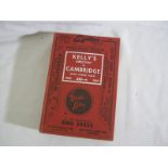
KELLY'S DIRECTORY OF CAMBRIDGE 1960, fdg map detchd but present, orig cl
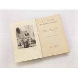
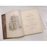
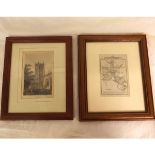
![[R BEATNIFFE]: THE NORFOLK TOUR OR TRAVELLERS POCKET COMPANION..., 1808 6th edn, engrd fdg frontis](https://portal-images.azureedge.net/auctions-2015/srkey10082/images/d864a4c9-1988-4a7d-c9ed-35390bb5af10.jpg?w=155&h=155)
[R BEATNIFFE]: THE NORFOLK TOUR OR TRAVELLERS POCKET COMPANION..., 1808 6th edn, engrd fdg frontis
[R BEATNIFFE]: THE NORFOLK TOUR OR TRAVELLERS POCKET COMPANION..., 1808 6th edn, engrd fdg frontis map, 12 mo, rebnd (not recent) hf mor by Bumpus
ABSTRACT OF THE ANSWERS AND RETURNS MADE PURSUANT TO AN ACT ..., INTITULED, "AN ACT FOR TAKING AN
ABSTRACT OF THE ANSWERS AND RETURNS MADE PURSUANT TO AN ACT ..., INTITULED, "AN ACT FOR TAKING AN ACCOUNT OF THE POPULATION OF GREAT BRITAIN, AND ...

One box: 100+ circa mid-20th Century Bartholomew's Folding Maps including 40+ revised 1/2 inch maps,
One box: 100+ circa mid-20th Century Bartholomew's Folding Maps including 40+ revised 1/2 inch maps, 20+ National Map Series etc, mainly fdg maps ...
One small box: Mapping, Map reference etc
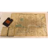
One small box: mixed including BACON'S LARGE PRINT MAP OF LONDON AND SUBURBS, G W Bacon & Co,
One small box: mixed including BACON'S LARGE PRINT MAP OF LONDON AND SUBURBS, G W Bacon & Co, circa 1920s approx size 27 x 35", fdg map, orig cl +...
One box: good quantity circa mid-20th Century Ordnance Survey and other folding maps, topography and
One box: good quantity circa mid-20th Century Ordnance Survey and other folding maps, topography and tourist attraction booklets etc
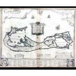
Seventy+ sheets of "Maid of Dort" Pro Patria Watermarked Paper, 11" x 8"
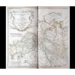
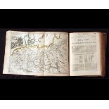
COMPOSITE ATLAS, circa 1751-80, 14 engrd maps including 12 dbl pge, some outline colour, mainly by
COMPOSITE ATLAS, circa 1751-80, 14 engrd maps including 12 dbl pge, some outline colour, mainly by Jean B D'Anville, including PREMIERE PARTIE DE ...
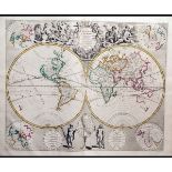
JOHN SENEX: A NEW GENERAL ATLAS CONTAINING A GEOGRAPHICAL AND HISTORICAL ACCOUNT OF ALL THE
JOHN SENEX: A NEW GENERAL ATLAS CONTAINING A GEOGRAPHICAL AND HISTORICAL ACCOUNT OF ALL THE EMPIRES KINGDOMS AND OTHER DOMINIONS OF THE WORLD, L, ...
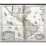
COMPOSITE ATLAS, circa 1620-1735, containing 53 engrd dbl pge mainly outline col'd/part col'd
COMPOSITE ATLAS, circa 1620-1735, containing 53 engrd dbl pge mainly outline col'd/part col'd maps, together with 2 plans and 1 prospect, a qty fr...
J SPEED: A PROSPECT OF THE MOST FAMOUS PARTS OF THE WORLD... TOGETHER WITH ALL THE PROVINCES,
J SPEED: A PROSPECT OF THE MOST FAMOUS PARTS OF THE WORLD... TOGETHER WITH ALL THE PROVINCES, COUNTRIES AND SHIRES CONTAINED IN THAT LARGE THEATER...
GUILLAUME DE L'ISLE: ATLAS NOUVEAU CONTENANT TOUTES LES PARTES DU MONDE ... Amsterdam, Jean Covens
GUILLAUME DE L'ISLE: ATLAS NOUVEAU CONTENANT TOUTES LES PARTES DU MONDE ... Amsterdam, Jean Covens and Corneille Mortier, circa 1742, added engrd ...
![[JOHN THOMSON]: A NEW GENERAL ATLAS CONSISTING OF A SERIES OF GEOGRAPHICAL DESIGNS ON VARIOUS](https://portal-images.azureedge.net/auctions-2015/srkey10082/images/9019dcdc-e4db-4775-a5ad-31649f59a213.jpg?w=155&h=155)
[JOHN THOMSON]: A NEW GENERAL ATLAS CONSISTING OF A SERIES OF GEOGRAPHICAL DESIGNS ON VARIOUS
[JOHN THOMSON]: A NEW GENERAL ATLAS CONSISTING OF A SERIES OF GEOGRAPHICAL DESIGNS ON VARIOUS PROJECTS EXHIBITING THE FORM AND COMPONENT PARTS OF ...
JAN JANSSON: NOVUS ATLAS?, circa 1658-61, 4 vols, lacking ttl pges, spine ttls Belgii/Britannia/
JAN JANSSON: NOVUS ATLAS?, circa 1658-61, 4 vols, lacking ttl pges, spine ttls Belgii/Britannia/Norvegiae, Hispaniae/Gallie, Germaniae, Italy/Gree...
H MOLL: ATLAS GEOGRAPHUS OR A COMPLEAT SYSTEM OF GEOGRAPHY, L, 1711-14, vols 1-4 (of 5), 80 engrd
H MOLL: ATLAS GEOGRAPHUS OR A COMPLEAT SYSTEM OF GEOGRAPHY, L, 1711-14, vols 1-4 (of 5), 80 engrd maps and plts including 68 hand col'd, mainly fd...
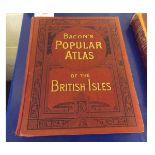
G W BACON: BACON'S POPULAR ATLAS OF THE BRITISH ISLES, 1904, fo, orig decor cl gt
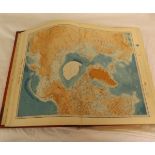
A K JOHNSTON: THE HANDY ROYAL ATLAS OF MODERN GEOGRAPHY, Ed G H Johnston, Edinburgh and L, W & A K
A K JOHNSTON: THE HANDY ROYAL ATLAS OF MODERN GEOGRAPHY, Ed G H Johnston, Edinburgh and L, W & A K Johnston, 1913, fo, orig hf cf worn
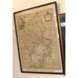
E BOWEN: AN IMPROVED MAP OF THE COUNTY OF STAFFORD DIVIDED INTO ITS HUNDREDS ..., engrd hand col'd
E BOWEN: AN IMPROVED MAP OF THE COUNTY OF STAFFORD DIVIDED INTO ITS HUNDREDS ..., engrd hand col'd map 1749, approx 26" x 20", f/g
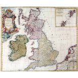
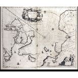
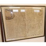
HEIRS OF JOHANN BAPTISTE HOMANN: A GENERAL MAP OF GREAT BRITAIN AND IRELAND WITH PART OF HOLLAND,
HEIRS OF JOHANN BAPTISTE HOMANN: A GENERAL MAP OF GREAT BRITAIN AND IRELAND WITH PART OF HOLLAND, FLANDERS, FRANCE ETC AGREEABLE TO MODERN HISTORY...
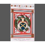
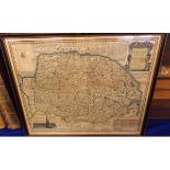
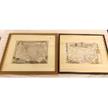
![J SPEED: THE COUNTIE OF NOTTINGHAM..., engrd hand col'd map [1676], approx 15" x 20", f/g](https://portal-images.azureedge.net/auctions-2015/srkey10082/images/8ac96bd6-0328-4b56-ee01-7accd72e2358.jpg?w=155&h=155)
J SPEED: THE COUNTIE OF NOTTINGHAM..., engrd hand col'd map [1676], approx 15" x 20", f/g
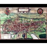
BRAUN AND HOGENBERG: NORDOVICUM ANGLAE CIVITAS, circa 1616, hand col'd engrd plan, approx 12" x 17",
BRAUN AND HOGENBERG: NORDOVICUM ANGLAE CIVITAS, circa 1616, hand col'd engrd plan, approx 12" x 17", f/g (A/F)
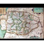
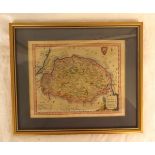
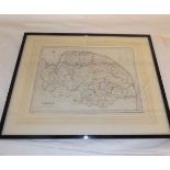
![J SPEED: RUTLANDSHIRE, engrvd map [1611], approx 14 3/4" x 19 1/2", f/g](https://portal-images.azureedge.net/auctions-2015/srkey10082/images/59c1fba6-f204-4e3d-b79d-6316018e1d9c.jpg?w=155&h=155)
J SPEED: RUTLANDSHIRE, engrvd map [1611], approx 14 3/4" x 19 1/2", f/g
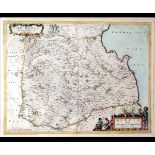
T PONT: THE MERCE OR SHIRREFDOME OF BERWICK, engrd hand col'd map circa 1664, approx 15" x 20", f/g
T PONT: THE MERCE OR SHIRREFDOME OF BERWICK, engrd hand col'd map circa 1664, approx 15" x 20", f/g
E BOWEN: AN ACCURATE MAP OF THE COUNTY OF NORFOLK DIVIDED INTO ITS HUNDREDS, engrd hand col'd map,
E BOWEN: AN ACCURATE MAP OF THE COUNTY OF NORFOLK DIVIDED INTO ITS HUNDREDS, engrd hand col'd map, 1777, approx 15 1/2" x 19 1/2", f/g
SAXTON/KIP: NORFOLKCIAE ..., engrd hand col'd map, circa 1607, approx 10 1/2" x 15", f/g
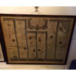
![MARTIN BOOTH: THE NORTH EAST PROSPECT OF THE CITY OF NORWICH, hand col'd engrd prospect [1768],](https://portal-images.azureedge.net/auctions-2015/srkey10082/images/8d40351f-7ed7-44a0-be59-04d896f74d49.jpg?w=155&h=155)
MARTIN BOOTH: THE NORTH EAST PROSPECT OF THE CITY OF NORWICH, hand col'd engrd prospect [1768],
MARTIN BOOTH: THE NORTH EAST PROSPECT OF THE CITY OF NORWICH, hand col'd engrd prospect [1768], reduced version of Kirkpatrick's Prospect of 1723,...
A NEW MAP OF ENGLAND, SCOTLAND AND IRELAND, engrvd map, circa 1732 from Paul Rapin de Toyras, THE
A NEW MAP OF ENGLAND, SCOTLAND AND IRELAND, engrvd map, circa 1732 from Paul Rapin de Toyras, THE HISTORY OF ENGLAND, approx 14 1/4" x 12 1/2" f/g...
J OGILBY: THE ROAD FROM KINGS-LYN TO NORWICH CONTINUED TO YARMOUTH IN NORFOLK, hand col'd engrd road
J OGILBY: THE ROAD FROM KINGS-LYN TO NORWICH CONTINUED TO YARMOUTH IN NORFOLK, hand col'd engrd road map circa 1675, approx 15 1/2" x 18", f/g
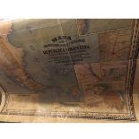
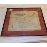
PEDRO LOPEZ: MAPA DE LAS COMUNICATIONES POSTALES Y TELEGRAFICAS DE LA REPUBLICA ARGENTINA ..., lge
PEDRO LOPEZ: MAPA DE LAS COMUNICATIONES POSTALES Y TELEGRAFICAS DE LA REPUBLICA ARGENTINA ..., lge scale col'd map, 1898, varnished bkd onto linen...
J J PASHOUX: ROYAUME D'ITALIE, TURQUIE D'EUROPE, engrvd map untitled, circa 1810, fdg bkd onto
J J PASHOUX: ROYAUME D'ITALIE, TURQUIE D'EUROPE, engrvd map untitled, circa 1810, fdg bkd onto linen, approx 22 1/2" x 30 1/2", s-c + THE AUTOCAR ...
JARROLD & SONS (PUB): COUNTIES OF NORFOLK AND SUFFOLK BASED ON THE ORDNANCE SURVEYS, hand col'd
JARROLD & SONS (PUB): COUNTIES OF NORFOLK AND SUFFOLK BASED ON THE ORDNANCE SURVEYS, hand col'd engrd map circa 1860, fdg bkd into linen, approx 4...
EDWARD STANFORD (PUB): MAP OF THE ENVIRONS OF LONDON REDUCED FOR THE ORDNANCE SURVEY, hand col'd
EDWARD STANFORD (PUB): MAP OF THE ENVIRONS OF LONDON REDUCED FOR THE ORDNANCE SURVEY, hand col'd engrd map circa 1860, fdg bkd onto linen, approx ...
J WHITBREAD: WHITBREAD'S NEW PLAN OF LONDON, engrvd hand col'd fdg plan, 1851, some splits and
J WHITBREAD: WHITBREAD'S NEW PLAN OF LONDON, engrvd hand col'd fdg plan, 1851, some splits and reinforcements at folds, orig cl ptd paper label, v...
J CARY: OXFORDSHIRE, engrvd hand col'd map 1787, approx 5 1/4" x 3 1/2" f/g + W & A K JOHNSTON:
J CARY: OXFORDSHIRE, engrvd hand col'd map 1787, approx 5 1/4" x 3 1/2" f/g + W & A K JOHNSTON: DURHAM, hand col'd litho map circa 1890, approx 5 ...
G A WALPOOLE: A NEW MAP OF NORFOLK, engrvd hand col'd map circa 1794, approx 6 1/4" x 7 3/4" f/g
G A WALPOOLE: A NEW MAP OF NORFOLK, engrvd hand col'd map circa 1794, approx 6 1/4" x 7 3/4" f/g
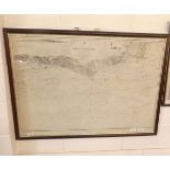
OWERS TO DUNGENESS, Admiralty litho Sea Chart, 1918, approx size 30" x 42", f/g
E BOWEN: AN ACCURATE MAP OF THE COUNTRY OF WORCESTER DIVIDED INTO ITS HUNDREDS ..., engrd hand col'd
E BOWEN: AN ACCURATE MAP OF THE COUNTRY OF WORCESTER DIVIDED INTO ITS HUNDREDS ..., engrd hand col'd map, 1756, approx 20" x 27", f/g
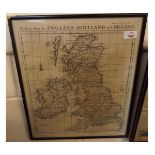
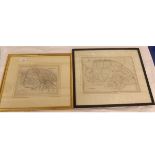
![R MORDEN: ENGLAND, hand col'd engrd map [1695], approx 14" x 16", f/g](https://portal-images.azureedge.net/auctions-2015/srkey10082/images/3890f9a4-ad03-4525-edfe-67049e86a515.jpg?w=155&h=155)
R MORDEN: ENGLAND, hand col'd engrd map [1695], approx 14" x 16", f/g
R CREIGHTON: NORFOLK, engrd outline hand col'd map, circa 1851, approx 9 1/2" x 12 1/2", f/g
R CREIGHTON: NORFOLK, engrd outline hand col'd map, circa 1851, approx 9 1/2" x 12 1/2", f/g
T MOULE: NORFOLK - SUFFOLK, two hand col'd engrd maps circa 1850, approx 8" x 10 1/2", each f/g (2)
T MOULE: NORFOLK - SUFFOLK, two hand col'd engrd maps circa 1850, approx 8" x 10 1/2", each f/g (2)
R CREIGHTON: NORFOLK, engrd hand col'd map circa 1840, approx 8 3/4" x 12" f/g + J ARCHER: NORFOLK, engrd hand col'd map circa 1835, approx 6 1/2"...
J TALLIS (pub): TURKEY IN EUROPE, engrd hand col'd map, circa 1848, approx 8 1/2" x 12 1/4" f/g
J TALLIS (pub): TURKEY IN EUROPE, engrd hand col'd map, circa 1848, approx 8 1/2" x 12 1/4" f/g