Refine your search
Filtered by:
- Show only bulk lots,
- Sale Section
5 items
- List
- Grid
This auctioneer has chosen to not publish their results. Please contact them directly for any enquiries.
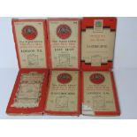

Six Ordnance Survey maps inc London, Greater London, East Kent and Eastbourne.
Lot 156
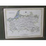
A hand coloured reproduction map of Limerick, Ireland, from Lewis' Topographical Dictionary,
A hand coloured reproduction map of Limerick, Ireland, from Lewis' Topographical Dictionary, framed and mounted, sight size 24 x 19cm, overall siz...
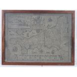
Map; Cornwall, published by John Speed, discoloured and a/f (cracking to right of centre), framed and in good heavily glazed frame, overall 54 x 4...
Lot 180
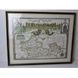
A contemporary print of a Berkshire map dated 1350, framed and glazed, overall size 61 x 49cm.
A contemporary print of a Berkshire map dated 1350, framed and glazed, overall size 61 x 49cm.
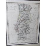
A hand coloured map of Portugal published by C Smith 172 Strand, engraved for Smith Atlas by Pickett, marked in pencil lower middle C.1820, in con...