Filtered by:
- Category
- List
- Grid
A subscription to the Price Guide is required to view results for auctions ten days or older. Click here for more information

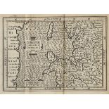
Atlases. A mixed collection of eighteen atlases, mostly late 19th & early 20th century, including
Atlases. A mixed collection of eighteen atlases, mostly late 19th & early 20th century, including examples by Bartholomew, Waverley, Bacon, Ordnan...
Martin (R. Montgomery). The Illustrated Atlas and Modern History of the World, published J.F.Tallis,
Martin (R. Montgomery). The Illustrated Atlas and Modern History of the World, published J.F.Tallis, circa 1857, uncoloured double page map of Liv...
Neele (Samuel & George ). Neele's General Atlas Consisting of a Complete Set of Maps Compiled from
Neele (Samuel & George ). Neele's General Atlas Consisting of a Complete Set of Maps Compiled from the Best Authorities and Including all the New ...
Wyld (James). An Atlas of the World, Comprehending Separate Maps of its various Countries, Constructed & Drawn from the latest Astronomical & Geog...
Armstrong (Mostyn John). An Actual Survey of the Great Post-Roads between London and Edinburgh,
Armstrong (Mostyn John). An Actual Survey of the Great Post-Roads between London and Edinburgh, published 1776, title page with engraved oval vign...
Badeslade (Thomas & Toms, William Henry). Chorographia Britanniae, or a New Set of Maps of all the
Badeslade (Thomas & Toms, William Henry). Chorographia Britanniae, or a New Set of Maps of all the Counties in England and Wales, published C.Hitc...
Camden (William). Guili. Camdeni Viri Clarrissimi Britannia sive florentiss. Regnorum Angliae,
Camden (William). Guili. Camdeni Viri Clarrissimi Britannia sive florentiss. Regnorum Angliae, Scotiae, Hiberniae, Insulaumq Adiacentium ex Intima...
Cary (John). Cary's New and Correct Engliah Atlas: Being a New Set of County Maps from Actual
Cary (John). Cary's New and Correct Engliah Atlas: Being a New Set of County Maps from Actual Surveys..., 1st edition, 1787, title, contents and d...
Cary (John). Cary's Traveller's Companion, or a Delineation of the Turnpike Roads of England and
Cary (John). Cary's Traveller's Companion, or a Delineation of the Turnpike Roads of England and Wales; Shewing the immediate Route to every Marke...
Clark (John). General View of the Agriculture of the County of Brecknock with observations on the
Clark (John). General View of the Agriculture of the County of Brecknock with observations on the means of its improvement, printed by J. Smeeton,...

Depping (G.B.). L'Angleterre ou Description Historique et Topographique du Royaume-Uni de la Grande Bretagne..., published Paris, 1824, title page...

Ellis (George). Ellis's New and Correct Atlas of England and Wales being an Entire New Set of County
Ellis (George). Ellis's New and Correct Atlas of England and Wales being an Entire New Set of County Maps..., 1819, calligraphic title, forty-four...

Ellis (John). Ellis's English Atlas: or A Compleat Chorography of England and Wales in Fifty-four
Ellis (John). Ellis's English Atlas: or A Compleat Chorography of England and Wales in Fifty-four Maps, Containing more Particulars than any other...
Jefferys (Thomas). [Jefferys's Itinerary; or Travellers Companion through England, Wales and Part of
Jefferys (Thomas). [Jefferys's Itinerary; or Travellers Companion through England, Wales and Part of Scotland, Containing all the Direct and Princ...
Laurie (R.H., publisher). Laurie's New Traveller's Companion and Guide through the Roads of England and Wales including Great part of Scotland wit...
Leigh (Samuel). Leigh's New Pocket Road-Book of England, Wales and Part of Scotland..., 2nd edition,
Leigh (Samuel). Leigh's New Pocket Road-Book of England, Wales and Part of Scotland..., 2nd edition, 1826, frontispiece of a 'Table of the Price o...
Lewis (Samuel, & Co., publishers). Atlas to the Topographical Dictionaries of England and Wales..., 1845, title page, folding engraved map of Engl...
Lewis (Samuel, & Co., publishers). Lewis's Atlas Comprising the Counties of Ireland and a General
Lewis (Samuel, & Co., publishers). Lewis's Atlas Comprising the Counties of Ireland and a General Map of the Kingdom, 1837, calligraphic title wit...

Ramble (Reuben). Reuben Ramble's Travels through the Counties of England, circa 1850, decorative
Ramble (Reuben). Reuben Ramble's Travels through the Counties of England, circa 1850, decorative frontispiece and additional decorative title, for...

Senex (John). The Roads through England delineated or Ogilby's Survey Revised, Improved and Reduced to a Size Portable for the Pocket..., publishe...

Speed (John). The Second Booke: Containing the Principality of Wales: Delivering an exact Topography
Speed (John). The Second Booke: Containing the Principality of Wales: Delivering an exact Topography of the Following Counties. Pembroke-Shire, Ca...

*Aegean Islands. Blaeu (Johannes), Maris Aegaei quod hodie Archipelago nuncupatur pars Septentrionalis, published Amsterdam, circa 1665, engraved ...
*Austria. Hondius (Henricus), Austria Archiducatus Auctore Waolgango Lazio, [1636], engraved map
*Austria. Hondius (Henricus), Austria Archiducatus Auctore Waolgango Lazio, [1636], engraved map with contemporary outline colouring, slight crack...

Balearic Islands. Blaeu (Johannes), Insulae Balearides et Pytiusae, published Amsterdam, circa 1660,
Balearic Islands. Blaeu (Johannes), Insulae Balearides et Pytiusae, published Amsterdam, circa 1660, hand coloured engraved map, 385 x 495 mm, Dut...
Bedfordshire. Speed (John), Bedford Shire and the Situation of Bedford described with the armes of
Bedfordshire. Speed (John), Bedford Shire and the Situation of Bedford described with the armes of thos Honorable Familyes that have borne ye titl...

Birmingham. Sherriff (James), A Map of Upwards of 25 Miles round the Town of Birmingham..., published Jas. Sherriff & Wm. Faden, 1798, large engra...
Brecknockshire. Speed (John), Breknoke both Shyre and Towne described, published Thomas Bassett &
Brecknockshire. Speed (John), Breknoke both Shyre and Towne described, published Thomas Bassett & Richard Chiswell, [1676], hand coloured engraved...
British Isles. Sanson (Nicolas), Carte Generale des Royaume D'Angleterre, Escosse et Irlande avecq
British Isles. Sanson (Nicolas), Carte Generale des Royaume D'Angleterre, Escosse et Irlande avecq les Isles Circonvoysines Conues toutes sous le ...

Coal mining. Lambert (M. & M.W.), Map of the Great Northern Coal Field in the Counties of Northumberland & Durham, including the whole of the Coal...
Derbyshire. A mixed collection of approximately seventy-five maps, 17th - 19th century, engraved
Derbyshire. A mixed collection of approximately seventy-five maps, 17th - 19th century, engraved maps, many with hand colouring, including example...

Durham. Blaeu (Johannes), Episcopatus Dunelmensis vulgo The Bishoprike of Durham, published Amsterdam, circa 1645, engraved map with contemporary ...

England & Wales. Greenough ( G.B.), A Geological Map of England & Wales by G.B.Greenough, President of the Geological Society..., 1819 [but publis...

England & Wales. (Walker J & C), A Geological Map of England, Wales and Part of Scotland, Showing
England & Wales. (Walker J & C), A Geological Map of England, Wales and Part of Scotland, Showing also the Inland Navigation by Means of Rivers & ...

England & Wales. Butt (Revd. J.M. Butt), New & Improved View of the Principal Hills & Remarkable
England & Wales. Butt (Revd. J.M. Butt), New & Improved View of the Principal Hills & Remarkable Eminences in England & Wales, According to the Gr...
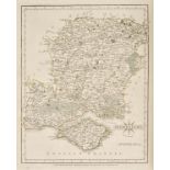
Essex. Greenwood (C & J), Map of the County of Essex from an Actual Survey made in the Year 1824...,
Essex. Greenwood (C & J), Map of the County of Essex from an Actual Survey made in the Year 1824..., published Greenwood & Pringle & Co., [1825], ...

Folding maps. A mixed collection of approximately eighty folding maps, mostly 19th and early 20th
Folding maps. A mixed collection of approximately eighty folding maps, mostly 19th and early 20th century, mixed collection of folding maps includ...
![*Greece. Speed (John), Greece, published Thomas Bassett & Richard Chiswell, [1676], hand coloured](https://portal-images.azureedge.net/auctions-2016/srdom10064/images/812e83aa-3eb7-4a89-dc47-0a836abe8897.jpg?w=155&h=155)
*Greece. Speed (John), Greece, published Thomas Bassett & Richard Chiswell, [1676], hand coloured
*Greece. Speed (John), Greece, published Thomas Bassett & Richard Chiswell, [1676], hand coloured engraved map, ornate strapwork cartouche and mil...

*Guinea. Van Keulen (Johannes), Pas-Caert vande Goud Cust in Guinea van C. Tres Puntas tot Acara...,
*Guinea. Van Keulen (Johannes), Pas-Caert vande Goud Cust in Guinea van C. Tres Puntas tot Acara..., published Amsterdam, circa 1719, uncoloured e...
*Guinea. Blaeu (Johannes), Guinea, published Amsterdam, circa 1640, engraved map with contemporary
*Guinea. Blaeu (Johannes), Guinea, published Amsterdam, circa 1640, engraved map with contemporary outline colouring, ornate cartouche and mileage...
Huntingdonshire. Schenk (Peiter & Valk Gerard), Huntingdonensis Comitatus Huntingtonshire, circa
Huntingdonshire. Schenk (Peiter & Valk Gerard), Huntingdonensis Comitatus Huntingtonshire, circa 1702, engraved map with contemporary hand colour...

Ireland. A mixed collection of fourteen maps, mostly 17th - 19th century, engraved maps, including
Ireland. A mixed collection of fourteen maps, mostly 17th - 19th century, engraved maps, including regional, country and town plans, with examples...
![Italy. Ortelius (Abraham), Thusciae Descriptio Auctore Hieronymo Bellarmato, [1588], uncoloured](https://portal-images.azureedge.net/auctions-2016/srdom10064/images/59758b37-9b6d-4c36-edd2-d9a965d3eff9.jpg?w=155&h=155)
Italy. Ortelius (Abraham), Thusciae Descriptio Auctore Hieronymo Bellarmato, [1588], uncoloured
Italy. Ortelius (Abraham), Thusciae Descriptio Auctore Hieronymo Bellarmato, [1588], uncoloured engraved map of Tuscany, ornate strapwork cartouch...
![Italy. Ortelius (Abraham), Tusciae Antiquae Typus..., [1595], uncoloured engraved map, three](https://portal-images.azureedge.net/auctions-2016/srdom10064/images/44bd1887-5b33-4e96-a059-25faba4827c1.jpg?w=155&h=155)
Italy. Ortelius (Abraham), Tusciae Antiquae Typus..., [1595], uncoloured engraved map, three
Italy. Ortelius (Abraham), Tusciae Antiquae Typus..., [1595], uncoloured engraved map, three decorative strapwork cartouches, 320 x 480 mm, Latin ...
*Italy. Mercator (Gerard), Italia, [1589 or later], engraved map with contemporary outline colouring, slight fraying and repaired closed tear to ...

Kent. A mixed collection of fifteen maps, 18th & 19th century, engraved maps, town plans and sea
Kent. A mixed collection of fifteen maps, 18th & 19th century, engraved maps, town plans and sea charts, including examples by Zatta, Moule, Bades...

Lancashire. Blaeu (Johannes), Lancastria Palatinatus Anglis Lancaster et Lancas Shire, published
Lancashire. Blaeu (Johannes), Lancastria Palatinatus Anglis Lancaster et Lancas Shire, published Amsterdam, circa 1645, engraved map with contempo...

Lancashire. A mixed collection of approximately thirty-five maps, mostly 18th & 19th century,
Lancashire. A mixed collection of approximately thirty-five maps, mostly 18th & 19th century, engraved maps and town plans, including examples by ...
Leicestershire & Rutland. Blaeu (Johannes), Leicestrensis Comitatus Leicester Shire [and] Rutlandia Comitatus Rutland Shire, published Amsterdam, ...
*Leicestershire. Speed (John), Leicester both Countye and Citie described, The Honorable Famylies
*Leicestershire. Speed (John), Leicester both Countye and Citie described, The Honorable Famylies that have had the titles of Earls thereof. With ...
Lincolnshire. Jansson (Jan), Lincolnia Comitatus Anglis Lincolne Shire, published Amsterdam, circa
Lincolnshire. Jansson (Jan), Lincolnia Comitatus Anglis Lincolne Shire, published Amsterdam, circa 1655, engraved map with contemporary hand colou...
*London. Flyn (J.), A New and Correct Plan of London, Westminster and Southwark with the New
*London. Flyn (J.), A New and Correct Plan of London, Westminster and Southwark with the New Building to the Year 1770, uncoloured engraved map, o...
Maps. A mixed collection of approximately forty maps, mostly 19th century, engraved and lithographic
Maps. A mixed collection of approximately forty maps, mostly 19th century, engraved and lithographic maps including several of the world and New Z...
Maps. A collection of fourteen foreign maps, mostly 18th & 19th century, engraved and lithographic
Maps. A collection of fourteen foreign maps, mostly 18th & 19th century, engraved and lithographic maps, including examples by Bowen, Tallis, Well...
Maps. A mixed collection of approximately 140 maps, photographs and engravings, mostly 19th century,
Maps. A mixed collection of approximately 140 maps, photographs and engravings, mostly 19th century, engraved British and foreign maps, including ...
Maps. A mixed collection of approximately 125 foreign maps, mostly 18th & 19th century, engraved and
Maps. A mixed collection of approximately 125 foreign maps, mostly 18th & 19th century, engraved and lithographic maps, including examples by Moll...
Maps. A mixed collection of eighteen maps, 17th - 19th century, including British county maps,
Maps. A mixed collection of eighteen maps, 17th - 19th century, including British county maps, maps of England & Wales and regional maps, includin...

Middlesex. Speed (John), Midle-Sex described with the most Famous Cities of London and Westminster, published George Humble, circa 1627, uncoloure...

Northamptonshire. Blaeu (Johannes), Comitatus Northantonensis vernacule Northamton Shire, published Amsterdam, circa 1648, hand coloured engraved ...
*Ogilby (John). The Continuation of the Road from London to St Davids commencing at Abington Co.
*Ogilby (John). The Continuation of the Road from London to St Davids commencing at Abington Co. Berks. and extending to Monmouth [and] The Road f...
Ogilby (John). The Continuation of the Road from London to Holy Head, circa 1675, uncoloured
Ogilby (John). The Continuation of the Road from London to Holy Head, circa 1675, uncoloured engraved strip road map, together with another copy w...