Filtered by:
- Sale Section
- List
- Grid
A subscription to the Price Guide is required to view results for auctions ten days or older. Click here for more information
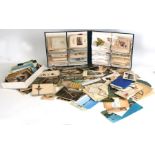

An album containing greeting cards; together with a quantity of topographical postcards and other
An album containing greeting cards; together with a quantity of topographical postcards and other ephemera.

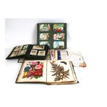
Three early 20th century photo albums (3).Condition Report. ...[more]
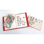
A Warwick stamp album containing British and world stamps, together with a quantity of loose stamps.
An early 20th century postcard album of saucy and other postcards, theatre programmes, visiting
An early 20th century postcard album of saucy and other postcards, theatre programmes, visiting cards and similar items.
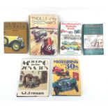
Assorted Motoring Volumes: Tibballs (Geoff), Motor-Racing Strangest Races; Robson (Graham), Motoring
Assorted Motoring Volumes: Tibballs (Geoff), Motor-Racing Strangest Races; Robson (Graham), Motoring in the 1930s; Dean, Thrills of the Speedways,...
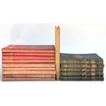
Wallace (Edgar) - The War Of The Nations - vols. 1 - 9, published by George Newnes Ltd, Strand,
Wallace (Edgar) - The War Of The Nations - vols. 1 - 9, published by George Newnes Ltd, Strand, London; together with Maxwell (Sir Herbert Bart MP...
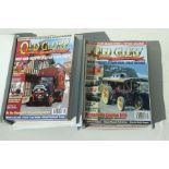
Old Glory magazines. In excess of 200 starting with issue number 1 from 1988 then consectutive
Old Glory magazines. In excess of 200 starting with issue number 1 from 1988 then consectutive numbers past 200, some in binders from the Gordon W...
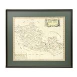
Morden (Robert) - The County of Palatine of Chester - a hand coloured map, sold by Abel Swale,
Morden (Robert) - The County of Palatine of Chester - a hand coloured map, sold by Abel Swale, Awnsham & John Churchill,, in a maple frame, 40 by...
Morden (Robert) - Barkshire - a hand coloured map, printed by Abel Swall and Awnsham & John Churchill, framed & glazed, 42 by 36cms. ...[more]
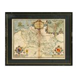
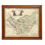
John Speed (1552-1629) - Denbighshire - a 17th century hand-tinted map with armorials and vignette
John Speed (1552-1629) - Denbighshire - a 17th century hand-tinted map with armorials and vignette Denbigh, framed & glazed, 52.5 by 38.5cms. .....
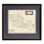
Robert Morden (c.1650-1703) - Barkshire - a 17th century map of Berkshire, highlighted in watercolour and vignette top right, framed & glazed, 42 ...
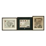
Three 19th century hand tinted maps of Devonshire, Gloucestershire and Cornwall, each with heraldic shields and vignettes of important buildings, ...
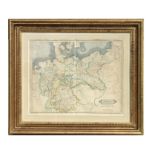
A 19th century map of Germany Prussian Dominions and Northern Independent States, published by W
A 19th century map of Germany Prussian Dominions and Northern Independent States, published by W Lizars, Edinburgh, framed & glazed, Rowley Galler...
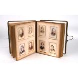
An album of carte de visites, mainly portraits.Condition Report50 cards in total, album itself is
An album of carte de visites, mainly portraits.Condition Report50 cards in total, album itself is tatty ...[more]
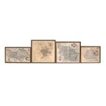
Three 18th / 19th century hand coloured maps of North Riding, framed & glazed, the largest 33 by
Three 18th / 19th century hand coloured maps of North Riding, framed & glazed, the largest 33 by 28cms; together with an early 19th century Plan o...
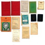
Railway interest: A collection of various timetables to include British Railways Western Operating
Railway interest: A collection of various timetables to include British Railways Western Operating Area, Service timetables, September 1954 to Ju...
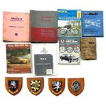
Four painted Heraldic College shields mounted on wooden plinths; together with various motor workshop manuals to include Wolesely 1500.