Filtered by:
- Category
- List
- Grid
A subscription to the Price Guide is required to view results for auctions ten days or older. Click here for more information
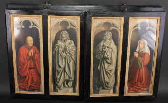

A late 19th/early 20th century antiquarian's facsimile triptych, after the Ghent altarpiece, the
A late 19th/early 20th century antiquarian's facsimile triptych, after the Ghent altarpiece, the panels printed after Jan van Eyck with The Adorat...
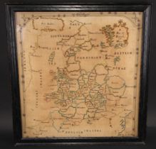
A George III map sampler, A Map of Englnad and Wales, by Ann Ambler, 1785, 55cm x 51cm, c.1785,
A George III map sampler, A Map of Englnad and Wales, by Ann Ambler, 1785, 55cm x 51cm, c.1785, oak frame
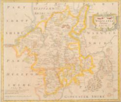
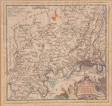
Robert Morden, an 18th century two-page coloured map, Worcestershire, 36.5cm x 43cm
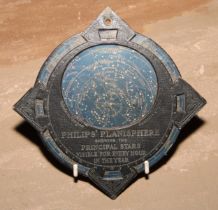
Astronomy - Philips’ Planisphere Showing the Principal Stars Visible For Every Hour in the Year,
Astronomy - Philips’ Planisphere Showing the Principal Stars Visible For Every Hour in the Year, 16.5cm diam
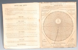
Astronomy and Cartography - Rev. William Hall's Visible Astronomical Compass, printed with a
Astronomy and Cartography - Rev. William Hall's Visible Astronomical Compass, printed with a stereo-graphic projection on the plane of the horizon...
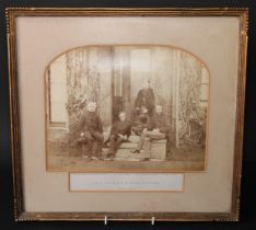
Photography - Royalty - a Victorian group portrait photograph, HRH The Prince of Wales at Oxford,
Photography - Royalty - a Victorian group portrait photograph, HRH The Prince of Wales at Oxford, the prince [later Edward VII] pictured at Frewen...
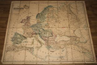
A 19th century thirty-two fold map, of Europe, published under the direction of the Committee of
A 19th century thirty-two fold map, of Europe, published under the direction of the Committee of General Literature & Education Appointed by the S...
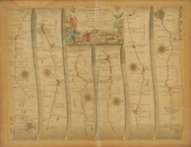
A map, John Ogilby, Oxford to Bristol, 32cm x 43cm
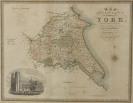
Cartography - J. & C. Walker, Map of the East Riding of the County of York, from an Actual Survey,
Cartography - J. & C. Walker, Map of the East Riding of the County of York, from an Actual Survey, Made in the Years 1831, & 1832, By C. Greenwood...
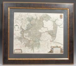
Joannes Bleau, a large 18th century two-page coloured map, Regiones Inundata [Fens or 'inundated'
Joannes Bleau, a large 18th century two-page coloured map, Regiones Inundata [Fens or 'inundated' areas of Norfolk, Suffolk, Huntingdonshire, Nort...
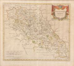
Robert Morden (1650 - 1703), a two-page coloured map, Northamptonshire, 41.5cm x 46cm
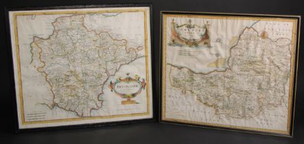
Robert Morden (1650 - 1703), a two-page coloured map, Somersetshire, 35cm x 42cm; another, Devonshire (2)
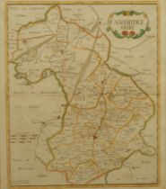
Robert Morden, an 18th century two-page coloured map, Cambridgeshire, published 1722, 44cm x 39cm
Robert Morden, an 18th century two-page coloured map, Cambridgeshire, published 1722, 44cm x 39cm
Thomas Kitchin (1719 - 1784), a coloured map, Middlesex, drawn from an accurate survey, 20cm x 21cm
Thomas Kitchin (1719 - 1784), a coloured map, Middlesex, drawn from an accurate survey, 20cm x 21cm
Thomas Moule, an engraved coloured map, Nottinghamshire, 26cm x 20cm
![Wales - John Speed (1551/52-1629), The Countye (sic) of Monmouth [...], [London]: [...] to be](https://portal-images.azureedge.net/auctions-2023/bamfor10907/images/dc25796f-e214-4510-b873-b0690104b8f1.jpg?h=210)
Wales - John Speed (1551/52-1629), The Countye (sic) of Monmouth [...], [London]: [...] to be
Wales - John Speed (1551/52-1629), The Countye (sic) of Monmouth [...], [London]: [...] to be solde (sic) in Popes head Alley, against the Exchang...
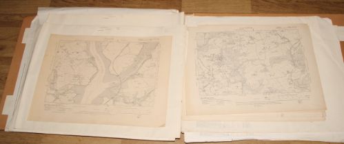
A folio of maps, West Country & London to include: Admiralty Charts: Cape Elizabeth to Portsmouth
A folio of maps, West Country & London to include: Admiralty Charts: Cape Elizabeth to Portsmouth Harbour (Maine) 1962, Die Jade (Wilhelmshavn) 19...