Filtered by:
- Category
- List
- Grid
A subscription to the Price Guide is required to view results for auctions ten days or older. Click here for more information
![After Johannes Blaeu, a map, Brasilia [Brazil], 45cm x 57cm overall; others, Nova Belgicaet Anglia](https://portal-images.azureedge.net/auctions-2022/bamfor10846/images/f8283680-0081-49b3-b776-af55013a235b.jpg?w=155&h=155)

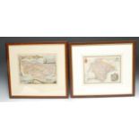
After Johannes Blaeu, a map, Brasilia [Brazil], 45cm x 57cm overall; others, Nova Belgicaet Anglia
After Johannes Blaeu, a map, Brasilia [Brazil], 45cm x 57cm overall; others, Nova Belgicaet Anglia Nova; Terra Firma et Novum RegnumGranatense et...

Cartography - Moule (Thomas) Atlas of County Maps, various British Counties and Australia, bound,
Cartography - Moule (Thomas) Atlas of County Maps, various British Counties and Australia, bound, 8vo

Cartography - The Middle East - a map, Persia, from Clark's New School Atlas, published by J Souter,
Cartography - The Middle East - a map, Persia, from Clark's New School Atlas, published by J Souter, London 1838, 21cm x 24cm; another (2)

Mudge, Lt. Col. William, a twenty-one fold engraved map, Ordnance Survey of the Isle of Wight and
Mudge, Lt. Col. William, a twenty-one fold engraved map, Ordnance Survey of the Isle of Wight and Part of Hampshire, paper laid on linen, 66cm x 9...
Robert Morden, a two-page coloured map, Nottinghamshire, 37cm x 43.5cm; another, Thomas Moule, Kent;
Robert Morden, a two-page coloured map, Nottinghamshire, 37cm x 43.5cm; another, Thomas Moule, Kent; another, Devonshire, 1836 (3)

Thomas Kitchen (1718 - 1784) , An Accurate Map of the Island of Martinico, engraved and coloured,
Thomas Kitchen (1718 - 1784) , An Accurate Map of the Island of Martinico, engraved and coloured, 18cm x 25cm

Thomas Kitchin, A New Map of Sussex, hand coloured, 20.5cm x 26.5cm; A Modern Map of Nottinghamshire, printed for Carington Bowles27cm x 20cm; a...

William Hole (d. 1624), after Christopher Saxton (c. 1540 - c. 1610), Universi: Derbienfis Comitatus
William Hole (d. 1624), after Christopher Saxton (c. 1540 - c. 1610), Universi: Derbienfis Comitatus [...] (sic), two-page map of Derbyshire, from...

A New Plan of London and Westminster, 1825, published by Edward Waller, 2 Skinner Street, London,
A New Plan of London and Westminster, 1825, published by Edward Waller, 2 Skinner Street, London, folded map, marble slip case, the map 51cm x 61...