Filtered by:
- Category
2 items
- List
- Grid
A subscription to the Price Guide is required to view results for auctions ten days or older. Click here for more information


Lot 356
Maps - Ordnance Survey, Quarter Inch Map of Great Britain first published 1946, England & Wales/
Maps - Ordnance Survey, Quarter Inch Map of Great Britain first published 1946, England & Wales/Scotland Sheet 1, England & Wales, sheet 2, 4, 6, ...
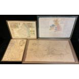
An early 19th century Geographical Map of the British Islands, engraved by Benjamin Davies; others, The Town of Newark, Dorset and Northumberland ...