Filtered by:
- Sale Section,
- Category
- List
- Grid
A subscription to the Price Guide is required to view results for auctions ten days or older. Click here for more information
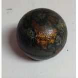

Advertising - a Rowntrees & Co. Ltd.
Advertising - a Rowntrees & Co. Ltd. tin pocket globe, 4cm diam, early 20th centutry
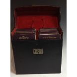
Automobilia - a set of early 20th century Ordnance Survey motoring maps, by J Bartholomew F.R.G.
Automobilia - a set of early 20th century Ordnance Survey motoring maps, by J Bartholomew F.R.G.S, numbered 1 to 24, leather travelling case
Buffier (Claude), Geografia Universale, Nuova Edizione, Col Trattato della Sfera del medefimo Autore, e Rami nuovi (sic), A Spese di Gregorio, e M...
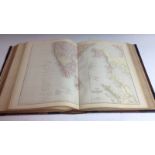
The Comprehensive Atlas & Geography of The World, Compiled and Engraved from the Most Authentic Sources, Under the Supervision of W.G. Blackie, Ph...
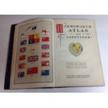
The Harmsworth Atlas and Gazetteer, 500 Maps and Diagrams in Colour, With Commercial Statistics and Gazetteer, Index of 105,000 Names, Carmelite H...
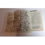
Aaron Arrowsmith (1750-1823), by, a four-fold map, Reduced Chart of the Pacific Ocean from the one published in Nine Sheets, published by A. Arrow...
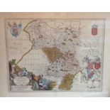
Joan Blaeu (1596-1673), after, a two-page map, Darbiensis Comitatus, Vernacule Darbie Shire [Derbyshire] (sic), later hand-colouring, 50cm x 58cm
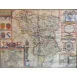
John Speed (1552-1629), by, a two-page map, Darbieshire (sic), 'to be fold in popes head Alley by John Sudbury and G. Humble [London] (sic), coppe...
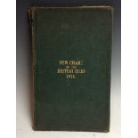
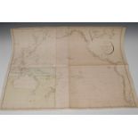
Richardson's Chart of the British Isles, 1916, 1:950,000 scale, two six-fold maps laid on canvas bound in a green buckram folio, the front cover t...
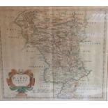
Robert Morden (1650-1703), by, a two-page map, Darbyshire (sic), Sold by Abel Swale, Awnfham and John Churchill (sic), hand-coloured copperplate e...