Refine your search
- List
- Grid
A subscription to the Price Guide is required to view results for auctions ten days or older. Click here for more information
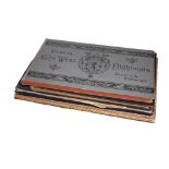

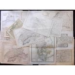
British Topogrpahy - Vignette Plate Books, Group of 4 Vols, 48 Plates. Scotland, Stratford, Winchester, Harwich, Dovercourt "Views in the West Hig...
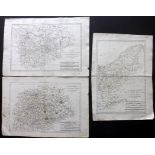
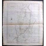
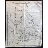
Cary, John - Cary's New Map of England and Wales, 82 Plates, 1794, First Edition "Cary's New Map
Cary, John - Cary's New Map of England and Wales, 82 Plates, 1794, First Edition "Cary's New Map of England and Wales, with Part of Scotland" Lond...
Combe, William - The Tour of Doctor Syntax Through London & In Search of the Picturesque, 2 Vols, 49
Combe, William - The Tour of Doctor Syntax Through London & In Search of the Picturesque, 2 Vols, 49 Aquatint Plates, 1813-20 "The Tour of Doctor ...
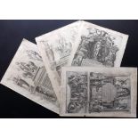
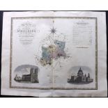
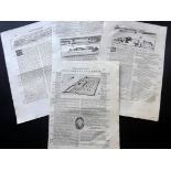
Nichols, John - The History and Antiquities of the County of Leicester, Plate Vol Only, Approx
Nichols, John - The History and Antiquities of the County of Leicester, Plate Vol Only, Approx 287 Engraved Plates, Uncommon, C1800 No Title. Pla...
Spencer's New History of England, Defective Copy, Numerous Engraved Plates/Maps, 1793, Folio "
Spencer's New History of England, Defective Copy, Numerous Engraved Plates/Maps, 1793, Folio "Spencer's New History of England" Folio. Lacking Tit...

The Tomahawk 1867-68, 2 Vols, Illustrations & Plates, Scarce Periodical, with 2 others, Political "
The Tomahawk 1867-68, 2 Vols, Illustrations & Plates, Scarce Periodical, with 2 others, Political "The Tomahawk" Volumes 1 and 2, No's 1-33 and 35...
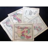
Americas C1856-C1875 Lot of 5 Maps by Colton & Johnson Incl "Argentine Republic, Chili, Uruguay &
Americas C1856-C1875 Lot of 5 Maps by Colton & Johnson Incl "Argentine Republic, Chili, Uruguay & Paraguay" Peru and Bolivia" "Patagonia, South Or...
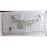
Anson, George 1748 Hand Coloured Map of Juan Fernandez Islands, Chile "A Plan of Juan Fernandes
Anson, George 1748 Hand Coloured Map of Juan Fernandez Islands, Chile "A Plan of Juan Fernandes Island in the South Sea..." Hand Coloured Copper P...
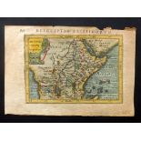
Bertius, Petrus C1600 Hand Coloured Map North Africa "Abissinorum Imperium" Hand Coloured Copper
Bertius, Petrus C1600 Hand Coloured Map North Africa "Abissinorum Imperium" Hand Coloured Copper Engraved Map Published 1600-1618, Amsterdam for "...
Bonne, Rigobert C1790 Group of 3 Maps of Germany Group of 3 Copper Engraved Maps Published C1790,
Bonne, Rigobert C1790 Group of 3 Maps of Germany Group of 3 Copper Engraved Maps Published C1790, Paris for "Atlas Portatif…" by Rigobert Bonne. O...
Braun, Georg & Hogenberg, Franz 1572-98 Group of 4 Title Pages to Civitates Orbis Terrarum Title
Braun, Georg & Hogenberg, Franz 1572-98 Group of 4 Title Pages to Civitates Orbis Terrarum Title Pages to vols 1, 2 (duplicated) and 5. Copper Pla...
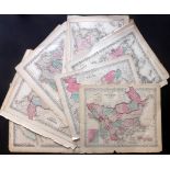
Colton, J. H & Johnson, A. J. C1856-75 Incl Turkey, China, Asia, Italy, Spain/Portugal, Holland/
Colton, J. H & Johnson, A. J. C1856-75 Incl Turkey, China, Asia, Italy, Spain/Portugal, Holland/Belgium, South America, Argentine Republic/Chili, ...
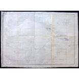
Dawson, Col. Robert - Boundary Commission 1837 Lot of 120 Maps, Town Plans of England & Wales "
Dawson, Col. Robert - Boundary Commission 1837 Lot of 120 Maps, Town Plans of England & Wales "Report of the Commissioners appointed to report and...
Delamarche, Felix 1832 Mixed Lot of 9 Maps from Atlas de la Geographie Incl Europe, Russia, Africa, Migration after Great Flood, Egypt, Tribes of ...
Depot de la Marine 1850 Large Coastal Chart Vado, Tuscany Coast, Italy "Plan du Mouillage de Vado…" Large Uncommon Steel Engraved Coastal Chart Pu...
Fullarton (Pub) 1872 Lot of 10 Maps of Ports & Harbours. UK, France & Germany Mostly British, also
Fullarton (Pub) 1872 Lot of 10 Maps of Ports & Harbours. UK, France & Germany Mostly British, also Germany and France. Lot of 10 Maps Published 18...
Greenwood, Charles & John 1834 Large Hand Coloured Map of Middlesex, London, UK "Map of the County
Greenwood, Charles & John 1834 Large Hand Coloured Map of Middlesex, London, UK "Map of the County of Middlesex from an Actual Survey made in the ...
Harrison, John (Pub) 1787 Map of Nottinghamshire, UK "A New, accurate, & correct, Map of Nottinghamshire..." Copper Engraved Map Published 1787, b...
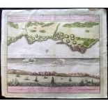
Homann Heirs 1732 Hand Coloured Map & View of Oran, Algeria "Topographica repraesentatio Barbarici
Homann Heirs 1732 Hand Coloured Map & View of Oran, Algeria "Topographica repraesentatio Barbarici portus et urbis munitae, Oran..." Hand Coloured...
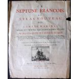
Jaillot, Hubert (Pub) 1693 Title Page to Le Neptune Francois. Engraved Illustration of Sail Ship
Jaillot, Hubert (Pub) 1693 Title Page to Le Neptune Francois. Engraved Illustration of Sail Ship Copper Engraved Title Page Published 1693 by Hube...
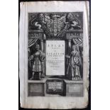
Jansson, Jan 1640's Copper Engraved Title Page to Atlas Novus Copper Engraved Title Page Published
Jansson, Jan 1640's Copper Engraved Title Page to Atlas Novus Copper Engraved Title Page Published 1638-66, Amsterdam for "Atlas Novus, Sive Theat...

Jansson, Jan C1650 Copper Engraved Title Page to Atlas Novus Copper Engraved Title Page Published
Jansson, Jan C1650 Copper Engraved Title Page to Atlas Novus Copper Engraved Title Page Published 1638-66, Amsterdam for "Atlas Novus, Sive Theatr...
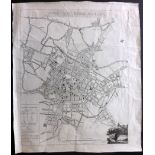
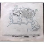
Kempson, John 1808 Rare Map Plan of Birmingham "Town of Birmingham" Rare, Separately Published,
Kempson, John 1808 Rare Map Plan of Birmingham "Town of Birmingham" Rare, Separately Published, Copper Engraved Map of Birmingham. Small engraving...
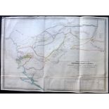
London 1826 Group of 5 Rare Bound Maps by Aaron Arrowsmith & James Basire "The Fifth Report of the
London 1826 Group of 5 Rare Bound Maps by Aaron Arrowsmith & James Basire "The Fifth Report of the Commissioners of His Majesty's Woods, Forests, ...
Madeira, Portugal 19th Century. Manuscript Map. Chart of the Madeira Islands after William Heather "Chart of the Madeira Islands" Good standard ma...
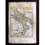
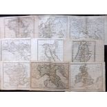
Mallet, Alain Manesson 1683 Hand Coloured Map of Naples, Italy "Royaume de Naples" Hand Coloured
Mallet, Alain Manesson 1683 Hand Coloured Map of Naples, Italy "Royaume de Naples" Hand Coloured Copper Engraved Map Published 1683, Paris for "De...
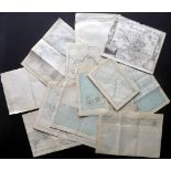
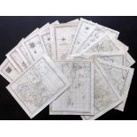
Maps 1683-C1870 Mixed Lot of 40 Lot of approx 40 Maps. Incl UK, France, Germany, Scandinavia,
Maps 1683-C1870 Mixed Lot of 40 Lot of approx 40 Maps. Incl UK, France, Germany, Scandinavia, Russia, Switzerland, Austria, Italy, Greece, Spain,...
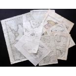
Maps 1777-1882 Lot of 13 Maps. UK, USA, Canada, Australia etc. Docks, Maritime interest "A Plan of
Maps 1777-1882 Lot of 13 Maps. UK, USA, Canada, Australia etc. Docks, Maritime interest "A Plan of the Navigable Canal from Chesterfield..." Coppe...
Maps 18th Century. Mixed Lot of 9 Copper Engraved Maps. Portugal, Chile, UK, Martinique, Red Sea,
Maps 18th Century. Mixed Lot of 9 Copper Engraved Maps. Portugal, Chile, UK, Martinique, Red Sea, Caspian, Roman Empire Lot of 9 Copper Engraved M...
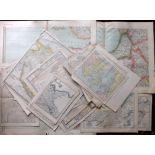
Maps 19th Century Mixed Lot of 50. UK, France, Germany, Canada, Switzerland etc Lot of approx 50
Maps 19th Century Mixed Lot of 50. UK, France, Germany, Canada, Switzerland etc Lot of approx 50 Maps, mostly Lithographed. Incl UK, France, Germa...
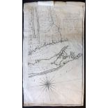
Montresor, John 1775 One Section (Of four) to the famous Map of the Province of New York "A Map of
Montresor, John 1775 One Section (Of four) to the famous Map of the Province of New York "A Map of the Province of New York, with Part of Pensilva...
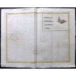
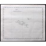
Perouse, Jean 1798 Map of Necker Island, Hawaii USA "Chart of Necker Island" Hand Coloured Copper
Perouse, Jean 1798 Map of Necker Island, Hawaii USA "Chart of Necker Island" Hand Coloured Copper Engraved Map, published 1797-1817 by G.G & I. Ro...
Rapin de Thoyras, Paul & Tindal, Nicholas 1745 Group of 3 Hand Coloured Maps/Battle Plans of Spain "Plan of the Battle of Saragossa" "Plan of Card...
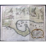
Rapin de Thoyras, Paul & Tindal, Nicholas 1745 Hand Coloured Map Plan of Messina, Sicily, Italy "
Rapin de Thoyras, Paul & Tindal, Nicholas 1745 Hand Coloured Map Plan of Messina, Sicily, Italy "Plan of the Works of the City of Messina,one of t...
Rapin de Thoyras, Paul & Tindal, Nicholas 1745 Hand Coloured Map/Battle Plan of Mahon, Minorca,
Rapin de Thoyras, Paul & Tindal, Nicholas 1745 Hand Coloured Map/Battle Plan of Mahon, Minorca, Spain "Plan of the Town and Harbour of Mahon, St. ...
Rapin de Thoyras, Paul & Tindal, Nicholas 1745 Hand Coloured Plan of Ostend, Belgium. Naval Battle
Rapin de Thoyras, Paul & Tindal, Nicholas 1745 Hand Coloured Plan of Ostend, Belgium. Naval Battle Map "Plan of the Investiture of Ostend surrende...
Rapin de Thoyras, Paul & Tindal, Nicholas 1745 Map Battle Plan of Brittany & Brest, France "Plan
Rapin de Thoyras, Paul & Tindal, Nicholas 1745 Map Battle Plan of Brittany & Brest, France "Plan of the Attack of Camaret Bay, on the Coast of Bre...
Rapin de Thoyras, Paul & Tindal, Nicholas C1785 Map Battle Plan of the Bay of Bulls, Rotta, Bay of
Rapin de Thoyras, Paul & Tindal, Nicholas C1785 Map Battle Plan of the Bay of Bulls, Rotta, Bay of Cadiz, Spain "Draught Of The Bay Of Bulls Betwe...
Rapin de Thoyras, Paul C1730 Map of Saxon Britian "Carte d'Angleterre Sous Les Saxons" Copper
Rapin de Thoyras, Paul C1730 Map of Saxon Britian "Carte d'Angleterre Sous Les Saxons" Copper Engraved Map Published 1724-35, The Hague for "Histo...
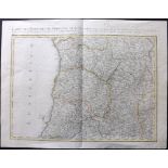
Rizzi Zannoni, Giovanni Antonio C1771 Hand Coloured Map of Portugal and the Algarve "Carte des
Rizzi Zannoni, Giovanni Antonio C1771 Hand Coloured Map of Portugal and the Algarve "Carte des royaumes de Portugal et d'Algarve" Hand Coloured Co...
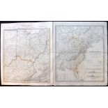
SDUK (Pub) 1833-C1840 Pair of Maps. USA & Canada. Ohio, Kentucky, Virginia, East Coast "North
SDUK (Pub) 1833-C1840 Pair of Maps. USA & Canada. Ohio, Kentucky, Virginia, East Coast "North America. Canada and the United States" and "North Am...
SDUK (Pub) C1840 Hand Coloured Town Plan Map of Brussels (Bruxelles) Steel Engraved Map Published
SDUK (Pub) C1840 Hand Coloured Town Plan Map of Brussels (Bruxelles) Steel Engraved Map Published C1840 for "Maps by the Society for the Diffusion...
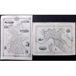
Tallis, John (Pub) 1851-52 Pair of Maps of Germany & Northern Italy Steel Engraved Map Published
Tallis, John (Pub) 1851-52 Pair of Maps of Germany & Northern Italy Steel Engraved Map Published 1851-1852, London for "The Universal Pronouncing ...
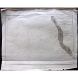
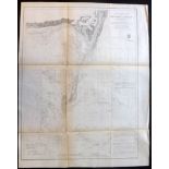
U.S. Coast Survey 1856 Map of Chesapeake Bay, incl Baltimore, Maryland "Chesapeake Bay Sheet No. 1
U.S. Coast Survey 1856 Map of Chesapeake Bay, incl Baltimore, Maryland "Chesapeake Bay Sheet No. 1 From the Head of the Bay to the Mouth of the Ma...
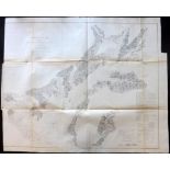
U.S. Coast Survey 1856 Map of Monomoy Shoals, Massachusetts "Preliminary Chart of Monomoy Shoals
U.S. Coast Survey 1856 Map of Monomoy Shoals, Massachusetts "Preliminary Chart of Monomoy Shoals Massachusetts" Electrotype Map Published 1843-65,...
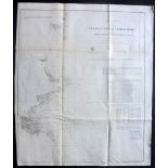
U.S. Coast Survey 1856 Map of Portland Maine to Race Point Massachusetts "Preliminary Chart No. 3 of
U.S. Coast Survey 1856 Map of Portland Maine to Race Point Massachusetts "Preliminary Chart No. 3 of the Sea Coast of the United States from Portl...
U.S. Coast Survey 1856 Map of San Pablo Bay, California "Preliminary Chart of San Pablo Bay California" Electrotype Map Published 1843-65, Washing...
West Africa 1779-1840 Pair of Maps by Bowen and James Wyld "Particular Map of the Western Coast of
West Africa 1779-1840 Pair of Maps by Bowen and James Wyld "Particular Map of the Western Coast of Africa…" after d'Anville, Engraved Bowen from R...
Wilkes, John & Neele S. & J., C1800-1820 Lot of 20 Copper Engraved Maps. Australia, China, Asia,
Wilkes, John & Neele S. & J., C1800-1820 Lot of 20 Copper Engraved Maps. Australia, China, Asia, UK Incl Asia, Polynesia/Australia, Prussia, Spain...
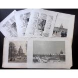
Benoist, Felix 1863 Pair of Lithographs of Paris, with 4 other Prints Lithographs Published 1861-63,
Benoist, Felix 1863 Pair of Lithographs of Paris, with 4 other Prints Lithographs Published 1861-63, Paris for "Paris dans sa Splendeur" Edited by...
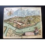
Blaeu, Joan 1682 Large Hand Coloured Birds Eye View of Bonneville, Haute-Savoie, France "Bonne
Blaeu, Joan 1682 Large Hand Coloured Birds Eye View of Bonneville, Haute-Savoie, France "Bonne Ville" Hand Coloured Copper Plate Published 1682, A...
Boydel, John & Josiah 1796 Lot of 7 Aquatint views of the River Thames Sepia Aquatints Published
Boydel, John & Josiah 1796 Lot of 7 Aquatint views of the River Thames Sepia Aquatints Published 1794-96, London for "An History of the River Tham...
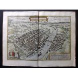
Braun, Georg & Hogenberg, Franz C1572 Hand Coloured Birds Eye View of Frankfurt, Germany "Civitas
Braun, Georg & Hogenberg, Franz C1572 Hand Coloured Birds Eye View of Frankfurt, Germany "Civitas Francofordiana" Hand Coloured Copper Plate Publi...
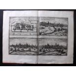
Braun, Georg & Hogenberg, Franz C1572 View of Wittenberg, Wismar, Francfort & Rostock, Germany "
Braun, Georg & Hogenberg, Franz C1572 View of Wittenberg, Wismar, Francfort & Rostock, Germany "Wittenburga" "Civitas Francfordiensis" "Wismaria" ...
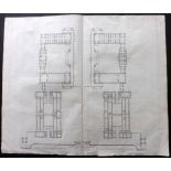
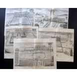
Campbell, Colen 1715-1725 Pair of Large Architectural Plans from the Vitruvius Britannicus Incl
Campbell, Colen 1715-1725 Pair of Large Architectural Plans from the Vitruvius Britannicus Incl Greenwich Hospital and Mereworth Castle, Kent. Cop...
Chatelain, Zacharie C1710 Group of 3 Large Copper Plates. Persian Views & Costume "Description des
Chatelain, Zacharie C1710 Group of 3 Large Copper Plates. Persian Views & Costume "Description des Habits des Persans…" and "Description de la Cel...
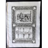
Chauncy, Henry 1700 Group of 5 Copper Engraved Views of Hertfordshire Copper Plates Published
Chauncy, Henry 1700 Group of 5 Copper Engraved Views of Hertfordshire Copper Plates Published 1700, London for "The Historical Antiquities of Hert...
Coronelli, Vincenzo 1696 Copper Engraved View of a Water Spouts and Maritime Ceremony Copper Plate
Coronelli, Vincenzo 1696 Copper Engraved View of a Water Spouts and Maritime Ceremony Copper Plate Published 1696-97, Venice for "Isolario descri...
Coronelli, Vincenzo 1696 Group of 4 Copper Plates of Italy - Venice Mostly 4 Sheets, mostly Venice. Incl "Isola do S. Lazzaro" "Isola di S. Elena"...
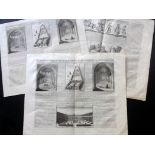
Egypt - Lepsius, Carl Richard C1850 Lot of 9 Large Prints of Egyptian Monuments & Hieroglyphics
Egypt - Lepsius, Carl Richard C1850 Lot of 9 Large Prints of Egyptian Monuments & Hieroglyphics Plates 245, 252, 290, 295, 296, 297, 301, 302 and3...