Refine your search
- List
- Grid
A subscription to the Price Guide is required to view results for auctions ten days or older. Click here for more information


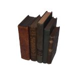
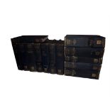
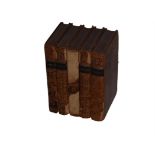
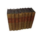
Art Reference - 19th & 20th Century, Lot of 15 Volumes, Ruskin Modern Painters, Dictionary of Painters etc Mixed lot of Art Reference. Various Tit...
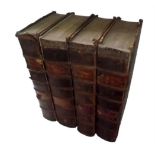
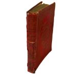
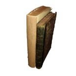
Atkyns, Robert - The Ancient and Present State of Glostershire, 1768, Lacking plates "The Ancient
Atkyns, Robert - The Ancient and Present State of Glostershire, 1768, Lacking plates "The Ancient and Present State of Glocestershire" London: T. ...
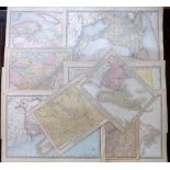
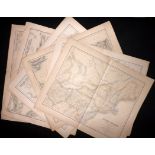
Atlases (Broken) Stieler, Black, Bartholomew, Phillip. Group of 4, 170 Maps Group of 4 Folio Broken Atlases. Incl "Black's General Atlas of the Wo...
Botanical - Gardening, 18th - 20th Century. Lot of 14 Volumes, Forsyth, Withering, John Hill "A
Botanical - Gardening, 18th - 20th Century. Lot of 14 Volumes, Forsyth, Withering, John Hill "A Treatise on the Culture and Management of Fruit-Tr...

Botanical - Orchids, 19th & 20th Century, Lot of 29 Volumes Lot of 29 Botanical & Gardening Volumes,
Botanical - Orchids, 19th & 20th Century, Lot of 29 Volumes Lot of 29 Botanical & Gardening Volumes, all relating to Orchids. Incl Harrison and Sa...
Botanical - Plates, 19th & 20th Century, 5 vols, Hulme, Horticultural Journal, Beeton, Crawford "
Botanical - Plates, 19th & 20th Century, 5 vols, Hulme, Horticultural Journal, Beeton, Crawford "Horticultral Journal" Parts 1 and 2 with four fi...
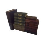
Cambridge University Press (Pub) The New Cambridge Modern History - 13 Vols, incl Atlas, 1957-70 "
Cambridge University Press (Pub) The New Cambridge Modern History - 13 Vols, incl Atlas, 1957-70 "The New Cambridge Modern History" Cambridge: At ...
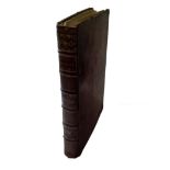
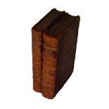
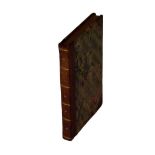
Chambers, Ephriam - Cyclopaedia: Or, An Universal Dictionary of Arts and Sciences, 4 Vols, Folio,
Chambers, Ephriam - Cyclopaedia: Or, An Universal Dictionary of Arts and Sciences, 4 Vols, Folio, 1783-86 "Chambers, Ephriam - Cyclopaedia: Or, An...
Cluver, Phillip & Bertius, Petrus - Atlas- Introductionis in Universam Geographiam, 39 Maps, Hemisphere - Insular California, Cyprus, America, 165...
Comenius, Johann Amos - Orbis Sensualium Pictus, The first Children's Picture Book, Over 150 Engraved Illustrations, 1728 "Orbis Sensualium Pictus...
Cooke, C - Cooke's pocket edition of the original & complete works of select British poets, Shakespeare, Thomson, Akenside, Dryden, Addison, 5 Vol...
Goodrich, Samuel Griswold - The World as It Is, and as It Has Been; or A Comprehensive Geography and
Goodrich, Samuel Griswold - The World as It Is, and as It Has Been; or A Comprehensive Geography and History, 79 Maps "The World as It Is, and as ...
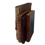
Hearne, Thomas & Wood, Anthony a - The Lives of Those Eminent Antiquaries John Leland, Thomas
Hearne, Thomas & Wood, Anthony a - The Lives of Those Eminent Antiquaries John Leland, Thomas Hearne, and Anthony a Wood, 2 Vols, 1772 "The Live...
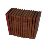
Kipling, Rudyard - Poems, 1929, 13 Vols, Gilt Bindings Group of 13 Various Titles. London: Macmillan
Kipling, Rudyard - Poems, 1929, 13 Vols, Gilt Bindings Group of 13 Various Titles. London: Macmillan and Co, 1929. 8vo (180 x 110mm) Uniform Red C...
Shakespeare, William & Knight, Charles - The Pictorial Edition of the Works of Shakespere, 8 Vol
Shakespeare, William & Knight, Charles - The Pictorial Edition of the Works of Shakespere, 8 Vol Set, 1839-43 "The Pictorial Edition of the Works ...
The Lady's Newspaper, 1849 and The Queen, The Lady's Newspaper, 1877, 2 Folio Vols, Many Fashion
The Lady's Newspaper, 1849 and The Queen, The Lady's Newspaper, 1877, 2 Folio Vols, Many Fashion Illustrations, several Coloured Plates "The Lady'...
Thomas Tegg (Pub) - The Economy of Human Life, First Edition, 1811 "The Economy of Human Life;
Thomas Tegg (Pub) - The Economy of Human Life, First Edition, 1811 "The Economy of Human Life; Translated from an Indian Manuscript, written by an...
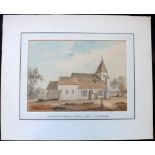
Buckler, John Chessel (1793-1894) Original Watercolour Guestling Church, Sussex 1830 Mounted to
Buckler, John Chessel (1793-1894) Original Watercolour Guestling Church, Sussex 1830 Mounted to board and matted, size including mount 14.5 x 12 i...
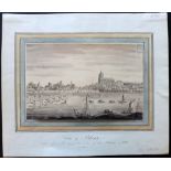
Forbes, *** 1803 Watercolour 'View of Blois' Loire River, France 10 x 6.5 inches (25x17cm) with
Forbes, *** 1803 Watercolour 'View of Blois' Loire River, France 10 x 6.5 inches (25x17cm) with watercolour border.

Murdock? W.L Original Watercolour 1972 'The Grand Bridge' Blenheim Palace Mounted to thin board 16 x
Murdock? W.L Original Watercolour 1972 'The Grand Bridge' Blenheim Palace Mounted to thin board 16 x 12.5 inches (42 x 32cm). Signed. Good standar...
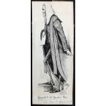
Reed, Edward Tennyson (1860-1933) Original Pen & Ink for Punch 1895. Pen & Ink on Card. Drawn for
Reed, Edward Tennyson (1860-1933) Original Pen & Ink for Punch 1895. Pen & Ink on Card. Drawn for Punch, or The London Charivari Volume 108, April...
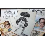
Smith, David (b1943) 1980's/90's 12 Original Pen & Ink Caricatures. Sports, Business, Politics.
Smith, David (b1943) 1980's/90's 12 Original Pen & Ink Caricatures. Sports, Business, Politics. Edwina Currie, Glenda Jackson, Tessa Sanderson, et...
Africa C1857-1915 Lot of 15 Maps. Egypt, Liberia, Guinea, Algeria, Tunisia, South Africa, Continent & Islands Lot of 15 Maps of Africa. Examples b...
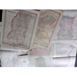
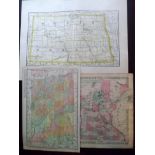
Arkansas, Louisiana, Mississippi C1860-1915 Lot of 8 Maps by Colton/Johnson, Century Atlas, and Rand
Arkansas, Louisiana, Mississippi C1860-1915 Lot of 8 Maps by Colton/Johnson, Century Atlas, and Rand & McNally Lot of 8 Engraved & Lithographed Ma...
Australia, New Zealand & Pacific C1890-1915 Lot of 12 Maps by Rand & McNally Lot of 12 Lithographed Maps by Rand & McNally. Occasional duplicates....
Bain, James 1937 Lot of 28 Maps of London and Suburbs Lot of 28 Lithographed Maps Published 1937,
Bain, James 1937 Lot of 28 Maps of London and Suburbs Lot of 28 Lithographed Maps Published 1937, London for "The Authentic Map Directory of Londo...
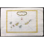
Bellin, Jacques C1750 Hand Coloured Map of Canary Islands, Spain. Tenerife, Fuerteventura, Gran
Bellin, Jacques C1750 Hand Coloured Map of Canary Islands, Spain. Tenerife, Fuerteventura, Gran Canaria, Lanzarote "Carte des Isles Canaries" Hand...
Bellin, Jacques C1750 Map of Le Maire Straight, Tierra del Fuego. Argentina "Carte du detroit de
Bellin, Jacques C1750 Map of Le Maire Straight, Tierra del Fuego. Argentina "Carte du detroit de le Maire" Copper Engraved Map Published 1746-1789...
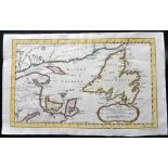
Bellin, Jacques C1760 Hand Coloured Map of St. Lawrence Bay, Canada "Carte du Golphe de St. Laurent et Pays Voisins.." Hand Coloured Copper Engrav...
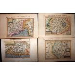
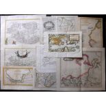
Bertius, Petrus C1600 Group of 4 Hand Coloured Maps of regions of Italy "Crema" "Marcha Anconae,
Bertius, Petrus C1600 Group of 4 Hand Coloured Maps of regions of Italy "Crema" "Marcha Anconae, Olim Picenum" "Forum Julii" and "Tractus Perusinu...
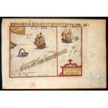
Bertius, Petrus C1600 Hand Coloured Map of the Maldives "Maldivae Insulae" Hand Coloured Copper
Bertius, Petrus C1600 Hand Coloured Map of the Maldives "Maldivae Insulae" Hand Coloured Copper Engraved Map Published 1600-1618, Amsterdam for "T...
Blaeu, Johan & Creite, E. L 1735 Hand Coloured Map of Dunkirk region, France "Accurata Territorii
Blaeu, Johan & Creite, E. L 1735 Hand Coloured Map of Dunkirk region, France "Accurata Territorii Bergensis et Aquaeductuum Delineatio" Hand Colou...
Bonne, Rigobert & Bellin, Jacques C1750-88 Pair of Hand Coloured Maps of St. Kitts & Virgin Islands.
Bonne, Rigobert & Bellin, Jacques C1750-88 Pair of Hand Coloured Maps of St. Kitts & Virgin Islands. West Indies Caribbean "Carte de l'isle St. Ch...
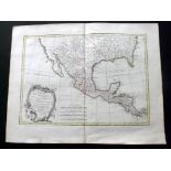
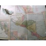
Bonne, Rogobert 1771 Hand Coloured Map of Mexico, Texas, California, Louisiana, US "Carte du Mexique
Bonne, Rogobert 1771 Hand Coloured Map of Mexico, Texas, California, Louisiana, US "Carte du Mexique ou de la Nlle. Espagne Contenant aussi le Nou...
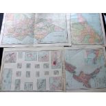
Canada C1855-1914 Lot of 37 Maps Lot of 37 Maps. Examples mostly by Rand & Mcnally. Also Colton,
Canada C1855-1914 Lot of 37 Maps Lot of 37 Maps. Examples mostly by Rand & Mcnally. Also Colton, Johnson, and Century Atlas. Mostly Folio and Larg...
Canada C1910-20 Lot of 10 Maps Published Rand & McNally Lot of 10 Lithographed Maps Published
Canada C1910-20 Lot of 10 Maps Published Rand & McNally Lot of 10 Lithographed Maps Published C1910-20, Chicago. Canada and Canadian Provinces. Pa...
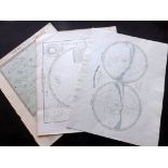
Celestial/Astronomy 19th Century. Lot 8 Maps/Charts Lot of 8 Maps. Including a set of 6 Star Maps
Celestial/Astronomy 19th Century. Lot 8 Maps/Charts Lot of 8 Maps. Including a set of 6 Star Maps Published in an early edition of "Lett's Popular...
Channel Islands & Isle of Man 1683-C1900 Lot of 7 Maps. Jersey, Guernsey, IOM Lot of 7 Maps. Examples by Tallis, Moule, Mallet, Lewis, Stanford a...
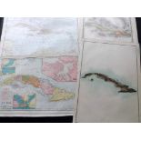
Cuba C1890-1915 Lot of 5 Maps by Rand & McNally Lot of 5 Lithographed Maps by Rand & McNally.
Cuba C1890-1915 Lot of 5 Maps by Rand & McNally Lot of 5 Lithographed Maps by Rand & McNally. Paper Size: Up to 28 x 20.5 inch (72 x 52cm) Good Co...
Dakota - North & South and Minnestota C1855-1914 Lot of 11 Maps Lot of 11 Maps. Examples by Rand &
Dakota - North & South and Minnestota C1855-1914 Lot of 11 Maps Lot of 11 Maps. Examples by Rand & Mcnally, Colton and Century Atlas. Paper Size: ...
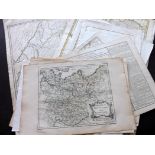
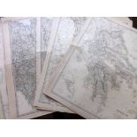
Europe 17th-18th Century. Lot of 25 Hand Coloured Copper Engraved Maps. Lot of 25 Maps. All Copper
Europe 17th-18th Century. Lot of 25 Hand Coloured Copper Engraved Maps. Lot of 25 Maps. All Copper Engraved, and all with hand colour. Examples by...
Europe C1860-1914 Lot of 40 Maps. France, Italy, Greece, Germany, Russia, Spain, Scandinavia Lot
Europe C1860-1914 Lot of 40 Maps. France, Italy, Greece, Germany, Russia, Spain, Scandinavia Lot of 40 Lithographed Maps Published C1860-1913, Chi...
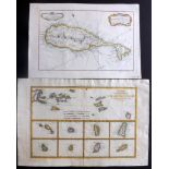
French Colonial Africa (Islands) 1775-C1850 Pair of Maps of Madagascar & Reunion by Mannevillette & Levasseur "Plan de la Cote de L'Est de Madaga...
Fullarton (Pub) 1872 Lot of 8 Maps from the Royal Illustrated Atlas "Algeria" "United States (North
Fullarton (Pub) 1872 Lot of 8 Maps from the Royal Illustrated Atlas "Algeria" "United States (North Central)" "United States (North Eastern)" "So...
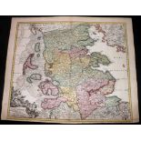
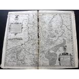
Homann, Johann Baptist C1716 Hand Coloured Map of North Germany "Ducatus Slesvicensis in omnes
Homann, Johann Baptist C1716 Hand Coloured Map of North Germany "Ducatus Slesvicensis in omnes ejusdem Generales et Particulares" Hand Coloured Co...
Johnston, Alexander Keith 1861 Lot of 33 Maps Published for The Royal Atlas of Modern Geography
Johnston, Alexander Keith 1861 Lot of 33 Maps Published for The Royal Atlas of Modern Geography Lot of 33 Maps Published 1861, Edinburgh for "The ...
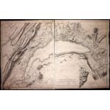
Mallet, Henri C1800 Large Map of Lake Geneva, Switzerland Large 2 sheet (Previously joined) Copper
Mallet, Henri C1800 Large Map of Lake Geneva, Switzerland Large 2 sheet (Previously joined) Copper Engraved Map Published 1781 (Or later) Overall ...
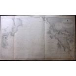
Malta C1930's Large Coastal Chart by Edward Weller "Malta to Cape Malea, including the Ionian
Malta C1930's Large Coastal Chart by Edward Weller "Malta to Cape Malea, including the Ionian islands" Large Steel Engraved Map Published C1930's ...
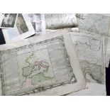
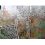
Maps 17th-19th Century. Lot of 13 Mostly Europe. Sanson, Salmon, d'Anville, etc Lot of 13 Mostly
Maps 17th-19th Century. Lot of 13 Mostly Europe. Sanson, Salmon, d'Anville, etc Lot of 13 Mostly Copper Engraved Maps. Incl England & Wales, Germa...
Maps 17th-19th Century. Mixed Lot of 15 Maps, many hand coloured. Lot of 15 Mostly Copper Engraved
Maps 17th-19th Century. Mixed Lot of 15 Maps, many hand coloured. Lot of 15 Mostly Copper Engraved Maps. Mainly 18th Century. Incl Tartary, Guyana...
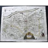
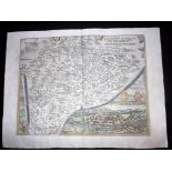
Maps 18th-19th Century. Mixed Lot of 9 Maps Lot of 9 Maps. Incl Kip & Morden Map of Gloucestershire,
Maps 18th-19th Century. Mixed Lot of 9 Maps Lot of 9 Maps. Incl Kip & Morden Map of Gloucestershire, published in "The Ancient and Present state o...
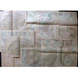
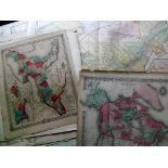
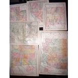
Maps C1855-1915 Mixed Lot of 55. Countries & Continents Mixed Lot of 55 Maps. Examples by Rand
Maps C1855-1915 Mixed Lot of 55. Countries & Continents Mixed Lot of 55 Maps. Examples by Rand Mcnally, Century Atlas, and Colton & Johnson. Paper...
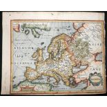
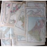
Mercator, Gerard & Jansson, Jan C1630 Hand Coloured Map of Europe. "Europa" Hand Coloured Copper
Mercator, Gerard & Jansson, Jan C1630 Hand Coloured Map of Europe. "Europa" Hand Coloured Copper Engraved Map, Published C1630 by Jan Jansson, Ams...
Mexico C1890-1915 Lot of 5 Maps by Rand & McNally Lot of 5 Lithographed Maps by Rand & McNally. Incl
Mexico C1890-1915 Lot of 5 Maps by Rand & McNally Lot of 5 Lithographed Maps by Rand & McNally. Incl 1 duplicate. Paper Size: Up to 28.5 x 20.5 in...
Montana, Wyoming & Idaho C1890-1915 Lot of 8 Maps Century Atlas and Rand & McNally Lot of 8 Lithographed Maps by Rand & McNally. Paper Size: Up to...
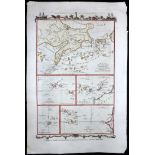
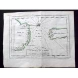
Moore, John Hamilton C1780 Hand Coloured Map. Atlantic, Canary Islands, Azores, Cape Verde "Various Charts of Islands &c, in the Atlantic & Pacifi...
Nevada, New Mexico, Utah, Arizona 1890's-1914 Lot of 12 Maps Lot of 12 Maps mostly by Rand & McNally. Mostly Folio and larger. Ocassional duplicat...
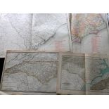
North & South Carolina C1890-1915 Lot of 6 Maps by the Century Atlas and Rand & McNally Lot of 6
North & South Carolina C1890-1915 Lot of 6 Maps by the Century Atlas and Rand & McNally Lot of 6 Lithographed Maps by Rand & McNally. Paper Size: ...
Ortelius, Abraham 1606 Map of Belgium & Germany "Limburgensis Ducatus Tabula Nova" Copper Engraved
Ortelius, Abraham 1606 Map of Belgium & Germany "Limburgensis Ducatus Tabula Nova" Copper Engraved Map Published 1606, London for the rare English...
Ortelius, Abraham C1570 Hand Coloured Map & View of Salzburg, Austria "Salisburgensis Jurisdictio..." Hand Coloured Copper Engraved Map Published ...