Refine your search
Estimate
Category
- Maps (86)
- Prints (61)
- Books & Periodicals (25)
- Watercolours (5)
- Oil, Acrylic paintings & Mixed Media (3)
- Drawings & Pastels (2)
- Arms, Armour & Militaria (1)
- Collectables (1)
- Fine Art & Antiques (1)
- Lighting (1)
- Metalware (1)
- Photographs (1)
- Salvage & Architectural Antiques (1)
- Vintage Fashion (1)
- Wines & Spirits (1)
- List
- Grid
A subscription to the Price Guide is required to view results for auctions ten days or older. Click here for more information
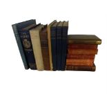

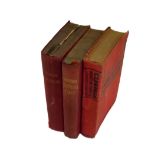
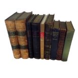
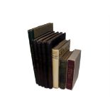
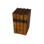
Mixed lot of Art Reference. Various Titles, 19th & 20th Century. Incl 5 Volumes of Ruskin's Modern
Mixed lot of Art Reference. Various Titles, 19th & 20th Century. Incl 5 Volumes of Ruskin's Modern Painters, Art in Spain & Portugal, Dictionary o...
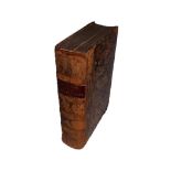
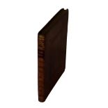
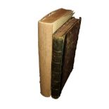
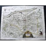
"The Ancient and Present State of Glocestershire" London: T. Splilsbury for W. Herbert, 1768. Folio (430 x 280mm) LACKING ALL ENGRAVED PLATES and ...
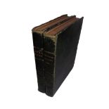
Pair of Broken Atlases. Incl Cary, John "Cary's New Universal Atlas" London: John Cary, 1816. Folio (380 x 330m) Six hand coloured maps (of 72) pl...
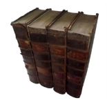
Group of 4 Folio Broken Atlases. Incl "Black's General Atlas of the World" n.d, C1873, Approx 42
Group of 4 Folio Broken Atlases. Incl "Black's General Atlas of the World" n.d, C1873, Approx 42 Maps (of 56) "The Popular Atlas of the World" n.d...
"Baedeker's Southern Italy" Leipsic & London: Karl Baedeker & Dulau and Co. 1903. Fourteenth Revised
"Baedeker's Southern Italy" Leipsic & London: Karl Baedeker & Dulau and Co. 1903. Fourteenth Revised Edition. With 27 Maps and 24 Plans. "Baedeker...
"Manuel d'Optique Experimentale..." Paris: Rousselon, 1825, 12mo (150 x 115mm) 44 Copper Engraved
"Manuel d'Optique Experimentale..." Paris: Rousselon, 1825, 12mo (150 x 115mm) 44 Copper Engraved Plates. Fine, full calf binding with Gilt Spine ...
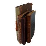
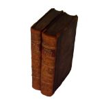
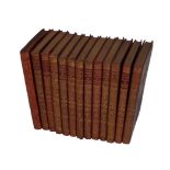
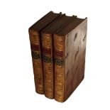
"The New Cambridge Modern History" Cambridge: At The University Press, 1957-70. 4to, (235 x 160mm)
"The New Cambridge Modern History" Cambridge: At The University Press, 1957-70. 4to, (235 x 160mm) 13 Vols, incl Atlas Volume. Blue Cloth with Gil...
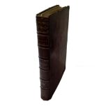
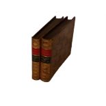
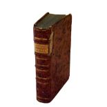
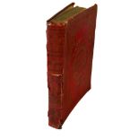
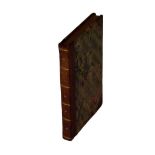
"Chambers, Ephriam - Cyclopaedia: Or, An Universal Dictionary of Arts and Sciences, 4 Vols, Folio,
"Chambers, Ephriam - Cyclopaedia: Or, An Universal Dictionary of Arts and Sciences, 4 Vols, Folio, 1783-86" London: J.F. And C Rivington et al. 1...
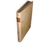
"A Treatise on the Decorative Part of Civil Architecture" London: Whittaker & Co, 1839, Imperial
"A Treatise on the Decorative Part of Civil Architecture" London: Whittaker & Co, 1839, Imperial 8vo, 280 x 200mm. Engraved Frontis Portrait of Ch...
"Orbis Sensualium Pictus...Visible World: or, a nomenclature, and pictures of all the chief things
"Orbis Sensualium Pictus...Visible World: or, a nomenclature, and pictures of all the chief things that are in the world" Translated into English ...
"Cooke's pocket edition of the original & complete works of select British poets" London: C. Cooke. 1796-1801. 12mo (145 x 90mm) Numerous Engraved...
"Le Geographe Manuel Contenant" Paris, 1782, 12mo (140 x 85mm) 6 Folding Engraved Maps in Early Hand
"Le Geographe Manuel Contenant" Paris, 1782, 12mo (140 x 85mm) 6 Folding Engraved Maps in Early Hand Colour. Incl nice double Hemisphere Map. Full...
"Atlas Minimus Universalis, or A Geographical Abridgement Ancient and Modern of the Several Parts of
"Atlas Minimus Universalis, or A Geographical Abridgement Ancient and Modern of the Several Parts of the Earth" London: James Wyld. 1825. Oblong 8...
"The World as It Is, and as It Has Been; or A Comprehensive Geography and History" New York: J. H.
"The World as It Is, and as It Has Been; or A Comprehensive Geography and History" New York: J. H. Colton, 1855. 79 hand coloured Maps within the ...
"Under the Window" First Edition. London: George Rutledge & Sons. nd, 1878. 8vo, 240 x 190mm. 64 pp.
"Under the Window" First Edition. London: George Rutledge & Sons. nd, 1878. 8vo, 240 x 190mm. 64 pp. Illustrated throughout. Contents shaken and p...
"The Lives of Those Eminent Antiquaries John Leland, Thomas Hearne, and Anthony a Wood..." Oxford: J
"The Lives of Those Eminent Antiquaries John Leland, Thomas Hearne, and Anthony a Wood..." Oxford: J & J Fletcher, 1772. 8vo (220 x 135mm) Several...
"The National Gallery of Pictures by the Great Masters…" First Edition. London: Jones & Co., C1840. 4to, (280 x 220mm) Engraved Frotispiece plus 1...
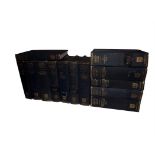
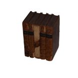
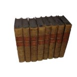
Group of 13 Various Titles. London: Macmillan and Co, 1929. 8vo (180 x 110mm) Uniform Red Cloth with
Group of 13 Various Titles. London: Macmillan and Co, 1929. 8vo (180 x 110mm) Uniform Red Cloth with Gilt Spines and Gilt Elephant & Swastika to f...
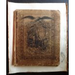
Untitled Manuscript Marine Log. Bristol, C1790-1830. 8vo, 200 x 160mm. 146 MS Numbered Pages on laid
Untitled Manuscript Marine Log. Bristol, C1790-1830. 8vo, 200 x 160mm. 146 MS Numbered Pages on laid paper plus Neat, colour coded hand made Index...
"A Manual of the Infusoria" by William Saville Kent. 3 Volumes bound as 2, London 1880-82. Hand
"A Manual of the Infusoria" by William Saville Kent. 3 Volumes bound as 2, London 1880-82. Hand coloured Engraved Frontispiece and 51 Engraved Pla...
"The Best Forage Plants..." London: David Nutt, 1889. 4to (320 x 240mm) 30 Chromolithograph Botanical Plates. Together with "The National Natural ...
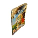
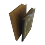
"The New Rupert Book" Daily Express, Watford & London. 245 x 185mm. 120 pp. Previous owners inscription on "This book belongs to…" 2 minor green m...
"The Pictorial Edition of the Works of Shakespere" London: Charles Knight, 1839-43. Small 4to (250 x
"The Pictorial Edition of the Works of Shakespere" London: Charles Knight, 1839-43. Small 4to (250 x 165mm) 8 Volume Set. Many Engravings within t...
"Voyage aux Indes orientales et à la Chine" Paris, 1782. 8vo (215x 140mm) Folding Engraved Plan plus
"Voyage aux Indes orientales et à la Chine" Paris, 1782. 8vo (215x 140mm) Folding Engraved Plan plus 6 Folding Engraved Plates (2 plates loose) Fi...
"The Lady's Newspaper" July to December 1849, Volume 6. Together with "The Queen, The Lady's Newspaper and Court Chronicle" January to June, 1877,...
"The Economy of Human Life; Translated from an Indian Manuscript, written by an Ancient Bramin"
"The Economy of Human Life; Translated from an Indian Manuscript, written by an Ancient Bramin" London: Thomas Tegg, 1811. 12mo (170 x 100mm) Firs...
"Le Imagini delle Donne Auguste intagliate in Istampa di Rame…" First Edition, Second Issue with
"Le Imagini delle Donne Auguste intagliate in Istampa di Rame…" First Edition, Second Issue with numbered plates. Venice: Enea Vico and Vincenzo V...
"Regles des cinq ordres d'Architecture" Paris: Jombert, 1764. 8vo, 200 x 140mm. Engraved Frontispiece plus 66 Copper Engraved Plates, incl 5 Foldi...
"The Works of Flavius Josephus, the Learned and Authentic Jewish Historian and Celebrated Warrior"
"The Works of Flavius Josephus, the Learned and Authentic Jewish Historian and Celebrated Warrior" London: William Whiston, 1818. 8vo (220 x 140mm...
"A Graphic Illustration of the Metropolitan Cathedral Church of Canterbury" First Edition. Plates
"A Graphic Illustration of the Metropolitan Cathedral Church of Canterbury" First Edition. Plates only. London: T. Cadell & W. Davies. Folio. 450 ...
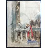
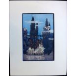
Interior of a Church/Monastery painted in Watercolour on paper. Caption reads 'The last sketch
Interior of a Church/Monastery painted in Watercolour on paper. Caption reads 'The last sketch from xxxx xxxx" Good standard. 12 x 9 inches (31 x ...
8.5 x 6 inches ( 21x15cm). Previously mounted with glue and paper remnants on verso.
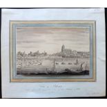
17.5 x 12 inchess (44x30cm) and 19 x 14 inches (49x36cm). Edges a little raggy and tone spotting
17.5 x 12 inchess (44x30cm) and 19 x 14 inches (49x36cm). Edges a little raggy and tone spotting to background.
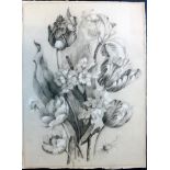
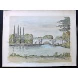
Mounted to board and matted, size including mount 14.5 x 12 inches (37 x 31cm). Unsigned. Fine
Mounted to board and matted, size including mount 14.5 x 12 inches (37 x 31cm). Unsigned. Fine watercolour.
10 x 6.5 inches (25x17cm) with watercolour border.
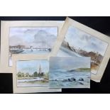
3 Mounted to paper, 2 signed. Nice group. Smallest 8.5 x 5.5 inches (21 x 13cm) largest 10 x 8
3 Mounted to paper, 2 signed. Nice group. Smallest 8.5 x 5.5 inches (21 x 13cm) largest 10 x 8 inches (26 x 20cm).
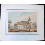
Mounted to thin board 16 x 12.5 inches (42 x 32cm). Signed. Good standard.
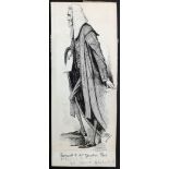
Pen & Ink on Card. Drawn for Punch, or The London Charivari Volume 108, April 20, 1895. Signed ETR
Pen & Ink on Card. Drawn for Punch, or The London Charivari Volume 108, April 20, 1895. Signed ETR and inscribed in pencil 'Farewell to Mr Speaker...
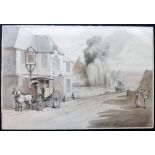
Pen & Ink with wash. Signed T. Rowlandson bottom right. Light scratch left side otherwise fine. 12 x
Pen & Ink with wash. Signed T. Rowlandson bottom right. Light scratch left side otherwise fine. 12 x 8 inches (31 x21cm).
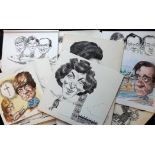
Edwina Currie, Glenda Jackson, Tessa Sanderson, etc. All on Academy Board. Smallest 10 x 9 inches (
Edwina Currie, Glenda Jackson, Tessa Sanderson, etc. All on Academy Board. Smallest 10 x 9 inches (24 x 23cm) largest 17 x 12 inches (43 x 30cm).
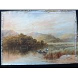
Sir James Linton Prize winning watercolour by Barbara Thom, 1925. Barbara Thom went on to study at
Sir James Linton Prize winning watercolour by Barbara Thom, 1925. Barbara Thom went on to study at Heatherley's art school. Mounted to board with ...
Largest 23 x 11 inches (58 x 28cm). Boat scene mounted to board and glue remnants to outer 1 inches of edges, flowers stuck to mount, Landscape on...
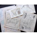
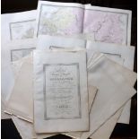
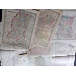
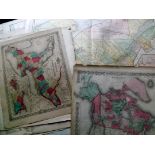
Lot of 15 Maps of Africa. Examples by Rand Mcnally and Colton. Paper Size: Up to 28 x 20.5 inch (
Lot of 15 Maps of Africa. Examples by Rand Mcnally and Colton. Paper Size: Up to 28 x 20.5 inch (71 x 52cm) Some small faults, fine overall.
Lot of 15 Steel Engraved Maps Published 1862, Paris for "Atlas Classique et Universel de Geographie Ancienne et Moderne" by Eugene Andriveau-Goujo...
Lot of 8 Engraved & Lithographed Maps. Examples by Colton/Johnson, Century Atlas, and Rand & McNally. Paper Size: Up to 25 x 17.5 inch (64 x 45cm)...
Lot of 14 Maps. Examples by Tallis, Bonne, Vaugondy, Kelly, Weller and others. Paper Size: Up to
Lot of 14 Maps. Examples by Tallis, Bonne, Vaugondy, Kelly, Weller and others. Paper Size: Up to 20 x 14.5 inch (51 x 37cm) Good condition overall.
Lot of 12 Lithographed Maps by Rand & McNally. Occasional duplicates. Paper Size: Up to 27 x 20.5
Lot of 12 Lithographed Maps by Rand & McNally. Occasional duplicates. Paper Size: Up to 27 x 20.5 inch (69 x 52cm) Good Condition
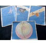
Group of 4 Copper Engraved Celestial Maps Published 1603-61, Augsburg for "Uranometria" by Johann
Group of 4 Copper Engraved Celestial Maps Published 1603-61, Augsburg for "Uranometria" by Johann Bayer. Fne watercolour & gouache hand colour, wi...
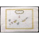
"Carte des Isles Canaries" Hand Coloured Copper Engraved Map Published 1746-1789, Paris & The
"Carte des Isles Canaries" Hand Coloured Copper Engraved Map Published 1746-1789, Paris & The Hague for "Histoire générale des voyages" by Antoine...
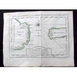
"Carte des Environs de Batavia" Copper Engraved Map Published 1746-1789, Paris & The Hague for "
"Carte des Environs de Batavia" Copper Engraved Map Published 1746-1789, Paris & The Hague for "Histoire générale des voyages" by Antoine Francois...
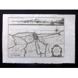
"Carte du detroit de le Maire" Copper Engraved Map Published 1746-1789, Paris & The Hague for "
"Carte du detroit de le Maire" Copper Engraved Map Published 1746-1789, Paris & The Hague for "Histoire générale des voyages" by Antoine Francois ...
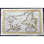
"Carte du Golphe de St. Laurent et Pays Voisins.." Hand Coloured Copper Engraved Map Published
"Carte du Golphe de St. Laurent et Pays Voisins.." Hand Coloured Copper Engraved Map Published 1746-1789, Paris & The Hague for "Histoire générale...
"Accurata Territorii Bergensis et Aquaeductuum Delineatio" Hand Coloured Copper Engraved Map Published 1735, The Hague for "Verheerlijkt Vlaandere...
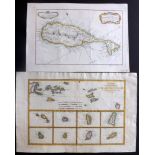
"Carte de l'isle St. Christophe" and "Cartes de Supplement pour les Isles Antilles" Pair of Hand
"Carte de l'isle St. Christophe" and "Cartes de Supplement pour les Isles Antilles" Pair of Hand Coloured Copper Engraved Maps Published 1746-1789...
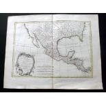
"Carte du Mexique ou de la Nlle. Espagne Contenant aussi le Nouveau Mexique, la Californie" Hand
"Carte du Mexique ou de la Nlle. Espagne Contenant aussi le Nouveau Mexique, la Californie" Hand Coloured Copper Engraved Map Published 1771, Pari...
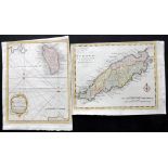
"A Map of the Island of Tobago" together with "A Map of the Island of Dominca" Pair of Hand Coloured
"A Map of the Island of Tobago" together with "A Map of the Island of Dominca" Pair of Hand Coloured Copper Engraved Maps Published 1778-79, Londo...
"Carte des declinaisons et inclinaisons de l'Aiguille Aimantee" Hand Coloured Copper Engraved Map of
"Carte des declinaisons et inclinaisons de l'Aiguille Aimantee" Hand Coloured Copper Engraved Map of Australasia and the Pacific. From the even le...
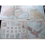
Lot of 37 Maps. Examples mostly by Rand & Mcnally. Also Colton, Johnson, and Century Atlas. Mostly
Lot of 37 Maps. Examples mostly by Rand & Mcnally. Also Colton, Johnson, and Century Atlas. Mostly Folio and Larger. Paper Size: Up to 28.5 x 20.5...
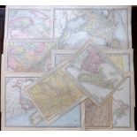
Lot of 10 Lithographed Maps Published C1910-20, Chicago. Canada and Canadian Provinces. Paper
Lot of 10 Lithographed Maps Published C1910-20, Chicago. Canada and Canadian Provinces. Paper Size: Up to 21.5 x 15 inch (55 x 38cm) Good conditio...
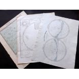
Lot of 8 Maps. Including a set of 6 Star Maps Published in an early edition of "Lett's Popular
Lot of 8 Maps. Including a set of 6 Star Maps Published in an early edition of "Lett's Popular Atlas" Together with 2 others. Paper Size: 17.5 x 1...